I've tried my best to remember the details of a story I was told about 10 years ago by the then assistant superintendant of wharton state park whose name I think was a Jim Donohue. I do remember for sure that he said he was a landscaper fom Freehold. From what I remember, he told me the story of an olympic athlete from new jersey who evidently did very well in the 1952? or '56 olympics. I think he said he was either a wrestler or a track and field guy. The state of New Jersey felt like he should be rewarded for his efforts and subsequently offered him a job in the parks division or something similiar. From what I was told, he was aware that the state was preparing to purchase large tracts of the pinelands and in advance of the states purchase bought a few hundred acres and established a campground, knowing that the state would have to negotiate with him for its purchase. I remember he made out well. I never did know the name of the campground or its location and wondered if anyone could add anything to fill in the missing pieces. On a different note, he also said there was an old radio tower still standing as he pointed to the west side of 206.

1950's campground
- Thread starter kingofthepines
- Start date
You are using an out of date browser. It may not display this or other websites correctly.
You should upgrade or use an alternative browser.
You should upgrade or use an alternative browser.
dutchtown. I've been thinking about that tower and he had to be wrong. A tower would have to be lit so there would be power lines and access roads etc. He must have meant something else.King,
Where were you when he pointed west?
Guy
dutchtown. I've been thinking about that tower and he had to be wrong. A tower would have to be lit so there would be power lines and access roads etc. He must have meant something else.
King,
By Dutchtown, you do mean right there by the little Junkyard on 206 right?? Looking West one could easily see the NJN towers out our way in Waterford. So ten years ago maybe your guy got crossed up. They are decieving in their location depending on where you are looking from and it's all too common that people make mistakes in positioning or locating them. Problem is, just for kicks to date them, I called NJN engineering this morn' and talked to their lead maint & engineering dude. Tower one was built in 70/71 following the state's broadcast act of 1968. It was a new project for a new entity so that blew my idea that it was to replace an older tower. I was just trying to narrow down your location if possible. Tower two was built in '80
Even looking at arials I can't place where this would have been. Perhaps Scott / RednekF350 has a thought? Your campground, can't place it.
It's obious he wasn't talking about paradise lakes.
G.
Largo,
I think you're right about those towers being easily seen toward the west from Dutchtown/Atsion. And they look alot closer than they really are.
Over the years I have had so many people, no matter how clear a direction I give, attempt to navigate back to my place in Waterford always saying " Oh Yeah right by the towers, no big deal I know exactly where to go ! "
Only to get a call when they are hopelessly lost in Hammonton, Winslow, or my favorite... somewhere out on 206!
g.
I was given a FAA map by a member of the PBX hiking club, which showed all the towers in the area so that pilots knew where they were. I would have noticed that if there was an odd tower out that way. I may still have the map and will look for it.
Guy
Guy
The Garmin Topo maps show many of the towers, although they haven't been updated for quite some time. You generally need to zoom way in (around 0.2 mi) before this kind of detail becomes visible. For example, the tower I think you just mentioned is there and labeled "WNJS-TV Camden".
You can play around with their map viewer here:
http://www.garmin.com/cgi-bin/mapgen/webmap.cgi?p=6&z=3&w=480&h=360&rz=0&k=1&sc=1
You can play around with their map viewer here:
http://www.garmin.com/cgi-bin/mapgen/webmap.cgi?p=6&z=3&w=480&h=360&rz=0&k=1&sc=1
Attachments
Just kind of a random thought here, but could the powerline towers off of burnt tavern road factor into this? Or are they the toweres you are referring to. I haven't been out that way in a while.
Jeff
Jeff
Just kind of a random thought here, but could the powerline towers off of burnt tavern road factor into this? Or are they the toweres you are referring to. I haven't been out that way in a while.Jeff
I do not think they play a roll here. Believe it or not they are not as tall to be seen as you might think and they span kind of North of the area in question I think. The Jersey station broadcast towers are very visible.
When on Google maps looking on satellite their forms, shadows, cables are pretty easily seen. Tower two is North of Tower one.
Back to the Campground, I bet if there was one back thataway, the family back the end Of Chew might could know about it. Perhaps I'll stop back and ask one of the elders. Funny, he was in front of me at the voting both this election past. I'll look into that when I get a chance.
he didn't specifically mention the campground being west of 206 so if his story was true it could have been anywhere. curious about wading pines and paradise lakes still being privately owned in the middle of the state forest. wonder which came first, the cg or the sf. the tower? I have no clue. he must have been mistaken, or perhaps I'm the one who misunderstood. are there any fire tower bases over that way that he may have mistaken for a radio tower?

he didn't specifically mention the campground being west of 206 so if his story was true it could have been anywhere. curious about wading pines and paradise lakes still being privately owned in the middle of the state forest. wonder which came first, the cg or the sf. the tower? I have no clue. he must have been mistaken, or perhaps I'm the one who misunderstood. are there any fire tower bases over that way that he may have mistaken for a radio tower?
The reason Paradise Lake Campground is still private is because of Joseph Wharton. Not only did he purchase property, he also sold some parcels. He sold the West Mill tract (Paradise Lake) to Andrew J. Ryder on January 15, 1898. You may know of Andrew Ryder as the founder of Ryder Collage. I suspect Wharton and him were acquaintances or friends. Ryder was a cranberry grower and the West Mill tract was perfect for that.
You may remember in the past that I searched for and found the "R98" stones which are on the four corners of that property. I never really knew what the "R" stood for, but was assuming it was a persons name. Member "Oriental" on this site made a very excellent informative guess that it stood for Andrew Ryder, and recently I found this map to prove his suspicions. Notice that eventually Haines owned it when this map was produced.

If you are new to this site here are the R98 stones. Three still survive completely intact; however, one has been leveled to the ground. This is the southern most stone near the campsite area which most likely is the reason why it is this way.
I will check on the Wading Pines. I don't think I have anything on that.
As for the towers, there were no firetowers west of 206 in that area at any time. I have a list of all of them and their locations.
Also, I must be brain dead right now...what does cg and sf mean in your post?
Guy
A sit down and a human history book.
I must be getting daft in my ripe old age of 36! At my disposal is a walking history of the area. Some close family friends and actually distant relations that own the large junkyard near me. The family has been around Waterford for ages. I went over this morning and held palaver over coffee. Before I knew it I had opened a can of worms. Bud, essentially my Uncle asks that I please try to procure the name of said Athlete. Perhaps if you could get me that King. He is checking with a friend he has breakfast with weekly who is an old Zoning official of the area. He also is sure that my first potential contact will not be of help. The family elder I need passed two years back. He feels that if such a place existed it may have been behind what are now Blueberry fields across from Rockwood on 206. He does feel that Haines Bros. may have had something to do with it. He also recalls a family ( please, I take liberty with the spelling and if anyone knows more please feel free to say so )Bezinski? That lived in Parkdale proper. On a side note he recanted a sad tail of a young Bezinski family girl that walked in front of the Blue Comet in '37. In his words " she wasn't right or depressed" was picking blueberries at about 3:30 in the afternoon and then was struck. Apparently the train operator tried his best to stop to no avail. I have never read more than an excerpt or two from "Trail of the Blue Comet" so I do not know how accurate this is. Jerseyman of course may know. My Aunt Gloria recalls the girl of 16 or 17 as a "pretty young girl". He also recanted of the "Britain?" family that lived in the old Parkdale schoolhouse before it burnt down. He gave me a few details of the landswap of Parkdale for other property. We also discussed the Airport that used to be back our way. "Lucky Malenchek?" was the name he used. We of course discussed Demarco and some of his dealings. Sorry to ramble but all in all a great conversation, accurate or not. This thread resulted in a nice visit for me. I await his info from this other fellow and when able will speak with a couple parties he gave me to contact. ( If they don't pass first!, Mostly old fellows ) . He as well can not recall this "Radio Tower". Will advise as I get more to go on, I so love digging up the historic bones of this particular area!
G.
Yes Largo...keep digging.
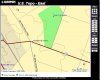
There is a possibility that the radio tower in question is the one that was/is on Jackson road in Medford. This is the Jackson road between Tuckerton road and the Jackson road in Atco with the racetrack.
The problem with that is Wharton does not make it up that far, so why would that have even been discussed it this is the one? Anyway, here it is on older topo's.
http://www.topozone.com/map.asp?lat=39.84398&lon=-74.8302&datum=nad27&u=4&layer=DRG&size=l&s=24
Is this still a radio tower?
http://maps.google.com/maps?q=39.84...938&spn=0.001514,0.003186&t=k&om=1&iwloc=addr
Guy
Largo,
The spelling of that is Berzihski. I have mentioned the name before. The family lived on Sandy Causeway just off of Chew road. At least the family of L.S. Berzihski did. It was a one Sly Frame house and was located here.
http://maps.google.com/maps?q=39.71...859&spn=0.006066,0.012746&t=k&om=1&iwloc=addr
That information was faxed to me by Rednek.
Guy