Just stumbled across this on the EPA website while researching the former tenant of a building we're moving into. Pretty cool mapping application that displays all known EPA sites on your choice of street, topo or ariel photo maps:
http://www.epa.gov/enviro/emef/
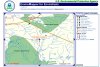
You can get coordinates from Google Maps and plug them in here, or search by other means as well. I've attached an example of the area around Chatsworth.
http://www.epa.gov/enviro/emef/
You can get coordinates from Google Maps and plug them in here, or search by other means as well. I've attached an example of the area around Chatsworth.