Boyd,
Thanks for the info. I will have to think about what I want to do.
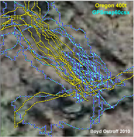
I have looked over my tracks from various places I have been, and picked out a few to show you. I rarely have my tracks stray from exactly where I walked or drove.
When Jessica and I traveled with Gloria a few months ago, we walked in various places such as tight roads, open roads, and very dense woods. Gloria can tell you about the area circled in yellow. In this area we were bushwacking and turned around and tried to follow our path back. As you can see I never lost the signal. BTW, AL, that is the stone we discussed tonight. I was oh so close!
This was our last PBX hike. This is dense swamp, brier in places, and tall trees. You can see a few places where we either found something, stopped to talk, or I had to avoid something in our path. This was not a road.
The day before the PBX hike, Bob and I did the usual water drop. This is the route we took. I was carrying Jessica on my back both ways for quite a bit of this section because the water was so deep. There is only one area where the tracks seem off and we may have actually taken that route.
This one shows me driving on a road. Clicking it makes it slightly bigger I believe.
http://teegate.njpinebarrens.com/06072010/tracks2.jpg
I am happy with the signal I get, I just despise the maps.
Guy