
Jobs Old Swamp
- Thread starter Tom
- Start date
You are using an out of date browser. It may not display this or other websites correctly.
You should upgrade or use an alternative browser.
You should upgrade or use an alternative browser.
Guy,
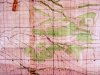
This may help. If you know where Troy Island is, you're there.
R. and S. H. Jones, Tanton Earl, Richard W. Earl, and Franklin W. Earl wishing to dispose of all their cedar timber in "Job's Old Swamp," will again offer for sale on Monday March 19, 1855, 15 or 20 acres of cedar timber suitable for logging or railing, in lots to suit the purchasers. It is situated near Troy Island at the foot of the Swamp, about 3 miles from Hanover Furnace, 2 from Hartshorn's Mill, 5 from Mount Misery, and 5 from Brown's Mills
Guy,
This may help. If you know where Troy Island is, you're there.
R. and S. H. Jones, Tanton Earl, Richard W. Earl, and Franklin W. Earl wishing to dispose of all their cedar timber in "Job's Old Swamp," will again offer for sale on Monday March 19, 1855, 15 or 20 acres of cedar timber suitable for logging or railing, in lots to suit the purchasers. It is situated near Troy Island at the foot of the Swamp, about 3 miles from Hanover Furnace, 2 from Hartshorn's Mill, 5 from Mount Misery, and 5 from Brown's Mills
I also see reference to Troy Island. Find me Taylors Branch or Beaver Dam Branch off of Pole Branch and that will help me.
Guy
I know this general area rather well. I am having trouble seeing all the text on the map. With limited info, and based off the map. I would place within military property, or possibly were present day country lakes is. Perhaps Whites bog.
Jeff
Jeff
Are you asking me Guy? The attached is downloaded from USAphoto maps:
http://forums.njpinebarrens.com/gallery/albums/userpics/10011/Pole_Bridge.JPG
Best to view it from the photo gallery. I don't see Beaver Branch. That Fort Dix map I have shows nothing different.
http://forums.njpinebarrens.com/gallery/albums/userpics/10011/Pole_Bridge.JPG
Best to view it from the photo gallery. I don't see Beaver Branch. That Fort Dix map I have shows nothing different.
All of the below is on a 76.41 degree line so it is a straight line. So using the below info the distance from the Burlington/Ocean county line (307.10) to Jobs Swamp ( 140.00 ) is 1671 chains or 11,028 feet or about 2 miles. So since it is not perpendicular with the county line, Job’s Swamp is less than two miles from the county line. If we find the head of Taylor’s Branch of Beaver Dam Branch we can use the 8.5 degree difference in magnetic north and find the location of Job’s Swamp.
Division Line June 14th 1861
2PM
Between R. Jones and S.W. Jones known as the Hanover Farms Tract
Present J. Wyatt
? Folks
? Bozerth
R. Ford
? Simpkins
Commissioners
John Black
Jos ?. ????
Thomas W. Ivans
Jos W. Cox survey
Beginning at a stone at the NW corner of 20 acres surveyed to Bennet Bard ??? (near) Pole Bridge Brook. Said corner being about 15 chains (990 feet) above where a small branch called Taylor’s Branch puts in the Pole Branch Brook. N 76.41 W. (5043 feet)
63 chains Head of Beaver Dam Branch
71.30 chains Road from Hanover to Hillards
80.00 chains Stake
90.00 chains Quit for the night
June 15th 1861
Continue the line
100. 00 chains Stake about 3 chains west of road for Jobs Swamp to Hillards ???? Hanover to Hillards running up south side Jobs Swamp.
110.00 edge of low lands
130.00 low lands north of Stewart Cedar Swamp.
140.00 Stake about 1.5 chains East of a road above the described south side Job’s Swamp.
141.50 said road
153.50 intersected northern line
160.00 stake
170.00 stake
180.00 stake
190 stake
196.20 Tar Kiln ???? On point past land putting into Troy Island.
197.30 Stake 2.22 chains south of D. Carrs Mill, 2.80 chains south of the fire place of his cabin.
226.97 Road to Hanover
Quit for the night
June 16th 1861
Continued said course
260.00 stake south side of cranberry ridge
267.50 Road again to Hanover
270.00 stake
280.00 stake
290.00 stake
307.10 County Line
Tom,
I still am not sure where this is. I am certain it is on the division line, most likely about 2 miles from the county line. That would put it around here but I am not certain yet.
http://maps.google.com/maps?q=39.96...847&spn=0.011792,0.030513&t=k&om=1&iwloc=addr
Guy
I still am not sure where this is. I am certain it is on the division line, most likely about 2 miles from the county line. That would put it around here but I am not certain yet.
http://maps.google.com/maps?q=39.96...847&spn=0.011792,0.030513&t=k&om=1&iwloc=addr
Guy
That would make it too close to all 3 places if you were using the distances Tom gave in his earlier post Guy.
Yea...I am not sure exactly where it is but it is on the division line between the two properties. The notes I have prove that. But where?
And you can never be too sure that the distances are correct. Remember they did not have an odometer then. Even the surveyors pulled chains through the woods.
Guy
And you can never be too sure that the distances are correct. Remember they did not have an odometer then. Even the surveyors pulled chains through the woods.
Guy
Remember they did not have an odometer then.
They may not have had an odometer... you're probably right, they used estimates when making maps. But it appears the odometer itself has been around for a long time
")
http://inventors.about.com/library/inventors/bl_Odometer.htm
Hmm... then again, maybe they did have an odometer?...
Ben Franklin (1706–1790) is best known as a statesman and writer, however he was also an inventor who invented swim fins, bifocals, a glass armonica, watertight bulkheads for ships, the lightning rod, a wood stove, and an odometer. While serving as Postmaster General in 1775, Franklin decided to analyze the best routes for delivering the mail. He invented a simple odometer to help measure the mileage of the routes that he attached to his carriage.
My current guess is this area where Pole Bridge crosses route 70 where I put the Red X:
http://www.topozone.com/map.asp?lat=39.94614&lon=-74.49167&size=l&u=4&datum=nad27&layer=DRG
http://www.topozone.com/map.asp?lat=39.94614&lon=-74.49167&size=l&u=4&datum=nad27&layer=DRG