NJ WMA maps

46er

Piney
Mar 24, 2004
8,837
2,143
Coastal NJ
Not sure if this has been posted; a search did not return any hits.

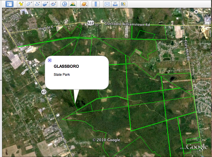
A fellow has created Google Earth layers for many of the NJ Wildlife Management Area's; the list is not complete, but his site is updated and he does accept requests. The links on his site open GE for that WMA and shows the boundaries; opening the GE TOPO layer gives a very nice reference map with the area boundary. Probably can be downloaded to a GPS if you can figure out how to do it :) I printed what I wanted and laminated them.

http://www.freemapsource.com/NJWMAs.html

He also has others available for differing activities.

http://www.freemapsource.com/
 

46er

Piney
Mar 24, 2004
8,837
2,143
Coastal NJ
I knew of the ones put out by F&W, and don't think they are worth the effort. I'll take a look at the ones you have. More is always better :)
 

manumuskin

Piney
Jul 20, 2003
8,555
2,469
59
millville nj
www.youtube.com
46 er,
thanks! I see they don't have a lot on south jersey yet but I'm sure they will.I knew of the site Boyd posted but it neat seeing the outlines on Google earth.I have downloaded their wilderness areas of the USA file and that brings up all the wilderness areas in the country's boundaries.this is the same with NJ WMA's.so cool!
Al
 

Boyd

Administrator
Staff member
Site Administrator
Jul 31, 2004
9,540
2,799
Ben's Branch, Stephen Creek
Would you like a file that works in Google Earth and shows all the NJ WMA's? I already have the data and think it would be pretty easy to make into a .kmz file for google. Personally, I don't use Google Earth, don't even have it on the machine I use for mapmaking, but I think it's easy to make an overlay.
 

Boyd

Administrator
Staff member
Site Administrator
Jul 31, 2004
9,540
2,799
Ben's Branch, Stephen Creek
OK, I have the file and it works in Google Earth. I had to disable the labels because they just cluttered up the map too much, but when you click on an area it will show the name. This is the same data I have gathered from several sources that include all public open space in NJ - state parks, WMA's, county-owned and other properties. It gets a bit confusing because as parcels are acquired, they are added to this database, so you will see lots of little parcels instead of just a simple big outline. But I believe this is the most accurate data available.

Trying it just now in Google Earth reminded me why I don't use it.... their NJ imagery is terrible! I don't want to deal with distributing this file, and it's not really something appropriate for GPSFileDepot. We can ask Guy if he can host it here, unless somebody else has a suggestion. The file is about 4MB. I already tried to attach it to this post; the attachment manager says I can upload .zip files, but when I try it won't let me.

Here's an example.

openspace.jpg
 

46er

Piney
Mar 24, 2004
8,837
2,143
Coastal NJ
OK, I have the file and it works in Google Earth. I had to disable the labels because they just cluttered up the map too much, but when you click on an area it will show the name. This is the same data I have gathered from several sources that include all public open space in NJ - state parks, WMA's, county-owned and other properties. It gets a bit confusing because as parcels are acquired, they are added to this database, so you will see lots of little parcels instead of just a simple big outline. But I believe this is the most accurate data available.

Trying it just now in Google Earth reminded me why I don't use it.... their NJ imagery is terrible! I don't want to deal with distributing this file, and it's not really something appropriate for GPSFileDepot. We can ask Guy if he can host it here, unless somebody else has a suggestion. The file is about 4MB. I already tried to attach it to this post; the attachment manager says I can upload .zip files, but when I try it won't let me.

Very nice of you to do that Boyd, thanks! Would you be able to email me that file? If so I'll send you my email via PM.
 

Boyd

Administrator
Staff member
Site Administrator
Jul 31, 2004
9,540
2,799
Ben's Branch, Stephen Creek
No problem. I did a bit more work on this, and have included a description of each area.

openspace2.jpg


Guy is going to put the map online where all can download; he will get back to us as soon as he has a chance. Happy New Years everyone! :dance:
 
  • Like
Reactions: Jennifer

Teegate

Administrator
Site Administrator
Sep 17, 2002
25,637
8,243
Here is Boyd's file. It is a direct download and will start as soon as you click on the link.


I want to warn all of you that Boyd has no control over the info on this file, and I can tell you from personal experience that there are numerous errors in it. So please be careful using it. In the end it is your responsibility to stay off of private property.


http://teegate.njpinebarrens.com/NJ-openspace.KMZ.zip


Guy
 

Boyd

Administrator
Staff member
Site Administrator
Jul 31, 2004
9,540
2,799
Ben's Branch, Stephen Creek
Of course that's good advice Guy. Good luck showing this map to the judge when you get arrested for trespassing! :)

For anyone who is interested, most of the data comes from here: http://www.state.nj.us/dep/gis/digidownload/metadata/statewide/newstate.htm

The data was derived from a variety of source maps including tax maps, surveys and even hand-drafted boundary lines on USGS topographic maps. These source materials vary in scale and level of accuracy. Due to the varied mapped sources and methods of data capture, this data set is limited in its ability to portray all open space lands accurately, particularly the parcels purchased prior to 1991.
_______________

All State-owned, protected, open space boundary lines were taken from hand-drafted delineations as they appeared on in-house 1:24000 USGS paper topoquads. These hand-drafted delineations mapped by the Divisions of Parks & Forestry or Fish & Wildlife varied greatly with regard to degree of accuracy, level of completeness & mapping methodology. In many cases, updates to these paper topos had been made sporadically over the years by different individuals with no documentation of the sources used or dates revisions were made.
_______________

Since 1995, the bulk of acquisitions are entered into the GIS using a certified survey of the property boundaries. The ArcInfo Cogo program facilitates the incorporation of deeds and surveys. Much effort is made to enter data within a year of the purchase. Tax map lines are utilized only if a survey does not exist.

I have also included data from the different counties where it was available, plus data from the USGS on federal property. This is just the same data included in my Map of New Jersey, but put into Google Earth's format.

Also note that this file is not in a format that can be used on a GPS. I was just reacting to a desire for people to use it in Google Earth on their computers. If you want it on a map in your GPS, use my Map of New Jersey: http://www.gpsfiledepot.com/maps/view/294/
 

Teegate

Administrator
Site Administrator
Sep 17, 2002
25,637
8,243
Of course that's good advice Guy. Good luck showing this map to the judge when you get arrested for trespassing! :)

Today, Al and I were stone searching and we were walking a ditch along private property. We were uncertain if the property we were on was state, but we had enough confidence so we gave it a try. We had first driven along the road in front of the private property and all indications made it seem there was nobody around, so going along the edge seemed acceptable.

Off we go up the trail and before we knew it we were standing in front of targets for target practice. Uncertainty on continuing on was raised, and suddenly Al informed me we were in the line of fire. I turned to see a man standing there with a cocked crossbow pointing right at us. I quickly yelled to him which startled the hell out of him. He had been looking down apparently sighting it or doing something before he was going to let it go.

When it was apparent we were safe I asked him if we could come over and talk to him. We apologized and told him we thought we were on state property which he quickly informed us was incorrect. After a short conversation, information that I had been told by Turtle calmed the situation down. It turns out he was the father of a man Turtle knows and he then allowed Al and I to roam the property freely. If this man had not been so nice, and I had not been told the information I knew, Al and I could have had a problem today.

Guy
 

46er

Piney
Mar 24, 2004
8,837
2,143
Coastal NJ
Today, Al and I were stone searching and we were walking a ditch along private property. We were uncertain if the property we were on was state, but we had enough confidence so we gave it a try. We had first driven along the road in front of the private property and all indications made it seem there was nobody around, so going along the edge seemed acceptable.

Off we go up the trail and before we knew it we were standing in front of targets for target practice. Uncertainty on continuing on was raised, and suddenly Al informed me we were in the line of fire. I turned to see a man standing there with a cocked crossbow pointing right at us. I quickly yelled to him which startled the hell out of him. He had been looking down apparently sighting it or doing something before he was going to let it go.

When it was apparent we were safe I asked him if we could come over and talk to him. We apologized and told him we thought we were on state property which he quickly informed us was incorrect. After a short conversation, information that I had been told by Turtle calmed the situation down. It turns out he was the father of a man Turtle knows and he then allowed Al and I to roam the property freely. If this man had not been so nice, and I had not been told the information I knew, Al and I could have had a problem today.

Guy

If you wandered onto private property that did not have any 'no trespassing' signs, you probably would not be in any legal trouble. However, an arrow stuck in your forehead would be a whole different issue : )

BTW, it is still bow deer season. Al should have had on his flourescent orange hat :D
 

Teegate

Administrator
Site Administrator
Sep 17, 2002
25,637
8,243
But did you find the stone?

No. We did see the concrete monument on the corner of the property and the other corner was a nightmare of briers. Al felt it was closer to the crossbow so we decided it was best not to bother him when he was shooting. Soon after that he packed up so we could have looked for it. He told us we could do whatever we wanted.


Guy
 
Top