Place name near Hammonton Airport

relayer

Explorer
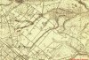
There is a collection of older houses at the interesting, triangle forming intersection of Rt 613 and Rt 693 that really looks like it ought to have a name. However, unless I had Mapquest and Google at the wrong scales to see it, no name was to be found. Didn't have any luck with the county maps at my site either. So, if anyone knows the name of this place, I'd love to hear it.

Thanks much

Best

relayer
 

Ben Ruset

Administrator
Site Administrator
Oct 12, 2004
7,618
1,873
Monmouth County
www.benruset.com
According to the historic topo map of Atlantic County, as well as the George Cook Atlas Sheet 15, there's no name for that intersection. It seems like it's always just been considered "Hammonton."

That's not to say that there may not be some sort of "local name" for it, but from my experience, the Cook Maps are pretty good at documenting that. Here's a link to Cook Map 15, and I'm attaching a snippet below.
 

Attachments

  • cook-sheet15.jpg
    cook-sheet15.jpg
    310.7 KB · Views: 216

relayer

Explorer
Ben, Guy and Jerseyman - Thanks for your help here. It looks like maybe I should stop the next time I go by there, kmock on a few doors and see what today's inhabitants call the place. "Outskirts of Hammonton" may be the best answer I get.

Mark Demitroff has pointed out that the nearest place name to the intersection is the dramatically named Desolation Pond, a now mostly dry spung noted in an 1803 survey by John Clement Sr.. I think Mark said it may show up on the Cook Map of the area. Apparently a very old trail/road that ran from spung to spung passed by there.

relayer
 
Top