Re-Exploring the Forked River Mountains

Ben Ruset

Administrator
Site Administrator
Oct 12, 2004
7,617
1,868
Monmouth County
www.benruset.com
I'd been meaning to go and revisit some of the places I'd been to in the Forked River Mountains between 2001-2004, but never really had the time or the inclination. Today I had both. :)

Coming in my usual way by the boardwalk on 539 I saw that the state seemed to have come in and did some maintenance on the road. All of the puddles are gone, and fresh sand is in their place. Eureka Gun Club is pretty grown over, which I imagine is part of their design to keep people off the property.

I really wan't expecting this surprise, though:

watermark.php


Yes, looks like Black's Bridge has been completely rebuilt out of metal. The wooden guardrails are gone, and the bridge deck is metal grating.

Goodbye, old wooden bridge:

watermark.php


I also stopped by to check on Black's Stone. It's really, really choked up back there.

watermark.php


watermark.php


Continuing on, I wanted to try to find Ted Gordon's Aserdaten Ruins, as was discussed here a few years ago. I think I may have been looking too far North, as all I found were the ruins that Bob found a few years ago.

watermark.php


watermark.php


watermark.php


Then, I found myself driving down a very narrow trail:

watermark.php


on my way to revisit the ruins of a gun club near Aserdaten that I had first visited in September of 2003. Since I can't find the pictures from back then, I re-uploaded them in this album.

I was very happy to see that the ruins are more or less as I left them 5 years ago. They're pretty out of the way, and not so easy to drive up to. The road was tight, and by the time I got to the intersection of Dutchman's Rd. and the road I was on (presumably unnamed) I figured I'd added enough pinstripes to the truck and I ought to stop. I did the same thing five years ago. :)

watermark.php


watermark.php


Now:
watermark.php


Then:
watermark.php


Now:
watermark.php


Then:
watermark.php


Now:
watermark.php


Then:
watermark.php


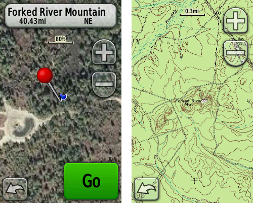
From there I retracted my steps up to the Forked River Mountain Preserve. Established in 1997, the preserve protects 531 acres of land from development. The preserve is north of Aserdaten, and you'll need some sort of 4x4 to get to it. The Nature Conservancy will let you drive back there as long as you stick to the established roads. The views are just absolutely amazing, and to be honest look more like the plains of Africa than the Pine Barrens.

watermark.php


watermark.php


watermark.php


Someone has also setup a shooting range back there. That's prohibited, but at least there's a HUGE berm behind the targets so no stray bullets can harm anything.

watermark.php


watermark.php


From there, I doubled back down past Aserdaten and went up the mountain:

watermark.php


Checked out the view:

watermark.php


and then visited the ammunition depot ruins by the Tuckerton RR:

watermark.php


watermark.php


I still really want to try to find the ruins that Ted is talking about. I just can't really picture where he says the ruins are, though.
 

bobpbx

Piney
Staff member
Oct 25, 2002
14,195
4,293
Pines; Bamber area
That new bridge is amazing. Who would have thought the State would just do that? Really surprises me. Looks like they took down that poison sumac too.

I like the before and after photos. Everything sinks eventually.
 

MarkBNJ

Piney
Jun 17, 2007
1,875
73
Long Valley, NJ
www.markbetz.net
I kind of miss that old bridge, but the new one does look shiny and strong! Great pictures, Ben. I have to get up to that area north of Aserdaten.

Does anyone else find the duct tape over that shot-up dummy's mouth a little wierd?
 

Boyd

Administrator
Staff member
Site Administrator
Jul 31, 2004
9,533
2,792
Ben's Branch, Stephen Creek
Nice report Ben! I love that area also and it's been about a year since I was there last... your photo's make me anxious to return. :)
 

Teegate

Administrator
Site Administrator
Sep 17, 2002
25,627
8,228
Ben,

Those plains were once a huge hill that the sand company removed.

Nice report. I guess the beavers were not happy about the bridge. I would have to assume the only reason they replaced it was because of them. The bridge was as solid as a rock, but the support beams were perfect for the beavers to use to shore up their dam. In any event, it would be interesting to know the real reason.


I believe this is the photo I took of the hill in 1978.


1_79.jpg


Guy
 

Ben Ruset

Administrator
Site Administrator
Oct 12, 2004
7,617
1,868
Monmouth County
www.benruset.com
Yeah, I imagined that *something* big must have happened there to cause those plains to form. There's only a few scattered pines, and just wavy grass there now. Totally does not feel like the Pine Barrens at all. I bet the deer love it.
 
Oct 25, 2006
1,757
1
73
Nice report and trip Ben.

Is the Gun Club you visited off of the first road to the right going south from Black's Bridge ?, i see two Club location in that area.

Jim
 
Oct 25, 2006
1,757
1
73

I tried getting to that area in my Taurus two years ago, i had to turn around after a certain distance due to the road condition, with the Jeep i hope to visit in the future.

The other club that i had in my was on the North side of the Chamberlain a short distance away.

http://maps.njpinebarrens.com/#lat=39.86047249120486&lng=-74.36087608337402&z=15&type=topo&gpx=

The above area between the red marker there are dots on each side of the Chamberlain, i am unfamiliar with the area, but are they former Gun Clubs or some other kind of structures ?

Jim
 

Ben Ruset

Administrator
Site Administrator
Oct 12, 2004
7,617
1,868
Monmouth County
www.benruset.com
If you have a vehicle that you don't really care about getting scratched up, you can drive right up to the club. As it is, I park at the intersection of Duchmans Rd. and walk the mile or so to the ruins.

As for the other place you mention, I think they're both gun clubs. I visited there a few years ago - that's where my dog got caught in an illegal snare.

http://gallery.njpinebarrens.com/showgallery.php/cat/83
 

PINEY MIKE

Explorer
Jan 30, 2009
707
25
Bamber Lake
Im back there most days walking the pooch. Funny you say the plains of Africa because whenever I explain that place to someone I describe it as "the Serengeti." Such a breath of fresh air out there.
 

Kevinhooa

Explorer
Mar 12, 2008
332
25
41
Hammonton, NJ.
www.flickr.com
Great photos Bruset! That area is a pretty neat place. Such a web of roads out there though. Am I right in remembering that there used to be a fire tower out there? I thought I saw the 4 foundations somewhere. Does anyone know what happened to that?
 

woodjin

Piney
Nov 8, 2004
4,341
327
Near Mt. Misery
Great photos Bruset! That area is a pretty neat place. Such a web of roads out there though. Am I right in remembering that there used to be a fire tower out there? I thought I saw the 4 foundations somewhere. Does anyone know what happened to that?

yes, it is near the "big pit" off of 539.
 

Teegate

Administrator
Site Administrator
Sep 17, 2002
25,627
8,228
Great photos Bruset! That area is a pretty neat place. Such a web of roads out there though. Am I right in remembering that there used to be a fire tower out there? I thought I saw the 4 foundations somewhere. Does anyone know what happened to that?

It was moved by helicopter because it did not have electricity and vandals were causing problems as usual. It is the same one that is now on 539. The bottom section was damaged during the move and it now is shorter.

It was located here.

http://maps.google.com/maps?hl=en&ie=UTF8&ll=39.830081,-74.340878&spn=0.002966,0.00648&t=h&z=18

Guy
 

Boyd

Administrator
Staff member
Site Administrator
Jul 31, 2004
9,533
2,792
Ben's Branch, Stephen Creek
This thread inspired me to make some new maps of the area. :) If you have a Garmin Oregon, Colorado or Dakota GPS, you can download them here: http://www.gpsfiledepot.com/maps/view/241. They use Garmin's new "custom map" format which was recently released in beta for the above-mentioned units (see: http://forums.njpinebarrens.com/showthread.php?t=6915). The download includes high resolution versions of both the USGS 1:24000 topo map and the NJ 2007 orthoimagery for the area.

frm06.jpg
 

Boyd

Administrator
Staff member
Site Administrator
Jul 31, 2004
9,533
2,792
Ben's Branch, Stephen Creek
Yes, that's from my Oregon. This is a really cool new feature from Garmin, but still in beta and a little buggy. I'm sure they will improve it with future updates. Anyone who is thinking about a new GPS should really consider these models (Oregon/Dakota/Colorado) IMO. Garmin has not said whether they will port it to older models, but I suspect they won't have enough processing power to support these new maps.

Garmin's format places a limit of 10,240 x 10,240 pixels on these maps. So a USGS 24k topo at full resolution can only be about 10 miles x 10 miles although that can be stretched to 20 miles x 20 miles without too much quality loss. The NJ 2007 aerials at full resolution will only cover about a 2 mile x 2 mile area, but this can be stretched to about 8 miles x 8 miles and still have quality comparable to Google Earth (maybe better).

I will be adding more maps here in the future: http://www.gpsfiledepot.com/maps/byuser/282/
 

NJBill

Explorer
Sep 10, 2008
120
2
Hamilton (Mercer County)
This thread inspired me to make some new maps of the area. :) If you have a Garmin Oregon, Colorado or Dakota GPS, you can download them here: http://www.gpsfiledepot.com/maps/view/241. They use Garmin's new "custom map" format which was recently released in beta for the above-mentioned units (see: http://forums.njpinebarrens.com/showthread.php?t=6915). The download includes high resolution versions of both the USGS 1:24000 topo map and the NJ 2007 orthoimagery for the area.

frm06.jpg

Once again hats off and many thanks to Boyd, GPS Master! It took some additional side help from Boyd (typical for me) to get this going on my Oregon. Very timely for me for an upcoming trip. I'm not sure that everyone realizes what these maps (even if available first of all) are worth.
THANKS BOYD!

Bll
 

Boyd

Administrator
Staff member
Site Administrator
Jul 31, 2004
9,533
2,792
Ben's Branch, Stephen Creek
My pleasure Bill. If my maps help people enjoy the pines, then I'm happy.

As I told Bill though, remember that the new Garmin Custom Map support is still in the beta-testing phase, and there are certainly some bugs. Anyone who plans to use these new maps should test them out close to home before heading off on a long hike with potentially buggy GPS firmware.

Let us know how it works for you. I will be uploading more pines-related maps at GPSFileDepot in the future.
 
Top