Richland Ruins

manumuskin

Piney
Jul 20, 2003
8,554
2,466
59
millville nj
www.youtube.com
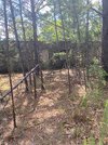
Took a bushwack with a friend yesterday and came upon some unexpected ruins , well two out of three ruins were unexpected,one showed on the topo.I believe they may all be hunting clubs.Am inquiring if anyone knows anything about them.I know this is Spungs turf so he might want to chime in.Here are the locations.The northern loacation is two separate ruins within eye shot of each other.One is about 40 by 30 and a cinder block wall about two ft high,no pic and the other is about 60 by 40 with a four foot high cinder block wall.The southern location is on the topo and this is where the pics were taken
Some very nice vernal ponds in the area, the reason for the trip to begin with
 

Attachments

  • 298953152_171023515459302_7384864529375305813_n.jpg
    298953152_171023515459302_7384864529375305813_n.jpg
    125.6 KB · Views: 129
  • 298768995_171023662125954_7975851121092439275_n.jpg
    298768995_171023662125954_7975851121092439275_n.jpg
    906.5 KB · Views: 124

Spung-Man

Explorer
Jan 5, 2009
977
659
64
Richland, NJ
loki.stockton.edu
Manumuskin,

You do get around! 'Bet you didn't know that you were on Hance Bridge Road at its intersection with the Old Lmmis Road. The former trail connects the Union House with Smith's Little Mill above Weymouth. The latter trail connects Mays Landing's Lummis Causeway over Lummis Run with Lummistown/Cedarville via the Cohansey Trail. Early on Lummis was all about Atlantic whitecedar.

You explored Lummis Swamp at South River Head. The largest basin is Lummis Pond, which is Figure 2 in French & Demitoff (2001, Cold-Climate Origin of the Enclosed Depressions and Wetlands [‘Spungs’] of the Pine Barrens, Southern New Jersey, USA). PC's John Bunnell is in the background for scale. The block building remains are the bones of a cryptic chop shop. I petitioned for the Lummis Swamp wetlands to be preserved and now its open space under Buena Vista Township.

S-M
 

manumuskin

Piney
Jul 20, 2003
8,554
2,466
59
millville nj
www.youtube.com
Well thank you Spung and what a nice piece of woods it is.A bit tough in spots but quite splendid with some awesome vernals. I did not know thats what those roads were but the north south road did appear to be quite old with a u shaped profile usually meaning worn in by horse and buggy and not modern wheeled vehicles the horses hooves creating the u shape. Very little human presence except for deer stands along the north south rd and the ruins themselves.Not a single stand was seen except for one along the edge at the park and none along the vernal edges.One atv trail in the northern high ground end that went past the ruins,probably created by the hunter along north south rd and I assume coming from the houses along Washington rd.
 
Top