Something I found....what was it?

bigoldford

New Member
Jan 3, 2009
18
0
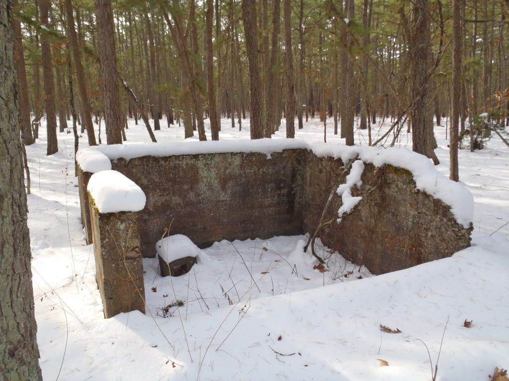
The other day we took one of our dogs for a walk from Hampton Furnace to Sunken Bridge. It was real nice with all of the snow. After our walk on our way out to 206 on hampton road i noticed a small foundation on the right a good ways back in the woods.
Does any one know what this is?
PC310047.jpg


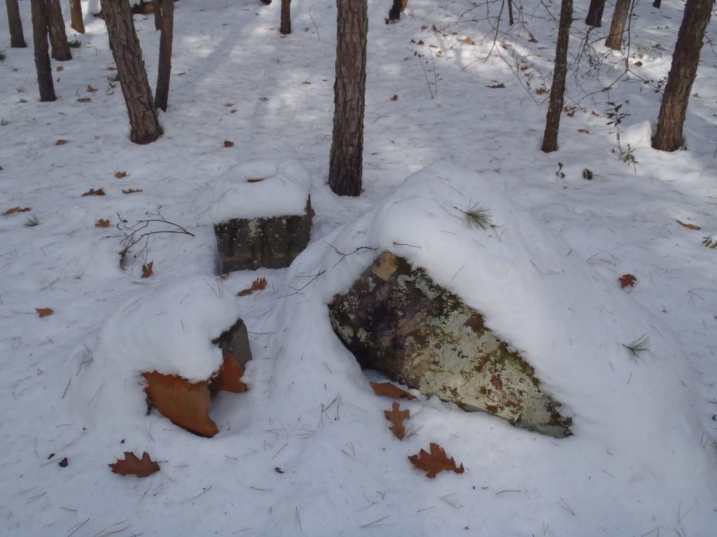
here is the chimney that's next to it
PC310048.jpg


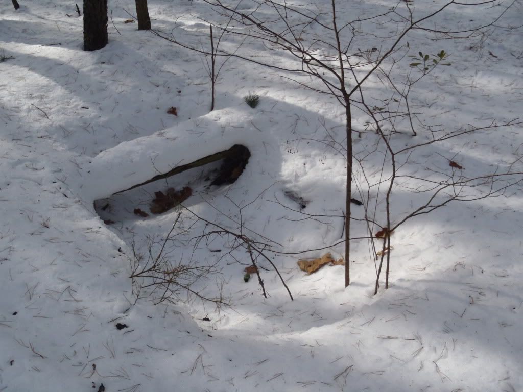
There was also a sinkhole near it
PC310049.jpg


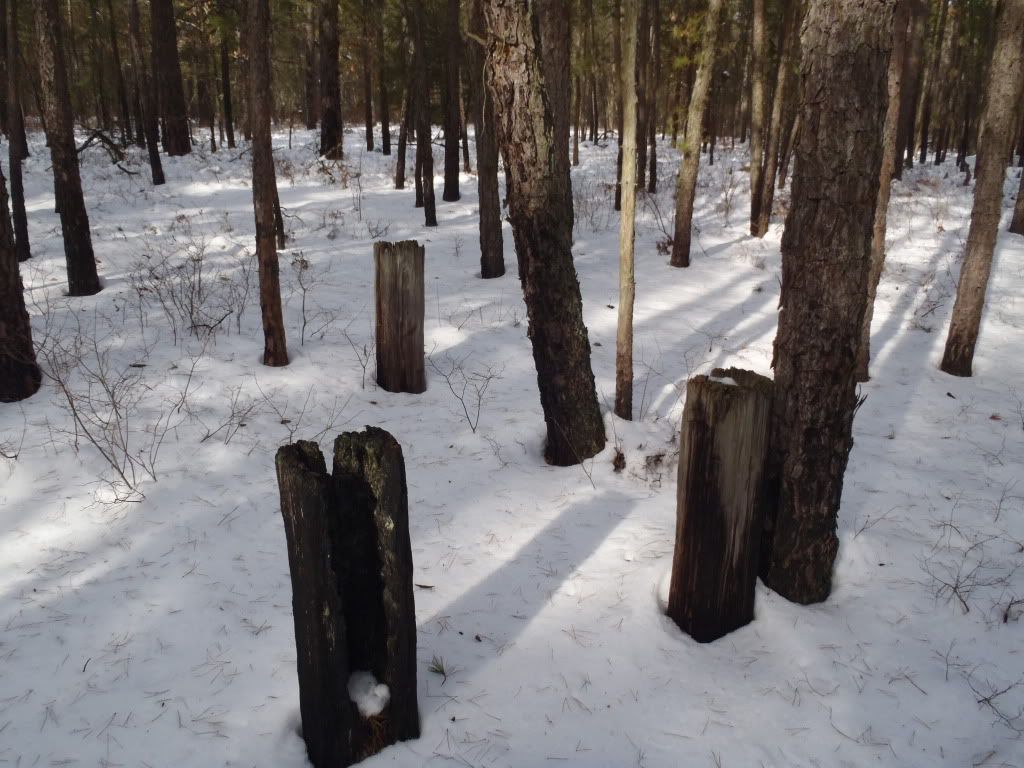
and finally I also found three railroad ties that were burried in the ground like they were blocking something at one point. They looked like they had been through at least one bad fire. They were also pretty far away from the building. Any ideas as to what these were for?
PC310050.jpg


I know the snow may make it harder to figure out what everything is, but i was just wondering what this used to be. I was thinking maybe some sort of hunting club, but it was awfully small foundation. Thanks so much!

Matt
 

gipsie

Explorer
Sep 14, 2008
547
67
55
atlantic county
That's it. Many a geocache has been placed there. Check out the Yucca's.

There is a cache near there now. Whoever placed it disappeare into the unknown and I have been keeping an eye on it to make sure it stays away from the ruins. It is a great area. And I was always curious about what the ruins were from...
 

bigoldford

New Member
Jan 3, 2009
18
0
thanks for the reply's. It is pretty interesting because it is currently not located near anything. Anyone else have any ideas what it is?
 

RednekF350

Piney
Feb 20, 2004
4,953
3,104
Pestletown, N.J.
thanks for the reply's. It is pretty interesting because it is currently not located near anything. Anyone else have any ideas what it is?

I think it is cranberry related. It was a pretty hopping area in the 1930 aerials.
It could have been a small dwelling. I have seen very small dwelling foundations around some old bogs right here in Ptown and in Parkdale complete with a spear well inside the house. These dwellings might have been 12' x 12' +/-
Here is a look at the 1930 aerial around Deep Run where the foundation is that you found.
 

Attachments

  • deep.jpg
    deep.jpg
    98.7 KB · Views: 277

Teegate

Administrator
Site Administrator
Sep 17, 2002
25,628
8,229
I asked about that building when I had email conversations with the man who gave me the photo of the cranberry warehouse at Hampton. In post 18 at the far below link he mentions it I believe. I would have to say it is the "small packing house" he refers to.


About a mile or so down the road to 206 there was another cranberry bog. I do not know who owned it originally. The State owned it during my connection with the area. There was a small packing house and a residence. They were burned down.


I am pretty confident I am correct on that. You can see in this 1951 aerial there is a circular drive around it. That usually indicates vehicles coming and going bring and taking away the cranberries. It is in a convenient location along the main road near all the bogs. If you go again take notice there is some sort of sidewalk leading to it for a short distance. When I first visited years ago I thought it was a house but after my email conversations I think it was a packing house or we could call it a storage house.


cranberry.jpg


building.JPG


http://forums.njpinebarrens.com/photographers-phorum/8099-cranberry-packing-house-hampton-park.html


Guy
 

Teegate

Administrator
Site Administrator
Sep 17, 2002
25,628
8,229
Ed,

My photo above is from I believe one of our first outings together. It was 11/24/2002. They were rebuilding Constable Bridge.

ConstableBridge.JPG


Guy
 

bigoldford

New Member
Jan 3, 2009
18
0
TeeGate thanks so much for this great info! The link to the cranberry packing house is awesome as well! I am defiantly going to go check this place out again with out the snow!
 

Teegate

Administrator
Site Administrator
Sep 17, 2002
25,628
8,229
I have our answer. It was the house. I will pass along all that I have later today.


Guy
 

Teegate

Administrator
Site Administrator
Sep 17, 2002
25,628
8,229
To be more exact the location in question is where the house was; however, the house had other structure around it so I am uncertain if it was actually the house. In any event, here is the info I learned.


Heading toward Route 206, the house was just past the bogs on the right side as the road turns left. There were also some out buildings as I recall.

My grandfather referred to the area, or farm, as "Deep Run".

The packing house was the long building near the bogs. I never saw the packing house standing. I did see the house, though.

I never walked around the house.


house_packing.jpg


In 1941 the packing house was there, but by 1951 it was gone.

Guy
 

ecampbell

Piney
Jan 2, 2003
2,841
964
There are remnants and soil disturbance at the packing house location. Also some upright ties.
 

Teegate

Administrator
Site Administrator
Sep 17, 2002
25,628
8,229
Top