Stafford Township and Bass River on 1949 topo

Boyd

Administrator
Staff member
Site Administrator
Jul 31, 2004
10,046
3,147
Ben's Branch, Stephen Creek
Do you mean here? Sorry, no idea but it is interesting if all that area was really cleared. Agriculture? Clear cutting for lumber/wood pulp? Or maybe it was pygmy pines that they did not consider to be "forest"? Could be that they just didn't have good landcover data for that area and left it blank?
 

Boyd

Administrator
Staff member
Site Administrator
Jul 31, 2004
10,046
3,147
Ben's Branch, Stephen Creek
Looking some more... also shows as blank on the 250k topo from the 1940's when you zoom out on the historic topo here. Also see the USGS historical topo map explorer 
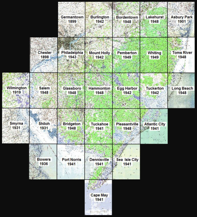
here. You can see that this is actually the 1942 Tuckerton quad. I named my map "1949 in the pines" because I liked the rhyme of "nine" and "pines". :D The actual dates of each quad are shown in the map info. Was there a big fire that burned that whole area back then?

quads1949.jpg
 

bobpbx

Piney
Staff member
Oct 25, 2002
14,849
5,074
Pines; Bamber area
You asked about a big fire there at the time. When I was watching that Bass River 1977 fire video, the narrator said there were 5 firefighters killed in the same area in the 1930s (1936?).
 
  • Like
Reactions: Boyd
Top