I'm sitting at my desk counting the days/hours until Saturday morning when I'll be heading up to the Kittatinnies with some old friends for a weekend of camping and exploring in and around the Delaware Water Gap. We'll be staying at Bear Creek Campground, which is basically an old farmstead that remained in private hands through the Tocks Island mess and is now a private campground not far from where the DWG borders Stokes State Forest. I've spent a lot of time pouring over NJPB maps and Garmin Basecamp plotting routes to some potentially interesting places. Pictures and trip report to follow!

Walpack for the weekend
- Thread starter Badfish740
- Start date
You are using an out of date browser. It may not display this or other websites correctly.
You should upgrade or use an alternative browser.
You should upgrade or use an alternative browser.
Does Bear Creek Campground have a website? It sounds interesting. What type of camping are you doing, tent, trailer?
No-it's pretty bare bones. It used to be called the Walpack Valley Campground, and Mrs. B's (I think?) before that. The guy who owns it now is a State Trooper who runs it as a side business. One part of it has an area with trailers that are more or less permanent-most are used by hunters and fishermen in season. There are tent sites along the Flatbrook River which runs through the campground. We'll be down on the Flatbrook in the woods. There are no showers or any other amenities-just porta-potties and a fresh water hydrant. The owner's name is Ken: 973-948-4384 Leave a message on the answering machine and he'll call you back.
I stay at the campground frequently, the owner Ken is a nice guy. Great trout fishing in the flatbrook and this the time of year. Walpack Inn is right there for fine food and spirits. We always stop in the Flatbrook Taphouse for a few after fly fishing all day. Enjoy your trip, I'll be in Ostego County NY turkey hunting this weekend.. hoping the weather clears.
I stay at the campground frequently, the owner Ken is a nice guy. Great trout fishing in the flatbrook and this the time of year. Walpack Inn is right there for fine food and spirits. We always stop in the Flatbrook Taphouse for a few after fly fishing all day. Enjoy your trip, I'll be in Ostego County NY turkey hunting this weekend.. hoping the weather clears.
Cool-this will be our first time staying there. I've been past the place a bunch of times and talked briefly with someone who keeps a trailer there. From what I understand the tent sites down on the Flatbrook are nice. The weather looks like we might get some showers Saturday but that it will be clear on Sunday. Here's hoping anyway...
It's still too early for me to hit the major streams. I prefer the solitude of later in the season. I have a few tiny streams I fish before then that get little pressure, some even containing wild brookies, but for now I occupy myself at the fly tying desk.
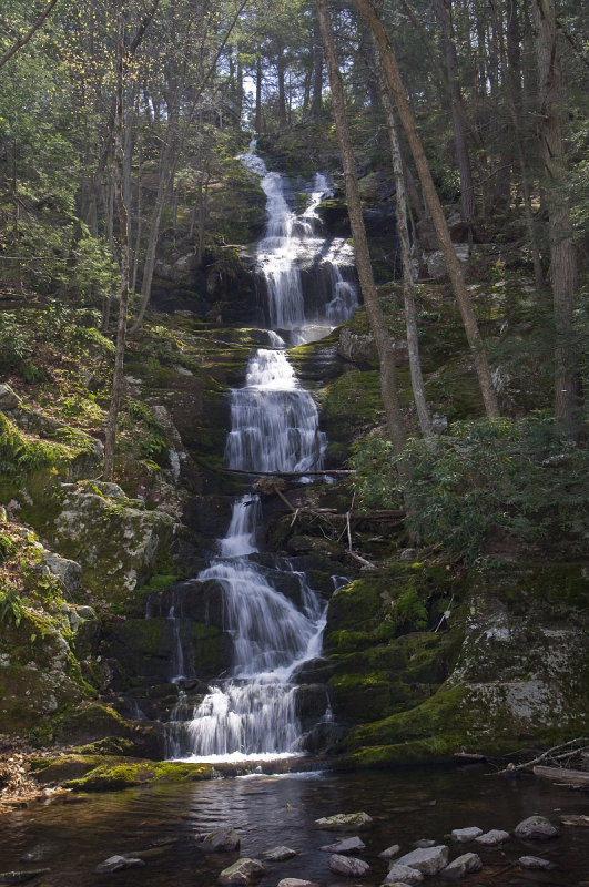
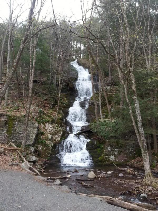
I hope you get to check out Buttermilk Falls. My son, dog and I hiked to the top last June and we stepped right over a timber rattlesnake!
I hope you get to check out Buttermilk Falls. My son, dog and I hiked to the top last June and we stepped right over a timber rattlesnake!

I hope you get to check out Buttermilk Falls. My son, dog and I hiked to the top last June and we stepped right over a timber rattlesnake!
We'll definitely check out Buttermilk. I've been there a bunch of times as has another one of the guys, but we'll be bringing up some South Jersey boys who consider the Forked River Mountains, to be well, mountains
 The falls ought to be raging this weekend given the rain we're getting today into tomorrow. The forecast is looking better and better for the weekend so things will be a bit soggy but otherwise good. I'm hoping that some of the roads I've been scoping out to explore aren't totally underwater though.
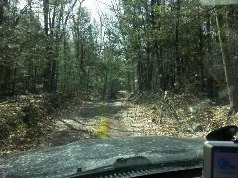
Pictures are taking forever to upload but we had a great trip. We had to cut it a little short and only hit the highlights because we got a late start. We had a blast exploring Stokes. It's not the Rubicon but there are some nice rides through the woods and it is challenging driving, but that's probably due to the fact that the spring melt/runoff combined with the 5" of rain Sussex County saw on Wednesday really tore up the roads. There were a lot of bad washouts and some of the roads were real teeth rattlers. It's really a shame that the NPS, save for a few exceptions, pretty much has a no motorized vehicles policy on its unpaved roads. There are many miles of roads left over from before the Tocks Island land grab that are gated.
One big disappointment was when we took Woods Road headed southwest from where it intersects with Brink Road. I was hoping we'd be able to follow it all the way out to the ponds/bogs that feed the stream which flows through the lane of the Shoemaker Farm (more on that later)-when we got to the border between Stokes at the DWG there was a gate. The road was much less defined beyond the gate, but definitely there. In fact, I'm fairly certain that it continues all the way to Hemlock Pond, though it's likely badly damaged/overgrown in some areas-a topographic map represents a connector that at times is depicted as an unpaved road and at times a trail. I plan on driving to the gate and then hiking the rest of the way this summer. It will be interesting to see what there is to find along the road-especially around the ponds. I don't think they're naturally occurring and must have been dammed at one time. I don't know of any developments in that area, but I suppose it could have been part of the same vacation community built around Hemlock, Crater, and Blue Mountain Lakes further to the southwest. The photos should be all uploaded by tomorrow.
One big disappointment was when we took Woods Road headed southwest from where it intersects with Brink Road. I was hoping we'd be able to follow it all the way out to the ponds/bogs that feed the stream which flows through the lane of the Shoemaker Farm (more on that later)-when we got to the border between Stokes at the DWG there was a gate. The road was much less defined beyond the gate, but definitely there. In fact, I'm fairly certain that it continues all the way to Hemlock Pond, though it's likely badly damaged/overgrown in some areas-a topographic map represents a connector that at times is depicted as an unpaved road and at times a trail. I plan on driving to the gate and then hiking the rest of the way this summer. It will be interesting to see what there is to find along the road-especially around the ponds. I don't think they're naturally occurring and must have been dammed at one time. I don't know of any developments in that area, but I suppose it could have been part of the same vacation community built around Hemlock, Crater, and Blue Mountain Lakes further to the southwest. The photos should be all uploaded by tomorrow.
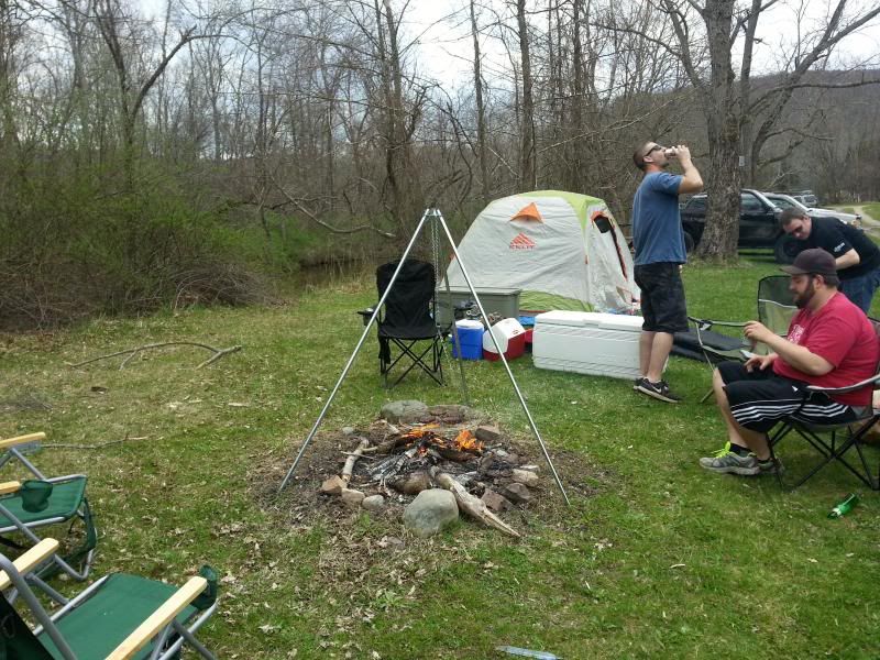
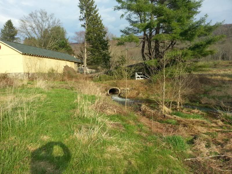
We got to Bear Creek around 11:00 but we had to wait for the owner to get back because the Wednesday rainstorm flooded out a lot of the wooded campsites along the Flatbrook. He showed us where we could set up-we made camp and got a little lunch going:
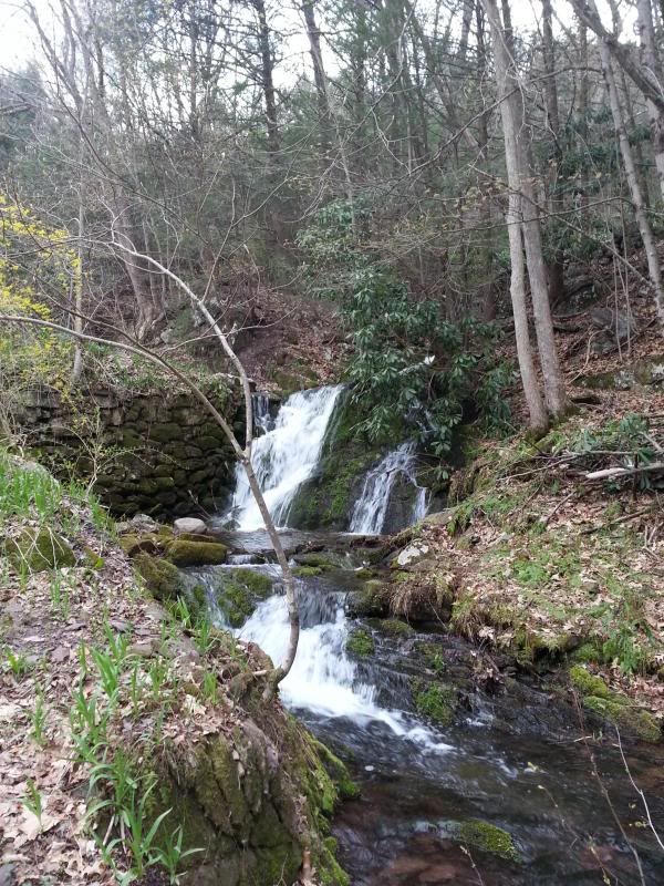
We hit Buttermilk first because none of them had ever been there before:
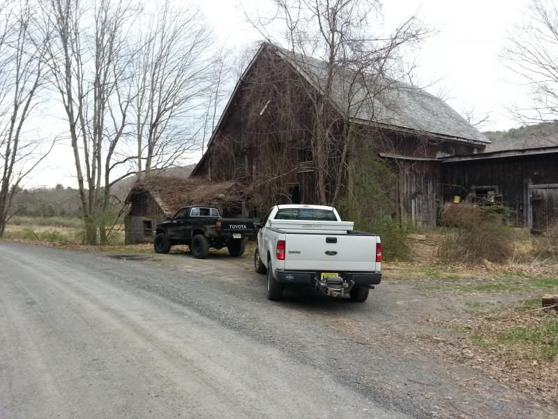
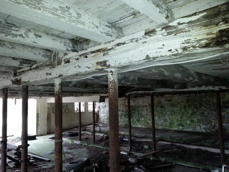
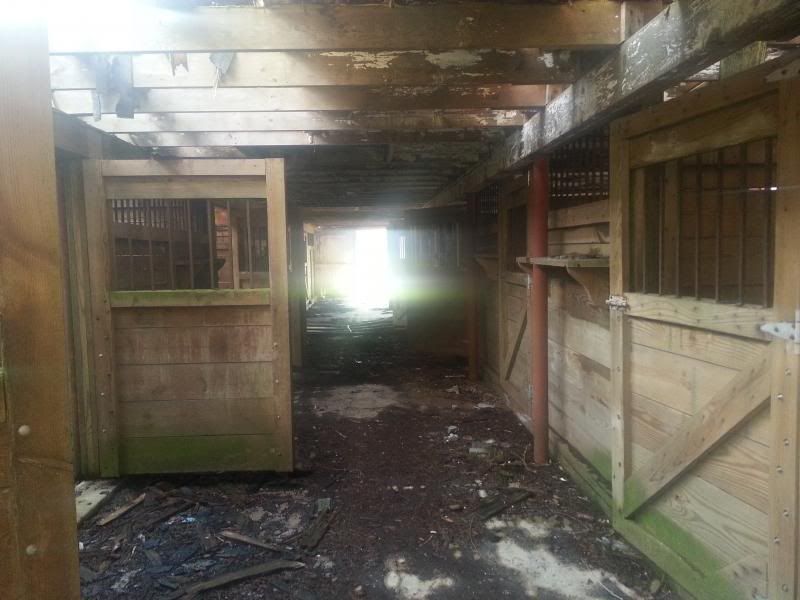
Then checked out the old cow barn across from the white house on Mountain Road-the Walpack valley used to be big dairy country:
Small waterfall across the road beside the white house-it amazes me how much stonework was done to guide the flow of water and that it's still there after all these years of heavy runoff and flooding:
Then up to Skyline Drive:
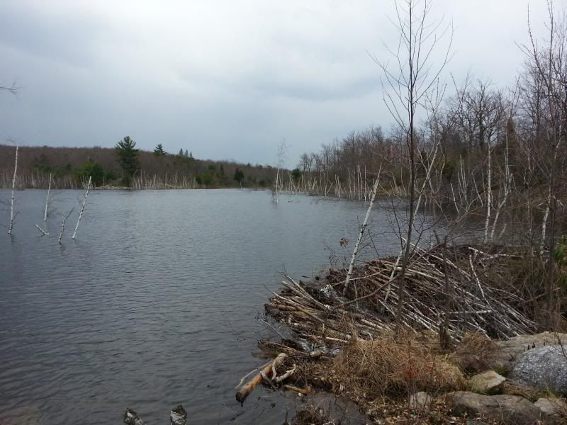
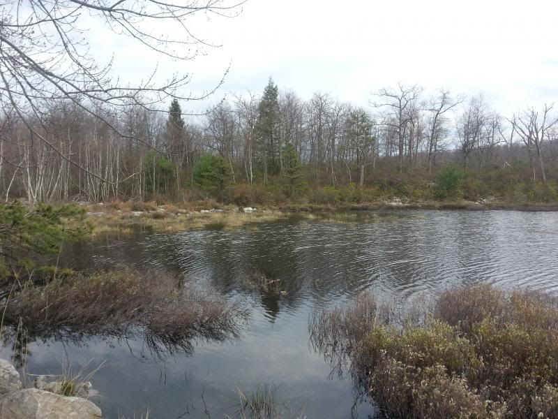
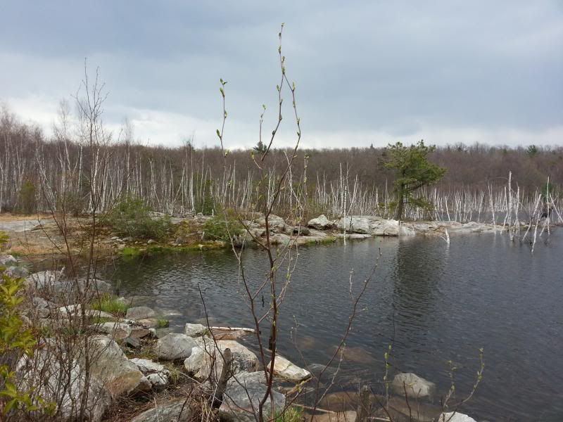
"Lake" Success (the first one you come to on Skyline on the way to Crater) is looking more like a lake again even though the NPS drained it sometime in the late '90s/early 2000s. Some beavers got to work and raised the water level about 6'. It was spilling over due to the heavy rains:
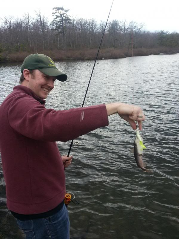
Caught dinner at Crater :laugh:
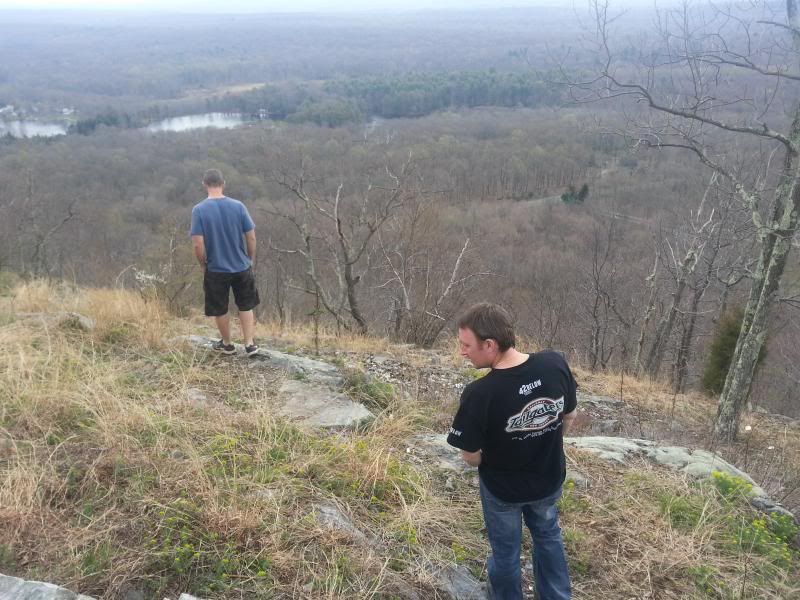
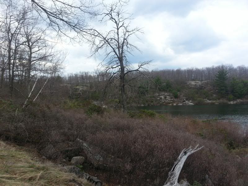
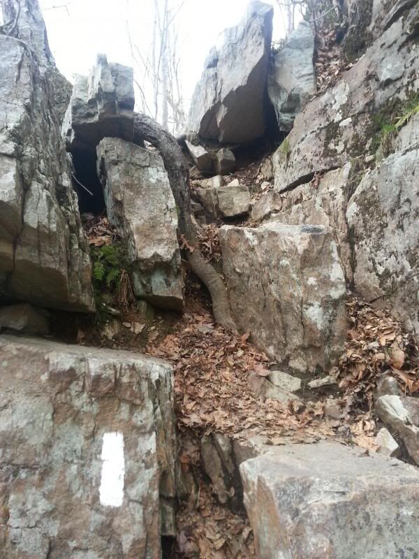
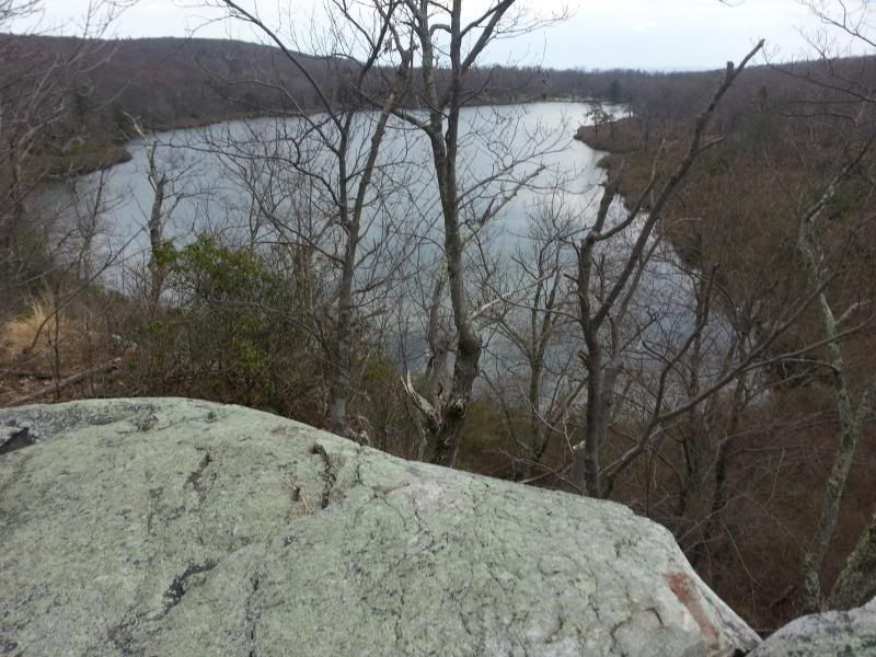
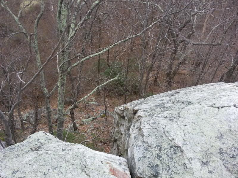
And then hiked around to the cliffs on the northeast side:
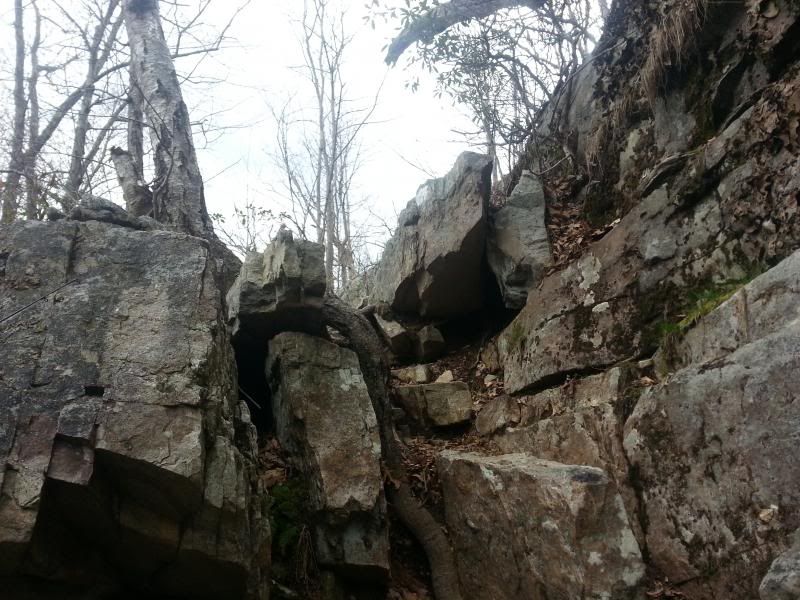
The rock face looks tough to climb but it's not:
Nice view from the top:
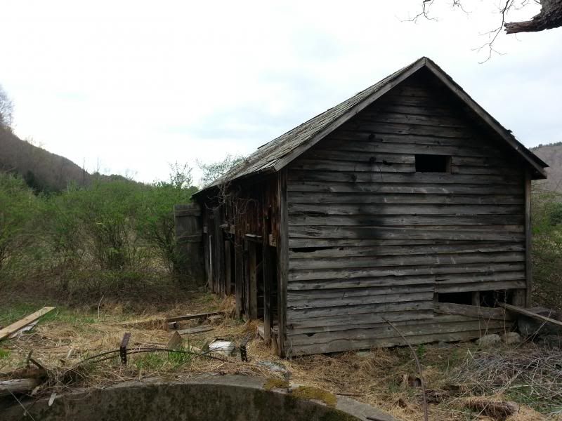
Back down in the Valley to the Shoemaker Farm:
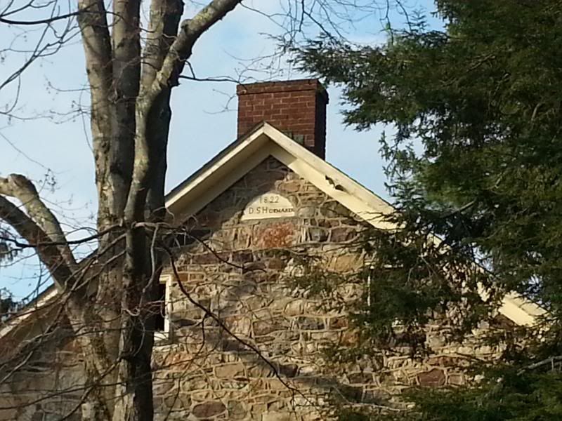
Someone was apparently renting the property from the NPS until about 2007 according to a friend of my wife's who lives in Stillwater, hence the fairly recent improvements to the horse barn:
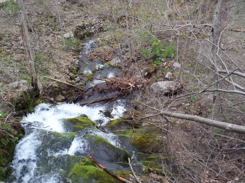
The outlet of the stream that tore up the lane going into the farm-this is the one that originates from the pond on top of the ridge where I was hoping to be able to drive through to but was stopped by the gate on Woods Road:
Took a small detour on the way back to camp to an area where the Flatbrook-Roy WMA and the Gap border each other. There's a decent hillclimb or two but it doesn't really go anywhere. Couldn't snap any pictures while I was driving:
Back to camp-mmmm...burgers, brats, and beer...
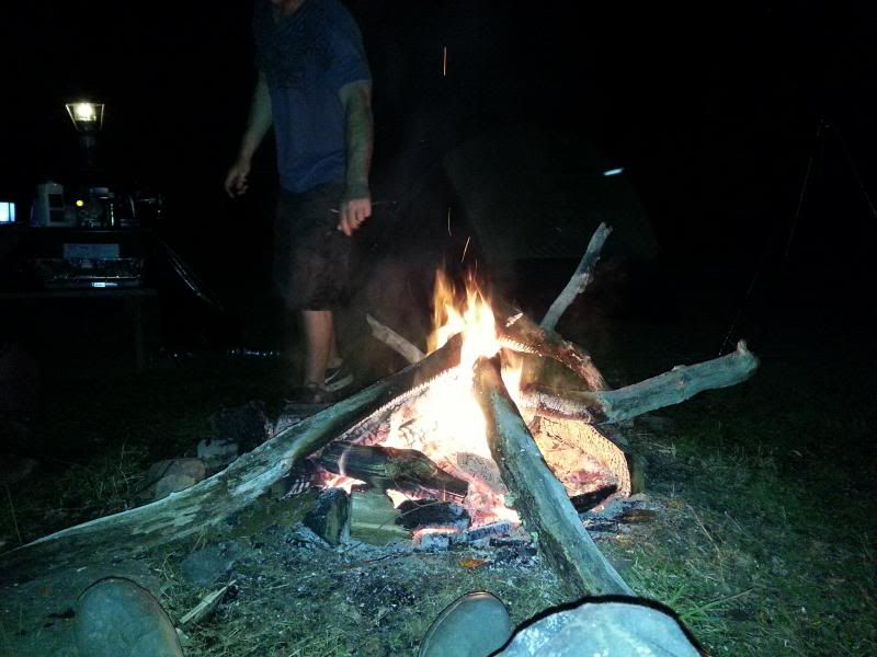
It rained a little which kind of sucked but it passed over before we really got soaked. I hit the sack first because I had been up since 5:00 a.m. and passed out. My buddies said they're pretty sure that if there were any bears in the area (we saw a big one at Crater) they probably cleared out because once I got to snoring I sounded like a big one :laugh: It's nice having a four man tent all to yourself.
We hit Buttermilk first because none of them had ever been there before:
Then checked out the old cow barn across from the white house on Mountain Road-the Walpack valley used to be big dairy country:
Small waterfall across the road beside the white house-it amazes me how much stonework was done to guide the flow of water and that it's still there after all these years of heavy runoff and flooding:
Then up to Skyline Drive:
"Lake" Success (the first one you come to on Skyline on the way to Crater) is looking more like a lake again even though the NPS drained it sometime in the late '90s/early 2000s. Some beavers got to work and raised the water level about 6'. It was spilling over due to the heavy rains:
Caught dinner at Crater :laugh:
And then hiked around to the cliffs on the northeast side:
The rock face looks tough to climb but it's not:
Nice view from the top:
Back down in the Valley to the Shoemaker Farm:
Someone was apparently renting the property from the NPS until about 2007 according to a friend of my wife's who lives in Stillwater, hence the fairly recent improvements to the horse barn:
The outlet of the stream that tore up the lane going into the farm-this is the one that originates from the pond on top of the ridge where I was hoping to be able to drive through to but was stopped by the gate on Woods Road:
Took a small detour on the way back to camp to an area where the Flatbrook-Roy WMA and the Gap border each other. There's a decent hillclimb or two but it doesn't really go anywhere. Couldn't snap any pictures while I was driving:
Back to camp-mmmm...burgers, brats, and beer...
It rained a little which kind of sucked but it passed over before we really got soaked. I hit the sack first because I had been up since 5:00 a.m. and passed out. My buddies said they're pretty sure that if there were any bears in the area (we saw a big one at Crater) they probably cleared out because once I got to snoring I sounded like a big one :laugh: It's nice having a four man tent all to yourself.

Day two-broke camp and headed out to Stokes (Brink Road):
After taking Brink as far as we could (Just past the Brink Road shelter) we hit the rocks that block the way down the mountainside to Route 521. I'm betting it's because the road just fell into disrepair because of the steep slope and is probably more like a waterfall/stream now. According to tax maps, where Brink (called Bevans on some maps at that point) hits Route 521 it's still state land. I need to go back and see if it can be accessed from there as well, but it's moot point anyway since it's blocked. At that point we turned around and headed southwest on Woods Road to the gate at the DWG border, then doubled back to Shay Road.
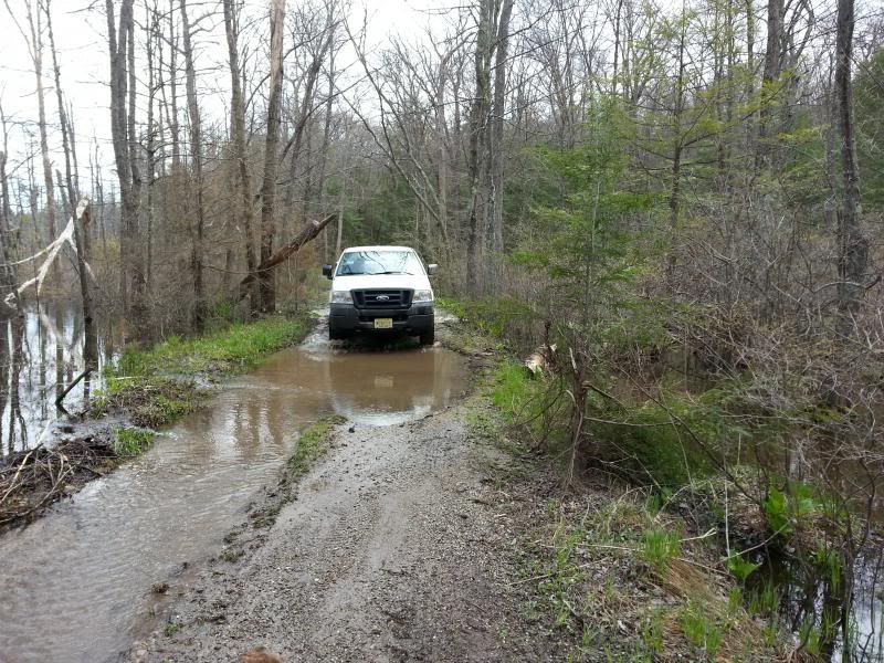
After that we found what we ended calling the "Beaver Pond trail." Some beavers had raised the water level of a bog up over the roadway making the holes seem a lot worse than they were. A Jeep headed in the other direction did get stuck briefly. We hung around for a minute to see if he needed help but he was able to back out and get through on his own:
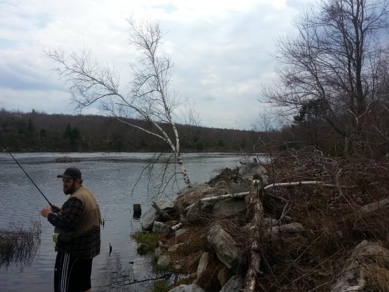
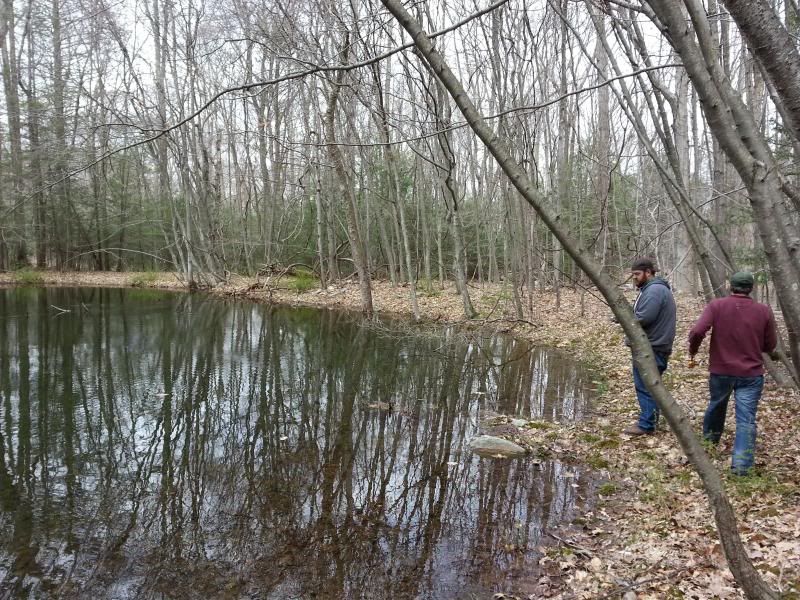
Stopped to wet a line in a small pond off of Shay:
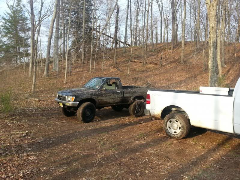
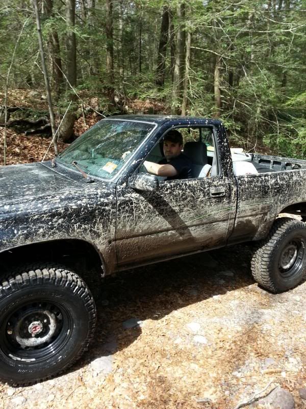
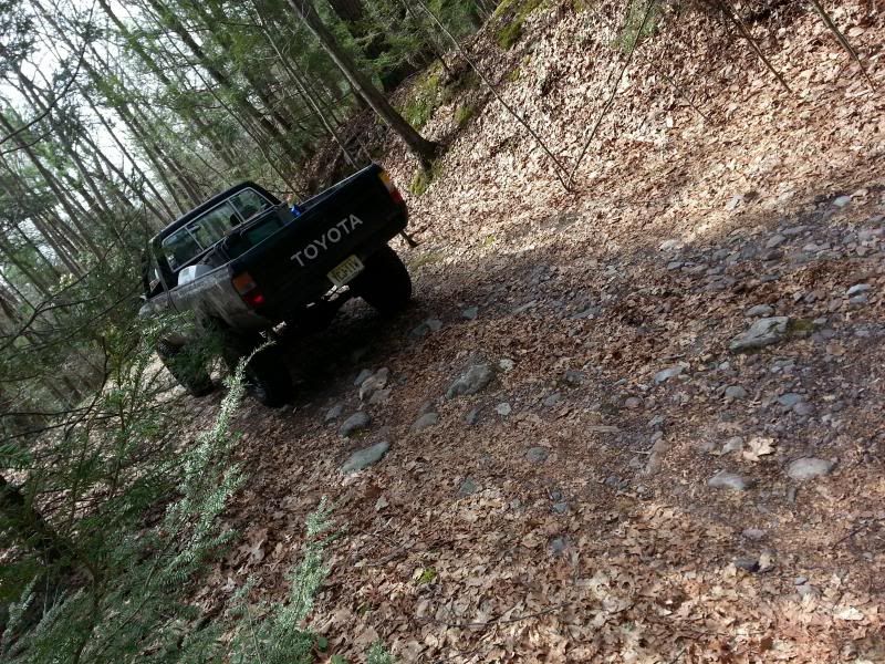
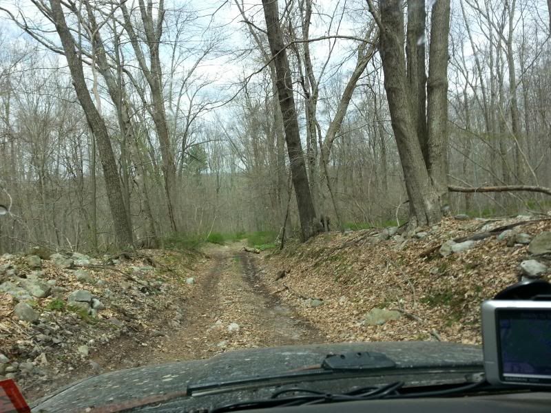
After that took an unnamed road off of Struble that runs behind the 4H camp and comes out at Flatbrook-Roy WMA. Lots of old stone walls here-definitely an area to get back to for some hiking. This was the roughest road by far-I idled through a lot of stuff in 1st/4LO just because it felt like the truck would rattle apart if I went any faster:
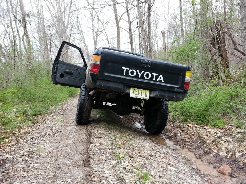
My heavy duty rear springs are great for hauling firewood-not so good for uneven terrain :laugh:
After that it was time to head for home. The only road I didn't get to was Coss, which runs NW/SE between Struble and Woods. It apparently also intersects with an unnamed road that heads NE above Kittatinny Lake and eventually makes it almost out to 206, but some of it may be Kittatinny Lake property and therefore off limits. Next time we'll plan on checking that out as well as the area Northeast of 206.
After taking Brink as far as we could (Just past the Brink Road shelter) we hit the rocks that block the way down the mountainside to Route 521. I'm betting it's because the road just fell into disrepair because of the steep slope and is probably more like a waterfall/stream now. According to tax maps, where Brink (called Bevans on some maps at that point) hits Route 521 it's still state land. I need to go back and see if it can be accessed from there as well, but it's moot point anyway since it's blocked. At that point we turned around and headed southwest on Woods Road to the gate at the DWG border, then doubled back to Shay Road.
After that we found what we ended calling the "Beaver Pond trail." Some beavers had raised the water level of a bog up over the roadway making the holes seem a lot worse than they were. A Jeep headed in the other direction did get stuck briefly. We hung around for a minute to see if he needed help but he was able to back out and get through on his own:
Stopped to wet a line in a small pond off of Shay:
After that took an unnamed road off of Struble that runs behind the 4H camp and comes out at Flatbrook-Roy WMA. Lots of old stone walls here-definitely an area to get back to for some hiking. This was the roughest road by far-I idled through a lot of stuff in 1st/4LO just because it felt like the truck would rattle apart if I went any faster:
My heavy duty rear springs are great for hauling firewood-not so good for uneven terrain :laugh:
After that it was time to head for home. The only road I didn't get to was Coss, which runs NW/SE between Struble and Woods. It apparently also intersects with an unnamed road that heads NE above Kittatinny Lake and eventually makes it almost out to 206, but some of it may be Kittatinny Lake property and therefore off limits. Next time we'll plan on checking that out as well as the area Northeast of 206.
Nice report. I had to cancel turkey hunting due to all the rain upstate NY was getting. Funny, I almost went up to Bear Creek, but the weather didnt look too great there either. Hit a river in the pines and camped out instead.
Nice report. I had to cancel turkey hunting due to all the rain upstate NY was getting. Funny, I almost went up to Bear Creek, but the weather didnt look too great there either. Hit a river in the pines and camped out instead.
We had two passing showers on Saturday but that was it. Sunday was beautiful-wish I could have stayed up longer.