Hiking the Parker Preserve

ecampbell

Piney
Jan 2, 2003
2,844
967
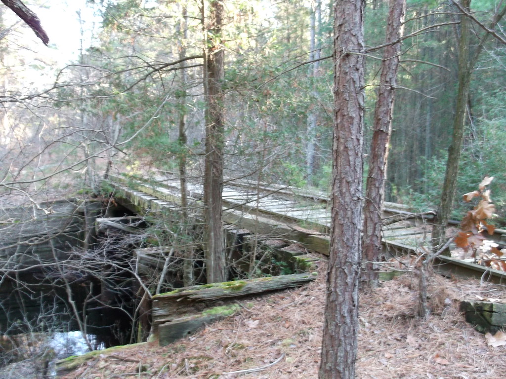
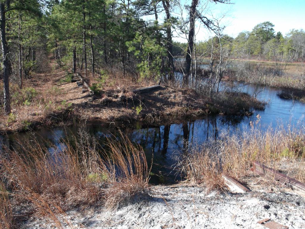
On Sunday we decided to revisit the RR trestle I used to canoe under in the early 70's, I hadn't been there since. This is just downstream from Chatsworth Lake and was reached by taking the red trail east from the parking lot.

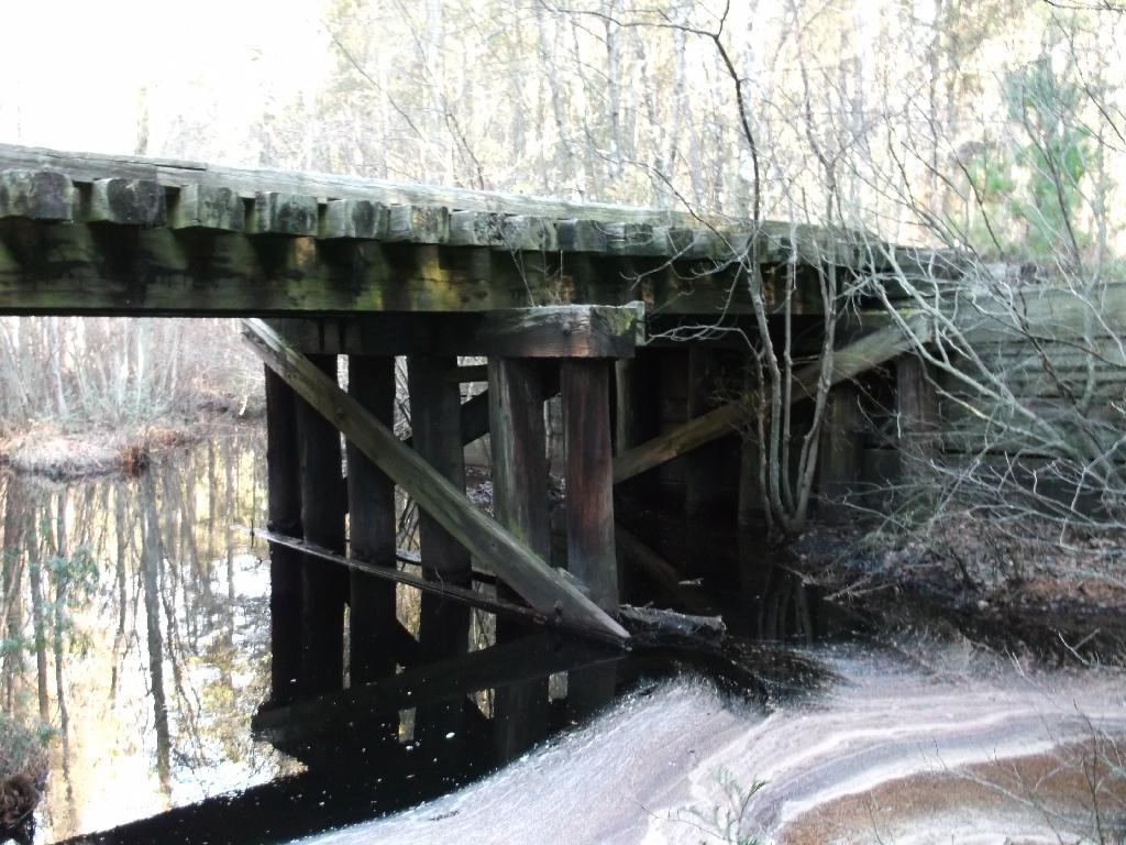
Looking east. It is in good shape but I don't know if it would take a train.
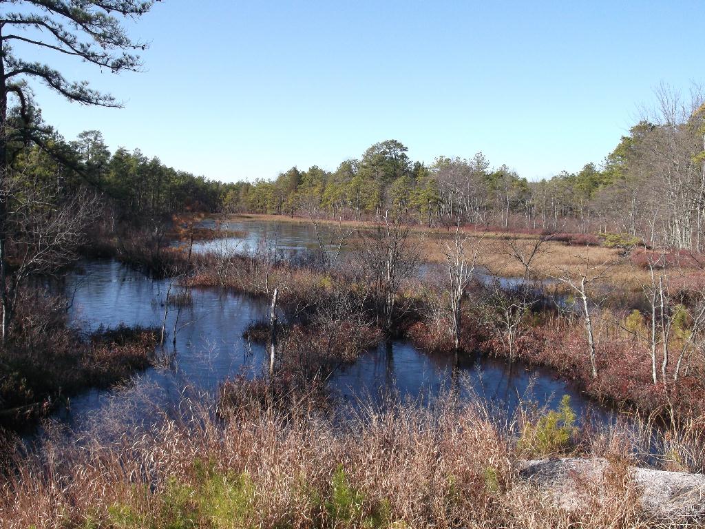

Looking upstream.


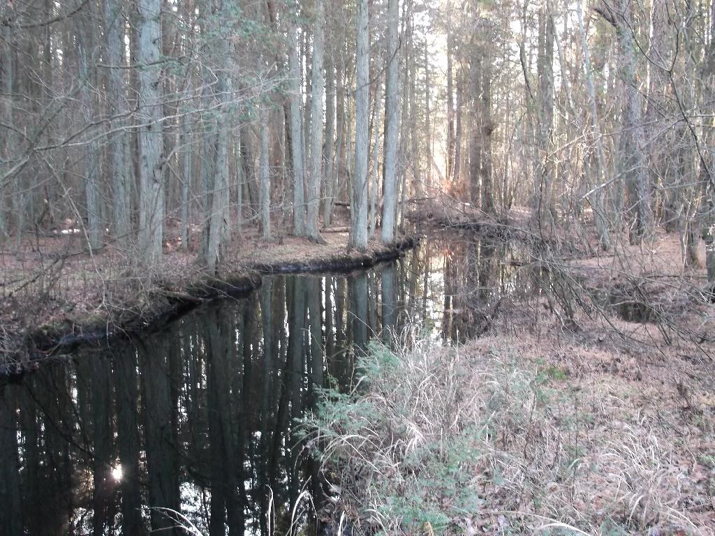
The Wading River looking downstream. It is slow, deep and just asking to be paddled.


Next we moved on to find an irrigation pond I saw on birdseye.
http://www.bing.com/maps/?v=2&cp=qn...=9.33&sty=b&where1=Chatsworth, NJ&form=LMLTCC
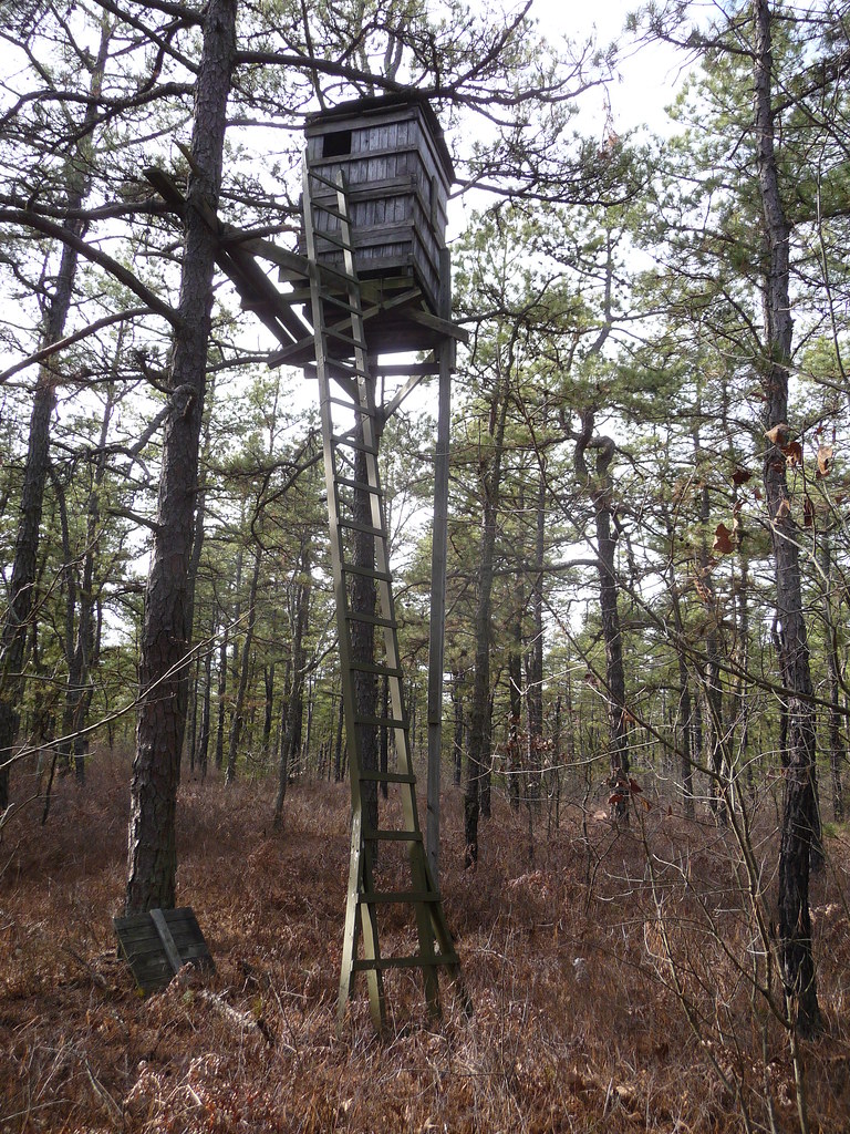
I wonder why they needed this with all that water out there.


We moved on following a road that parallels the RR tracks.
http://www.bing.com/maps/?v=2&cp=qn...88.59&sty=b&where1=Chatsworth, NJ&form=LMLTCC

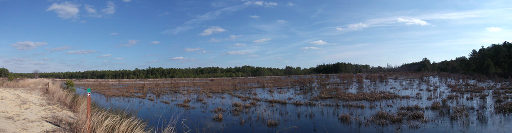
Unfortunately it was quite flooded and may stay that way depending on what they do with the dikes.


The end of the line at the previous location.


More to come.
Ed
 
  • Like
Reactions: dogg57 and glowordz

Gibby

Piney
Apr 4, 2011
1,640
442
Trenton
Thanks! I enjoy your reports very much. There use to be a makeshift bridge, made of railroad ties, that could be used to cross the the gap in your last photo. Did you notice the ornate stone used around the bridge in your first picture? I think it was used to "dress" the abutments because of how close the crossing was to Chatsworth Station.
 

Teegate

Administrator
Site Administrator
Sep 17, 2002
25,656
8,266
Nice report Ed.

That bridge is Bridge 74. After the accident of the Blue Comet, the dam at Union Lake (Chatsworth Lake) broke and washed out the west embankment at the bridge. If you look closely there it appears they just used bags of concrete or something similar to build that up and those stones were part of the fill. They may have been brought in to shore up the bridge.

Those bogs in the 5th and 6th photo were the Kennedy Bogs which were in operation at the time of the derailment.

Guy
 

Gibby

Piney
Apr 4, 2011
1,640
442
Trenton
Teegate, thanks for the correction. The stones being used as a retaining wall makes sense, but they are rather ornate for their purpose.
 

Teegate

Administrator
Site Administrator
Sep 17, 2002
25,656
8,266
I am not correcting you because I am not sure if they were used as you say or brought in for fill.

Guy
 

Gibby

Piney
Apr 4, 2011
1,640
442
Trenton
I am not correcting you because I am not sure if they were used as you say or brought in for fill.

Guy

No problem, Teegate. The stones may be used for the combination of looks and purpose.

There are some rails along this stretch of track that have forging dates that many will find astonishing. I was impressed that they have survived as long as they have. They are a fine example of Bethlehem Steel's forgings.
 

ecampbell

Piney
Jan 2, 2003
2,844
967
Ed, thanks for your guidence Sunday as we found the Blue Comet crash site.

Polcat, I'm glad you joined the site. It was nice meeting you and your friends out at Parker on Sunday. I was afraid you would think I was sending you on a snipe hunt when I dropped you off at the end of Apple Jack Rd. I know how dense and wet it can be back there. Here is a link to a great article on the Blue Comet wreck site written by Guy (Teegate).
http://forums.njpinebarrens.com/threads/then-and-now-the-accident-of-the-blue-comet-train.1666/
 

ecampbell

Piney
Jan 2, 2003
2,844
967
No problem, Teegate. The stones may be used for the combination of looks and purpose.

There are some rails along this stretch of track that have forging dates that many will find astonishing. I was impressed that they have survived as long as they have. They are a fine example of Bethlehem Steel's forgings.

What kind of dates did you see? I've never seen any older than 1928, but now I'll start looking.

I saw the stones but they looked bore like bags of concrete and are quite worn.
 

Gibby

Piney
Apr 4, 2011
1,640
442
Trenton
What kind of dates did you see? I've never seen any older than 1928, but now I'll start looking.

I saw the stones but they looked bore like bags of concrete and are quite worn.

Ecampell, I saw a rail dated 1913 between the broken crossing sign and the location of your last picture.
 

Teegate

Administrator
Site Administrator
Sep 17, 2002
25,656
8,266
There is an old property stone near that bridge. It marks one corner of the Parker Preserve.

IMG_7125.JPG


Guy
 

Gibby

Piney
Apr 4, 2011
1,640
442
Trenton
I found a battery today by bridge 74 that Ecampbell went to visit. It had been pulled out of the muck nearby. Edison Carbonaire batteries, of this style, were used starting around 1953 to power railroad signals. More than likely, there was a battery box nearby for the signals for the station and this was tossed into the woods when it was no longer needed. It is larger than it appears, around ten inches square and eighteen inches tall. It is amusing that simple artifacts can still be found.

bat2.jpg


http://www.natsulators.com/misc/edison/edisonss.php
 

ecampbell

Piney
Jan 2, 2003
2,844
967
On Sunday we hiked from the North Gate to the South Gate in order to explore a more remote area of the preserve. We combined sections of the green, white, blue and yellow trails to customize our hike. Along the way we picked up 4 geocaches, found a beautiful picnic spot, an old cultivated blueberry field, and a tree stand I haven't seen since a PBX hike in 2004.
The route.


The tree stand. I had expected it to be on the ground by now but it has been kept up and is in excellent shape. Perhaps it is still in use, I will ask the next time I see a volunteer. I saw no bait and the dogs found no gut piles.:)


There were Tundra Swans on the reservoir.

The weather has been great.
Ed
 

Teegate

Administrator
Site Administrator
Sep 17, 2002
25,656
8,266
I was told that there aren't any permanent hunting structures allowed on the preserve.

Tom,

That was there in 2004 when we did our Parker Preserve hike. This was before the public was allowed on the property. We got permission to go there by the late Bob Bruneau who is in the group photo at the below link in the orange hat. Ed is to the right of him. So I am certain this was there long before the property was purchased from DeMarco. It is semi remote so very few people even go there.

I have fixed the photo's from our hike there in 2004. Here is the link.


http://forums.njpinebarrens.com/threads/the-pbx-parker-preserve-hike.1302/


Guy
 

Hewey

Piney
Mar 10, 2005
1,042
110
Pinewald, NJ
Very nice! Great report!

That treestand is a death trap! No stealth tactics in that set up! It probably took the deer a year just to get use to it.

There shouldn't be any Tom, nor in State Forests, Parks or WMA's but I find some pretty elaborate box blind stands built were they shouldn't be.

Chris
 
Top