The rectangular thing
- Thread starter bobpbx
- Start date
You are using an out of date browser. It may not display this or other websites correctly.
You should upgrade or use an alternative browser.
You should upgrade or use an alternative browser.
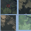
I would say duck blind. There is an extensive one southeast of Wescoat Bogs and I have been to remnants of one east of the active bogs off of Dave's Road. You have been to the one southeast of Wescoat on my Bog Slog hike.
boydsmaps.com
boydsmaps.com
Nice!
I find it hard to believe they put one there. Have to see what way they were going in.
I looked on Historical Aerials. Not there in 2002, but is there in 2006, and no trails to it.
Maybe they floated the lumber down the creek and built it onsite? You're right though, it's really remote for seemingly no reason.
Or maybe it drifted there on one of the big flooding events which apparently happen there.Maybe they floated the lumber down the creek and built it onsite? You're right though, it's really remote for seemingly no reason.
@woodjin visited a duck blind in that very area some years backNice!
I find it hard to believe they put one there. Have to see what way they were going in.
boydsmaps.com
boydsmaps.com
What's going on here? Looks like ponds, but not when you look at the aerials.
Then there is this mound: https://boydsmaps.com/#18.00/39.695349/-74.703706/midatlidar/0.00/0.00
boydsmaps.com
boydsmaps.com
What's going on here? Looks like ponds, but not when you look at the aerials.
Then there is this mound: https://boydsmaps.com/#18.00/39.695349/-74.703706/midatlidar/0.00/0.00
Beaver?
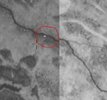
Probably nothing. You will see a lot of "artifacts" on those 1930 aerialsWonder what this is? From Bob's 1930 aerial:
That's what I was pointing out, another on the stream, but yet, if you run through Boyd's aerials with the same spot held there, the creek shifted 50 feet.Wonder what this is? From Bob's 1930 aerial:
It could be, there's considerable slope compared to the rest of the shoreline.Beaver?
It's also 20 ft in diameter. Too big for beaver. No pun intended.It could be, there's considerable slope compared to the rest of the shoreline.
View attachment 19107
kind of appears reflective as you mentioned in the first post.That's what I was pointing out, another on the stream, but yet, if you run through Boyd's aerials with the same spot held there, the creek shifted 50 feet.
I think it was something, there are also square ones in the 1931. But by 1940 on Historical Aerials, the rectangular one is gone.kind of appears reflective as you mentioned in the first post.
It doesn't show in 1940. Likely just an artifact, like this nearby rectangle: https://boydsmaps.com/#18.00/39.693116/-74.697092/njgin1930/0.00/0.00I think it was something, there are also square ones in the 1931. But by 1940 on Historical Aerials, the rectangular one is gone.


