Where is Calico Ridge?

woodjin

Piney
Nov 8, 2004
4,341
327
Near Mt. Misery
Went to the spot I determined to be Calico ridge. There is a very steep drop going down to martha's pond. It is somewhat hidden now due to tree maturity, but I can imagine it must have been an amazing vista years ago. Take a look at the photo again 1971
CalicoRidge.jpg


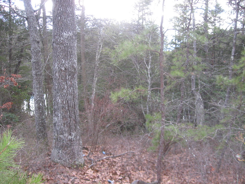
Now look at this photo i took today.
8519585141_cecde34bc1_c.jpg


It is the same spot. The trail the girl is walking on is still there but has been replaced by a newer one on the left (and even that is old) Look at the large gum tree on the left and the "broken gum" on the right. Compare to original photo. The river can be seen in the bottom left corner of my photo, the vista is now blocked by cedar growth.

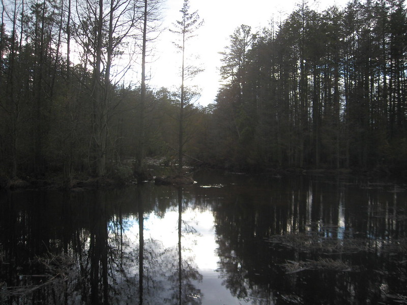
this is a pic of the oswego from the bank beyond the cedars.
8519587527_003383579f_c.jpg


Compare it to the picture of the islands in the original photo.

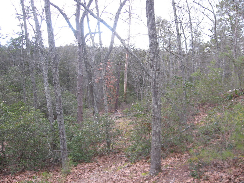
I can see how this must have been a great campground at one time. The entire area has a dramatically steep drop to the oswego. Oh yeah, it has a lot of calico (mountain laurel) also.

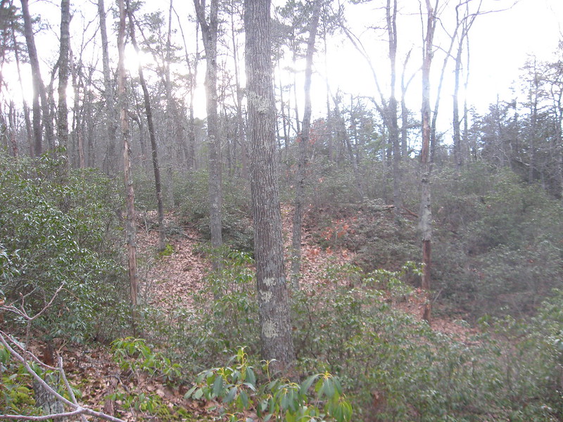
Looking toward the Oswego slightly south of above area.
8519589163_895006d933_c.jpg


8520704644_e92a8492a0_c.jpg


Jeff
 

Teegate

Administrator
Site Administrator
Sep 17, 2002
25,647
8,251
The same spot as you say. A very nice Then & Now! I am betting you had the 1971 photo with you :D

For all we know that photo may have been taken a few years before it was published so it may be from the 60s.

Guy
 

ecampbell

Piney
Jan 2, 2003
2,844
967
Wow, this thread has ben great. Jeff, you really ran with my question. I must visit the ridge, I'm sure I canoed by it. I also learned that calico is mt laurel, and the pizza queen. That old picture really gives the location meaning. AMF, do you have any pictures from when you camped there? That was truely a golden time for the pines. :)
 

Boyd

Administrator
Staff member
Site Administrator
Jul 31, 2004
9,548
2,807
Ben's Branch, Stephen Creek
  • Like
Reactions: Teegate

woodjin

Piney
Nov 8, 2004
4,341
327
Near Mt. Misery
that is really cool, Boyd. I would be interested to know the geological considerations in the formation of the ridge. Not being very well educated in geology I would first consider it a testiment to the age the oswego.

Guy, you are absolutely right. I had the picture in hand as I took the new one. However, it was right at the bend in the river per Parnes' notes and it was the first place i stopped.

Jeff
 
Apr 6, 2004
3,613
556
Galloway
that is really cool, Boyd. I would be interested to know the geological considerations in the formation of the ridge. Not being very well educated in geology I would first consider it a testiment to the age the oswego.

I'd bet that what we're looking at is another remnant of the ancient Hudson River, much the same as most of the hills and ridges in the Pines.
 

Gibby

Piney
Apr 4, 2011
1,640
442
Trenton
There is that typical Northwestern ramp in the Barren's topography. Could this be a cause of glacial winds?
 

ecampbell

Piney
Jan 2, 2003
2,844
967
Hey Boyd, the LIDAR image you posted is much more detailed than the one I downloaded from File Depot. Even the colors are different. Your post shows brown.
 

Gibby

Piney
Apr 4, 2011
1,640
442
Trenton
Not sure what you mean by Northwestern ramp.

Pinelandpaddler, have you ever notice on the topos that the elevation frequently ramps up facing a Northwest direction in many areas in the barrens. I have never researched on the subject but I thought it may be from winds blowing across the glaciers or a combination of thawing and winds from the same frozen period.

-Another example would be where the Chamberlain Branch crosses with Rt 539. The NW facing side has a sharp increase of elevation, while the NE facing side in rather rolling and flat.
 

Boyd

Administrator
Staff member
Site Administrator
Jul 31, 2004
9,548
2,807
Ben's Branch, Stephen Creek
Hey Boyd, the LIDAR image you posted is much more detailed than the one I downloaded from File Depot. Even the colors are different. Your post shows brown.

This will get a bit technical, but here goes.... :) The Garmin map at GPSFileDepot (here: http://www.gpsfiledepot.com/maps/view/276/) is rather low resolution. In order to make it compatible with all Garmin devices, I converted a raster image (a picture) into a vector image (polygons made from a list of coordinates). So that map is a bit of a novelty, and not something capable of showing a lot of detail. The LIDAR imagery on my site shows the full amount of detail available from the source data: http://boydsmaps.com/#lidar,39.684753,-74.505586,16 Each pixel on your screen at that link represents about 8 feet.

For the purpose of those illustrations above, I zoomed in even farther, and also rendered it in 3d which is something that GlobalMapper can do. The color difference is another matter. Color is used to represent elevation, and I can control which colors are used. In the images I posted above, I used the full range from blue to red to represent the range of elevations in that small rectangular area. As you can see from the contour lines, that is rather limited, with a high point of about 60 feet and a low point of about 20 feet. So you are seeing the full color pallette representing about a 40 foot range of elevation. For a map of the entire South Jersey area, I am using a similar pallette to represent about a 260 foot range of elevation.

I have actually been spending a little time studying color schemes recently - I can write my own shader that specifies exactly how color relates to elevation. In the near future you will probably notice a change in the colors at boydsmaps.com as I try to find a new scheme that brings out the maximum possible amount of detail.
 

Boyd

Administrator
Staff member
Site Administrator
Jul 31, 2004
9,548
2,807
Ben's Branch, Stephen Creek
Pinelandpaddler, have you ever notice on the topos that the elevation frequently ramps up facing a Northwest direction in many areas in the barrens.

That's interesting, I never heard this before. I will have to take a look at this when I get a chance. I can render the LIDAR imagery with a "slope direction shader" that might highlight this tendency.
 

ecampbell

Piney
Jan 2, 2003
2,844
967
Boyd, I get it. I really don't need that high res on my Oregon, but bascamp would be nice. Anyway I can always go to your site.
Thanks, It's a great map!
Ed
 

Boyd

Administrator
Staff member
Site Administrator
Jul 31, 2004
9,548
2,807
Ben's Branch, Stephen Creek
Just tried and the slope direction shader doesn't help much. But here's your example rendered with the new shader I'm working on. The steep slopes show bands of color - these are roughly equivalent to elevation contours that are spaced one meter (3.25 feet) apart.

Are you saying that river/stream valleys in particular demonstrate this characteristic, or that it is a general feature of all pine topography? Because I see steep slopes facing other directions also. :)

Compare the image below to the current version of my map here and you will see the difference between the old shader and the new one I'm working on. It still needs some work, but I think the new one brings out more detail, what do you think? http://boydsmaps.com/#lidar,39.848023,-74.381904,16

chamberlain.jpg
 

Boyd

Administrator
Staff member
Site Administrator
Jul 31, 2004
9,548
2,807
Ben's Branch, Stephen Creek
Boyd, I get it. I really don't need that high res on my Oregon, but bascamp would be nice.

I plan to make the full resolution imagery available for download on my site in the future. You would be able to use this in Basecamp as well as on your Oregon, but due to Garmin's limitations you could only load 6 USGS quads of the full res imagery to the GPS.

No estimate on when this will be available, but it's on my list. :)
 
Top