Key's Sandwash--Menantico Ponds?

htucker7161

New Member
Jan 30, 2018
1
0
MIllville NJ
I was going through a local history page and this photo popped up. I've looked through most of the Library of Congress photos, Sanborn and Rutgers maps--I can't seem to find Key's Sandwash. I wanna say it's out at Menantico Ponds. Can anyone help me out here? Thanks :)

That and I can't figure out how to add the photo to the body of my post LOL

https://photos.app.goo.gl/C4bTQdGq30cX7JZ53
 

Boyd

Administrator
Staff member
Site Administrator
Jul 31, 2004
9,502
2,765
Ben's Branch, Stephen Creek
Welcome to the site! Sorry, can't help with Key's sandwash. But to post a photo you can either use an external link to an image or you can attach it directly here at NJPB. The link you posted is not in a format that can be inserted in your post - you need a link to an actual file, something that ends in .jpg, .png, .bmp etc. Your link is just code that is used to display an image.

To attach an image to your post, click the "Upload a file" button, choose the file on your computer, upload it, then use the option to insert a full size image in your post.

One other note, please do not post any images unless you have permission from whoever holds the copyright. Unfortunately, the site owner had a legal problem a few years ago when someone posted a scan of the front page of a historical newspaper.
 

Teegate

Administrator
Site Administrator
Sep 17, 2002
25,602
8,178
Manumuskin may be able to help. He might post later today.
 

manumuskin

Piney
Jul 20, 2003
8,552
2,465
59
millville nj
www.youtube.com
I must say i have never heard of Keys Sand Wash and I know Menantico pretty well. I"ll ask around, Some old heads down here that might know something about it.Then again at 53 I guess I"m officially an "old head" myself now.
 

manumuskin

Piney
Jul 20, 2003
8,552
2,465
59
millville nj
www.youtube.com
Okay I have some info sent to me by my anonymous "old head" Problem is my "old head" is a bit younger then i am.You know what this means don't you? means I"m on the down side of the hill myself. In any case before i build momentum and lose control let me copy and paste the info he sent me.By the way I do know where the concrete rail supports along the river are and I also know a large old oak next to the river that has had an I beam imbedded in ti since i was a kid (70"s) at least and this beam may actually be a piece of a small gage rail line?As far as the sand wash which actually had me thinking of blue holes I know of none anywhere near the bluffs but there are a couple of old gravel pits that the sand wash may be referring to? I also know where a few old cellar holes are in the area as well.

miles below Millville in the vicinity of TNC’s Maurice River Bluffs Preserve somewhere between the “bluffs” proper and the former Straubmuller property. For a discussion of the Key “glass-sand bank” (likely = to Key’s sand wash) see the Annual Report of the (NJ) State Geologist for 1897 (Link 1). This general area was also known as Key’s Wharf as it is identified in the Congressional Edition Vol. 7697 published in 1921 (see Link 2). The Charles Key (the surname misspelled as “Keys”) identified in the Congressional Edition for 1921 was likely Charles L. Key (1852-1926). C. L. Key’s grandfather and son were Samuel Cooper Key (1810-1901) and Charles Everett Key (1910-2006), respectively. The “Key” entry from CU’s Maurice River Recollections is an excellent summary of the Key place names along the Maurice River (Link 3) The Key family is well known in Millville and believed to be descended from Francis Scott Key (1779-1843) of Star Spangled Banner fame (see Links 4, 5 for genealogy of Key family from Millville).


Link 1: https://books.google.com/books?id=k...IOjAD#v=onepage&q=keys sand millville&f=false


Link 2:

https://books.google.com/books?id=6...#v=onepage&q="Keys Wharf" "Millville"&f=false


Link 3: http://www.cumauriceriver.org/reaches/pg/narratives.cfm?sku=11


Link4: https://www.ancestry.com/boards/thr...tham.usa.states.newjersey.counties.cumberland


Link 5: http://boards.rootsweb.com/thread.a...tham.usa.states.newjersey.counties.cumberland

Hope this helps.
Thanks Anonymous Old head:)
 
  • Like
Reactions: Jon Holcombe

Boyd

Administrator
Staff member
Site Administrator
Jul 31, 2004
9,502
2,765
Ben's Branch, Stephen Creek
there are a couple of old gravel pits that the sand wash may be referring to?

Apparently "sandwash" used to refer to sand/gravel pits. Have seen several examples while working on my maps, although nothing in the area @htucker7161 mentions.

sandwash.png


My map has quite a few historical sand pits and structures near Menantico if you're interested in that area however.

https://boydsmaps.com/boyds-map-of-the-pines-hd/

historical.png
 

Attachments

  • menantico.png
    menantico.png
    628.1 KB · Views: 595
  • Like
Reactions: manumuskin

manumuskin

Piney
Jul 20, 2003
8,552
2,465
59
millville nj
www.youtube.com
The area that the links I posted make claim that the Key Sand Wash is in the area known as Maurice River Bluffs today and was known in my day as Wheaton Wharf and the Grain Elevator.This would be exactly across the Maurice River from Menantico WMA along Silver Run Rd.There is an old large pit that was occasionally used into the 80"s known as Giffords on the west side of Silver Run Rd.Could be it? There are also several older pits a couple with vernal ponds in them immediately east of the road between the road and river.
 

Zach McGarvey

Explorer
Feb 11, 2018
248
168
37
Woodbury / Vineland NJ
Is the shell of the old stone house above the bluffs still standing? Haven't been back there in years, and it looks like they moved the access road.

Funny, it never occurred to me that "sandwash" wasn't a universally understood term. I guess it's actually quite the opposite-- a Cumberland County regionalism. Used to spend most of my time as a kid at the sandwash between Schooner Landing Rd. and the Manumuskin creek, along the old rail yard where they now store all the tank cars. Loved swimming back there as a teenager, but I've been stopped by the state police the past few times I've walked back there and questioned. Apparently it became quite the well-known party spot in the last decade or so, with kids opening the trails to vehicles for easier access. I've more recently heard the southernmost lake referred to as "Loon Pond."
 
Last edited:

Jon Holcombe

Explorer
Dec 1, 2015
967
1,934
Medford
Hi Zach! The stone house was still there, on the Maurice River Bluffs as of last February. There are "do not cross signs" warning people off. I would post a picture of it (if I had one), but posting said picture would be acknowledgment of a crime, and I try to follow the rules, unless taking a picture of an old stone structure is an essential part of my mission to document the Pinelands in all of its beauty and history. And of course walking up and snapping a photo does not harm anything, but of course, I did not do that, on February 13 of last year.
 

manumuskin

Piney
Jul 20, 2003
8,552
2,465
59
millville nj
www.youtube.com
is the Stone House your referring to the old Wheaton mansion along the road to the floating dock? The one with the double chimneys ? the western chimney fell into the house a few years ago.
And yes Loon Pond has turned into the party hole.The state boys have cameras along the road back there and their LIVE so they wait till a bunch of yahoos get back there before they go make their bust.Mostly shoobies believe it or not.I swim there but go to the far side where there is nothing but woods behind me and they would have to approach via a visible dirt road along the edge and i walk a very long ways in and don't come in by any trails but straight through the bush.I can also see the far end where the yahoos hang out and if their there which their usually not because i very seldom have weekends off then i just leave and head north to the other pond.
 

Zach McGarvey

Explorer
Feb 11, 2018
248
168
37
Woodbury / Vineland NJ
Yes, I meant the one with the double chimneys.

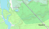
Last time I was back at Loon Pond was August 2016, me and a friend went for a quick swim. A state cop in an unmarked sedan stopped us on the long road back to the gate by Rt. 55. We were carrying wet towels so there was no denying we had been swimming. He let us go, and said to spread the word to keep out. I'm not exactly a kid anymore, so he probably figured I wasn't up to any great mischief. However, my wife's little brother got arrested back there not long after, but I'm not sure what the circumstances were. He's also eleven years younger than myself and it may have been in the evening- both of those factors I bet made a big difference. I spent plenty of time in there in the early 2000s, had lots of parties and barbecues there myself, but always carried the trash back with me and tried to keep the place pristine. In more recent years they moved the gate up closer to the highway, to keep an eye on who was parked there, I guess. The northeast pond, closest to the Manumuskin, has some nice sandy banks for swimming as well, but the northwest one is mostly red clay mud and seems to have lots of industrial remnants underwater to cut your feet on.
 

manumuskin

Piney
Jul 20, 2003
8,552
2,465
59
millville nj
www.youtube.com
You'd be better off parking at Barth rd or Port Cumberland rd and walking in that way.All the yahoos go in on Schooner landing because you can drive in that way.They keep blocking it but they make routes around the blocks.I think they have given up blocking it and are arresting people hoping the word gets around.The Guy who lives near the gate along menantico Creek I believe is responsible for the gate being moved back and signs posted saying no parking.That used to be the trailhead for the hiking trails they made that are now illegal to park to access?????? The vehicle is what gets you caught.You can even park in the woods east of Port Cumberland out of sight of the road,cross the road and walk the tracks in.Everyone that drove back in the woods and seen your vehicle would assume you were in Peaslees somewhere.Swimming in NJ is basically illegal unless you have someone blowing a whistle at you. I guess thats because if you drown then your next of kin will sue the property owner or the state for leaving that dangerous blue hole there that killed you.
 

Zach McGarvey

Explorer
Feb 11, 2018
248
168
37
Woodbury / Vineland NJ
There's actually a private road, clearly visible on satellite, that begins behind a house on Barth Rd and goes to the south side of the pond, but I assume you have to know the owner, and I don't. I'm getting to old to be dodging cops, so I guess swimming there is just no longer a possibility. I parked once by the tracks at Manumuskin Junction to walk in from that side and got yelled at by a guy with some big dogs. Entering at the trailhead at the end of Barth Rd and then west along the tracks seems to be the only permissible way in these days. I know some people who tried to enter from the north with a jeep on a private road off of 49 and ended up arrested and their car impounded (this was circa 2005 or so). I grew up in East Vineland near Lincoln and Dante, and though I now live up here in the shadow of the Walt Whitman Bridge and don't make it back to southern Cumberland County to explore much, hanging out back there was really a staple of my teenage years and beyond. It was actually a failed overnight camping trip with a friend at the Manumuskin preserve that led to my meeting my now wife, following a weird series of events.

Anyway, I'm glad to have found this site, thank you to those who have made and maintained it-- this is a great resource.
 
  • Like
Reactions: Boyd

manumuskin

Piney
Jul 20, 2003
8,552
2,465
59
millville nj
www.youtube.com
You are allowed to walk the tracks in from Port Cumberland rd but I bet I know who gave you hell.He is an ex cop,i won't give his name here but he lives on Port Cumberland rd and has 36 acres surrounded by preserve.He thinks the preserve is his and he does or did have two big Dobermans.He gave me some crap once and i informed Him I wasn't on his land and I knew exactly where his corners were and told him where.He at once changed his attitude and became quite friendly once I called crap on him.My wife was with me and her grinning I don't think pleased Him.He frequents the tracks.He lives on the old Camp Hollybrook property. And yes there is a driveable sand rd heading north from barth but the only way to get onto it is to drive through someones yard and no i don't know them so i park at the end of the road.I have driven all those roads in the past when there used to be away down fro ACE Electric property but yes if your caught on that now they will arrest you.The road from Cumberland Pond is actually a border between nature Conservancy property and ACE property ,well actually the line parallels the road 100 ft east of it which does put it on ACE property but it was a public driveable road till the hunting club that leased the property took over and blocked it up.Thats was a good way into the nature conservancy but your not allowed to drive onto the conservancy anyway so I'd rather park legal and walk in.By the way the guy with the dogs tried to sneak up on me and my wife wearing a bright blue hoodie.I seen him 50 yards away and told him to come out from behind that tree.i think thats why maybe he had an attitude then again i heard he's like that with everybody.He especially hates motorcycles but i don't think he likes anyone.He does have a real nice stone on one of his corners.He'd of flipped a biscuit if he knew I took pics of it 200 ft from his house.I did approach it legal though,but i did cheat on the way back:)
 

Zach McGarvey

Explorer
Feb 11, 2018
248
168
37
Woodbury / Vineland NJ
The guy who chased me lived on the southeast corner of the rail crossing on Port Elizabeth- Cumberland road. If you walk east along the tracks past the wye there's some cool old train cars back there, all pretty well overgrown. Last time i visited, the branch of the track heading south was full of stored hopper cars almost as far as 47, and east of the junction seems to be an active sand operation, lots of heavy earthmoving equipment moving around. The tracks peter out somewhere between there and Weatherby road and it doesn't look like they actually ship the sand out by rail. Pretty sure it's all just a train parking lot.

One more observation-
While standing on the rail bridge over the manumuskin one can look north and see a house on the water. I have always been curious about it, that's a pretty isolated site for a home.
 

manumuskin

Piney
Jul 20, 2003
8,552
2,465
59
millville nj
www.youtube.com
Seems like there are more ignoramuses out there then one:)
The tracks disappear at Jones Mill bu the grade extends through Belleplain and Wodbine all the way to the Tracks that parallel Route 9.you can drive it from Hunters Mill rd to Woodbine.And yes thats all they do with the cars now is park them out there.the NC tried to buy the tracks through the preserve but the railroad refused to sell because they use the tracks to park cars their not using at the moment.
I know the house you mean.Thei driveway is at the sandstone pillars where a road goes in off port cumberland road.
Have you ever been to fries mill and seen the old chimneys and tavern foundation and old mill foundation?
 

Zach McGarvey

Explorer
Feb 11, 2018
248
168
37
Woodbury / Vineland NJ
No, I haven't been to Fries Mill. I don't know where to enter, but I have heard there's a really decrepit old wooden bridge back there over the creek. Is it the nicely maintained paved road that heads west off port cumberland, about half way between 49 and the tracks?

39°20'59.60"N
74°57'11.40"W

If so, I always figured that to be a driveway.
 
Last edited:

manumuskin

Piney
Jul 20, 2003
8,552
2,465
59
millville nj
www.youtube.com
That is a driveway,the ying yang i was speaking of and yes that leads to the bridge which is not decrepit but is blocked from vehicles and the road does lead to fries Mill.The bridge is in quite good shape for walking across .I can take you in that way but not up the road.That would take you past His house and thats how i got the confrontation with him.he only owns the north side of the road.Well me and Momma walked past His house and veered to the south to show her the old chapel and the pads where our chickee huts were where we camped in the old Camp Hollybrook.He seen and heard us pass his house and followed us.I explained to him after he asked if i knew i was tresspassing that if i knew it i would not have walked past his house and secondly I"m not tresspassing since you only own the north side of the road,I then detailed his property out line for Him.He then became friendly.He has ran numerous cyclers off the Preserve so they let Him do his thing because they don't want cycles out there anyway but he tries to intimidate anyone He catches out there and often succedes.I have never heard about your ying yang down south.Technically the tracks are private property,the land north of them is preserve,a small plot till you get to the property of the house you mentioned.I doubt the railroad cares about folks walking the tracks and crossing the trestle to the preserve.And whats it to Him anyway.I would have told Him to kiss off as well.I often park on the short road diagonally across from his house.It's just long enough to get out of site of the road and it's state property.I have weird days off but if you ever want me to take you to Fries Mill maybe we can do a trip.You can get there via the Trestle,the sneak around his house,Barth rd or from Cumberland Pond.Barth and Cumberland are quite long hikes.
 

Zach McGarvey

Explorer
Feb 11, 2018
248
168
37
Woodbury / Vineland NJ
Appreciate the offer, I have weird days off too. Maybe someday we can do that. You're saying if you enter at the lat/long I gave you, follow that paved road west, then turn slightly left when you reach the house, this is public property, and legal to be on? I assume that's what you meant by short diagonal road-- the one leading towards the old bridge. Approx 39°20'58.77"N and 74°57'27.43"W.

(https://www.google.com/maps/place/3...!3m4!1s0x0:0x0!8m2!3d39.3496583!4d-74.9576194)
 
Top