Recently have gotten into kayaking to explore the pines. Curious what the easiest drop in and spots the paddle Mullica are. Jackson road drop in is down the street but it looks fairly tight. We have a two person kayak which is long and two singles. Just wondering what the best spot to paddle on Mullica for beginners. We usually go to wading but it’s just too crowded with micks.

Kayaking Mullica
- Thread starter dragoncjo
- Start date
You are using an out of date browser. It may not display this or other websites correctly.
You should upgrade or use an alternative browser.
You should upgrade or use an alternative browser.
I assume you mean with transportation set up at the end of your journey? I recall that people used to put in here, just downstream of the Atsion Dam.


But why not practice in a safe lake. I assume your children are young? You don't want anyone freaking out going under the train trestle just down from the above put in.
The Mullica is tight and twisty with a lot of over hanging brush from Jackson rd down to almost Goshen pond before it opens up.Goshen pond is gorgeous but I think your supposed to be camping there to put in there.You could drop in at the sand road just below it but you'd miss the pond unless you went upstream first. Bobs spot is the best put in for the lower river and is about a seven hour trip from these to Pleasant Mills in a canoe,no doubt faster in a yak.
I start here, some people call it "first beach". https://maps.njpinebarrens.com/#lat=39.734148975415906&lng=-74.7110775670803&z=20&type=nj2015&gpx=
It takes about five hours to get to Batsto, a few more if you just coast with the current.
If you put in at Jackson Road or Sandy Causeway/ Plastic Bridge currently you better bring a chainsaw. I was there this morning and it's completely impassable!
It takes about five hours to get to Batsto, a few more if you just coast with the current.
If you put in at Jackson Road or Sandy Causeway/ Plastic Bridge currently you better bring a chainsaw. I was there this morning and it's completely impassable!
I start here, some people call it "first beach". https://maps.njpinebarrens.com/#lat=39.734148975415906&lng=-74.7110775670803&z=20&type=nj2015&gpx=
It takes about five hours to get to Batsto, a few more if you just coast with the current.
If you put in at Jackson Road or Sandy Causeway/ Plastic Bridge currently you better bring a chainsaw. I was there this morning and it's completely impassable!
You mean Pleasant Mills I hope. Don't want to give people the wrong idea that they'll float into Batsto lake on the Mullica.
We dropped in at Quaker bridge and down to batsto lake. It took about 3.5 hours and was a really nice paddle. Some beautiful wild woods and nice cedar stands. Tried to drop in off jackson and sandy causeway but both were too tight to paddle. Would like to drop in there since it’s so close to house but don’t think it’s doable, can only do on the other side of 206.
I haven't canoied the upper Mullica since the late 80's.Perhaps no one is clearing it any more.Not nearly as beautiful as the lower river but a nice little twisty isolated run none the less.We dropped in at Quaker bridge and down to batsto lake. It took about 3.5 hours and was a really nice paddle. Some beautiful wild woods and nice cedar stands. Tried to drop in off jackson and sandy causeway but both were too tight to paddle. Would like to drop in there since it’s so close to house but don’t think it’s doable, can only do on the other side of 206.
Aren't you confusing the names of rivers? Is this some sort of test you guys are giving me?
Bob, I see you are not getting the answer you wanted
That is what I meant to say. I take out at the ramp on the east side, just past the 542 bridge and river gauge.
If you wanted to shorten the trip you could go from First Beach to Constable Bridge. That's probably more like four hours, with decent road access to both.
You mean Pleasant Mills I hope. Don't want to give people the wrong idea that they'll float into Batsto lake on the Mullica.
If you wanted to shorten the trip you could go from First Beach to Constable Bridge. That's probably more like four hours, with decent road access to both.
Last edited:
That is what I meant to say. I take out at the ramp on the east side, just past the 542 bridge and river gauge.
If you wanted to shorten the trip you could go from First Beach to Constable Bridge. That's probably more like four hours, with decent road access to both.
Four hours is moving fast!
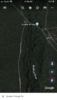
Says Mullica on google earth...
Google maps has incorrectly listed the Batsto River as the Mullica as long as I have been on this site. I don't know what their naming protocol is (maybe like "Wikipedia"?), but if you put in at Quaker Bridge, you were on the Batsto, not the Mullica.
The route Zach was discussing, from First Beach to Constable Bridge, is the "real" Mullica.
Back in 2002 a group of us put in the Mullica at Atsion, then when we were near Locks Bridge, we portaged over to lower forge campground, and finished the next day on the Batsto. That was memorable. We dragged our canoes through the woods with ropes. It was hard but easier than we thought. I had a porterhouse steak packed away for the lower forge camp.
Says Mullica on google earth, but I was confused since it turns into Batsto
HERE maps gets it right (they are Garmin's data source).
https://online.boydsmaps.com/#15/39.7119/-74.6732/hereHybrid
Last edited:
Google maps has incorrectly listed the Batsto River as the Mullica as long as I have been on this site. I don't know what their naming protocol is (maybe like "Wikipedia"?), but if you put in at Quaker Bridge, you were on the Batsto, not the Mullica.
The route Zach was discussing, from First Beach to Constable Bridge, is the "real" Mullica.
As far as I'm concerned, the Batsto River has just as much right to the name "Mullica" as does the Atsion River. Think of the former as the East Branch of the Mullica and the latter as the West Branch.
")
We did move fast, to complete in that time.
Four hours is moving fast!