
Me wife and I and the new dog a female black lab pup named Sophie went to explore some new woods and break the dog in to the Barrens.I stupidly left the camera on the table so there are no pics but I found some interesting things so I decided to post this anyway.I have attached a gpx file of my tracks for anyone interested and will add the link to the online trail map.I will be going back to walk the rest of the trails in the future.
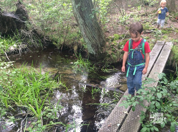
I threw the dog in three times at the first stream crossing since she was obviously suffering from heat exhaustion and would not go in on her own.The third time I brought her out from her barrens baptism she revived and went careening down the dirt road at high speed out of sight.This upset Momma severly because she told me to dunk her and now she was a runaway.We followed her about 300 yeards her screaming and me whistling for her until we seen a flash ahead and I thought it was a deer but then a white pickup came down the road and I asked the driver if he seen the dog which he had and here she came running so we had her back.The man was a caretaker of the preserve because when I told him he was headed for a locked gate at the bridge and would have a long backup he said he had the key and was caretaking the site.I imagine someone on Sooy road seen us parked and telephoned him,he probably lived up on 72 or 70 because thats the way he came from.We were being monitored no doubt and lucky for us he didn't run over our dog on this supposedly no vehicles allowed wilderness trail/sand road.
We procedded to Gun Spring branch which was a lovely little stream and I wanted a drink so bad but i didn't.I hadn't realized it but upon checking aerials afterwards it runs right through the state school so it would not be a nice place to drink from.We then went to four mile spring before turning left to make the loop back south on the green trail.The dog at the second two styreams would not approach the stream for a drink unless Momma stood between us and the whole time she drank she kept a wary eye on me at all times not knowing that Momma was not her protector but the actual antagonizer of the previous dunking.
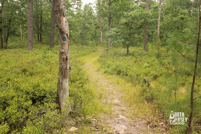
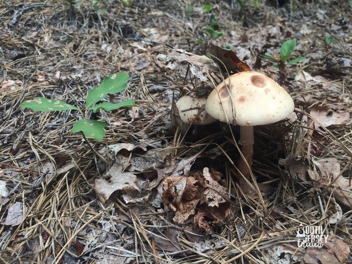
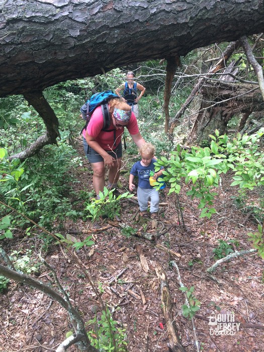
we then headed back south on the western leg of the green trail through some very nice open woods that were covered in fresh green wire grass and in spots profuse turkeybeard blooms.WE made the mistake of instead of taking the yellow trail back to the white trail (sand road) we proceeded to cross the swamp on the green trail.This trail across the swamp does not exist.The swamp is very open and the trail blazes are so few and far between Momma had to stay planted at each blaze while I went back and forth in semi circles looking for the next blaze.It heads left immediately over the bridge and afte that your on your own.There are many downed trees and a few of them have the blazes on them so check logs too if you try it.n the other side of the swamp the trail resumed just fine but it took us over a half hour to cross the swamp while I scoured trees and logs for blazes.a footway is non existent and use is obviously nil.The Birgeto cross the stream is very interesting.It is a huge steel object that obviously was a bridge somewhere else and somehow God only knows was transported here and dropped across the stream haphazardly and needed a few logs to complete the crossing because it was dropped so.You can see this bridge on birds eye.By the way the birds I heard and identified were of course the Prairie warbler,prothonatary warbler,Parula,black throated blue and black throated green warblers,ovenbirds,northern Towhees,pine warblers,scarlet tanager and a bird that was either a northern junco or a worm eating warbler,I doubt it was chipping sparrow in the heart of the barrens,I still can't tell these three apart.
In any case I have attached my track as a gpx file,and the coords of the bridge and a possible deer stand that i didn't go to but noticed on the aerials when i got home and also the link to the online map.
Bridge
39.87516° N
74.60612° W
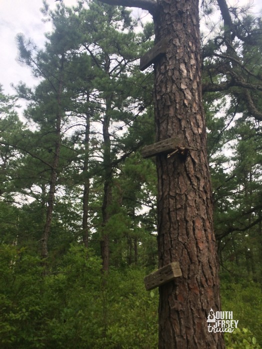
deer stand
39. 878576
74. 605074
this is approximate since i took the coords off google earth,i forgot how to get them off of birds eye and thats where the stand is visible.
http://www.njconservation.org/preserves/Huber_trailmap.pdf
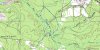
okay apparently a gpx file will not attach to this thread so i made a jpeg of the track and posted that instead,not as good but it will have to do.
Some ral nice woods here and the trails except for the main one don't look heavily used.haven't been on the red trail yet or on certain sections of the green,or the yellow and the northern sections of the white and i noticed several old dirt roads that aren't even shown as trails so there is quite a bit left to explore.There is also an island inside island spung that is apparent on birds eye,of course thats on my to do list for next trip.
Al
I threw the dog in three times at the first stream crossing since she was obviously suffering from heat exhaustion and would not go in on her own.The third time I brought her out from her barrens baptism she revived and went careening down the dirt road at high speed out of sight.This upset Momma severly because she told me to dunk her and now she was a runaway.We followed her about 300 yeards her screaming and me whistling for her until we seen a flash ahead and I thought it was a deer but then a white pickup came down the road and I asked the driver if he seen the dog which he had and here she came running so we had her back.The man was a caretaker of the preserve because when I told him he was headed for a locked gate at the bridge and would have a long backup he said he had the key and was caretaking the site.I imagine someone on Sooy road seen us parked and telephoned him,he probably lived up on 72 or 70 because thats the way he came from.We were being monitored no doubt and lucky for us he didn't run over our dog on this supposedly no vehicles allowed wilderness trail/sand road.
We procedded to Gun Spring branch which was a lovely little stream and I wanted a drink so bad but i didn't.I hadn't realized it but upon checking aerials afterwards it runs right through the state school so it would not be a nice place to drink from.We then went to four mile spring before turning left to make the loop back south on the green trail.The dog at the second two styreams would not approach the stream for a drink unless Momma stood between us and the whole time she drank she kept a wary eye on me at all times not knowing that Momma was not her protector but the actual antagonizer of the previous dunking.
we then headed back south on the western leg of the green trail through some very nice open woods that were covered in fresh green wire grass and in spots profuse turkeybeard blooms.WE made the mistake of instead of taking the yellow trail back to the white trail (sand road) we proceeded to cross the swamp on the green trail.This trail across the swamp does not exist.The swamp is very open and the trail blazes are so few and far between Momma had to stay planted at each blaze while I went back and forth in semi circles looking for the next blaze.It heads left immediately over the bridge and afte that your on your own.There are many downed trees and a few of them have the blazes on them so check logs too if you try it.n the other side of the swamp the trail resumed just fine but it took us over a half hour to cross the swamp while I scoured trees and logs for blazes.a footway is non existent and use is obviously nil.The Birgeto cross the stream is very interesting.It is a huge steel object that obviously was a bridge somewhere else and somehow God only knows was transported here and dropped across the stream haphazardly and needed a few logs to complete the crossing because it was dropped so.You can see this bridge on birds eye.By the way the birds I heard and identified were of course the Prairie warbler,prothonatary warbler,Parula,black throated blue and black throated green warblers,ovenbirds,northern Towhees,pine warblers,scarlet tanager and a bird that was either a northern junco or a worm eating warbler,I doubt it was chipping sparrow in the heart of the barrens,I still can't tell these three apart.
In any case I have attached my track as a gpx file,and the coords of the bridge and a possible deer stand that i didn't go to but noticed on the aerials when i got home and also the link to the online map.
Bridge
39.87516° N
74.60612° W
deer stand
39. 878576
74. 605074
this is approximate since i took the coords off google earth,i forgot how to get them off of birds eye and thats where the stand is visible.
http://www.njconservation.org/preserves/Huber_trailmap.pdf
okay apparently a gpx file will not attach to this thread so i made a jpeg of the track and posted that instead,not as good but it will have to do.
Some ral nice woods here and the trails except for the main one don't look heavily used.haven't been on the red trail yet or on certain sections of the green,or the yellow and the northern sections of the white and i noticed several old dirt roads that aren't even shown as trails so there is quite a bit left to explore.There is also an island inside island spung that is apparent on birds eye,of course thats on my to do list for next trip.
Al


") .
.