Interesting software that I just found - especially for Mac users since there is not much GPS software available. Download here. You can register for the free version by just entering your name and e-mail, which I did. It says all the features work for 30 days.
http://www.twonav.com/en/support/downloads
The user manual is available here:
http://manual.twonav.com/manual/land_air_76_en/wiki_land_air/
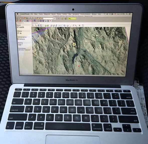
I only played around briefly with the Mac version. It seemed to open my LIDAR .kmz maps fine (see https://forums.njpinebarrens.com/threads/lidar-enhanced-aerial-views.10340/page-3#post-124283)
I was not able to get the software working with my Bluetooth Garmin GLO GPS however. This might be a Mac-specific issue, not sure. Also couldn't get it working with my Montana 600 over USB. Will look into this a little deeper in the future. But this could be handy software even without GPS capabilities, because it appears to open many GIS file formats.
http://www.twonav.com/en/support/downloads
The user manual is available here:
http://manual.twonav.com/manual/land_air_76_en/wiki_land_air/
I only played around briefly with the Mac version. It seemed to open my LIDAR .kmz maps fine (see https://forums.njpinebarrens.com/threads/lidar-enhanced-aerial-views.10340/page-3#post-124283)
I was not able to get the software working with my Bluetooth Garmin GLO GPS however. This might be a Mac-specific issue, not sure. Also couldn't get it working with my Montana 600 over USB. Will look into this a little deeper in the future. But this could be handy software even without GPS capabilities, because it appears to open many GIS file formats.
Last edited:
")