All,
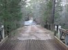
With the quick removal of the snow by the rain, today was a perfect opertunity to stone search for a few stones I have been wanting to find. Unfortuantly, we found the water in some places to be quite high, but with a few detours, and passing on one location, we had a pretty good day. Our first stop was again to the Pine Crest Gun Club to narrow down the Friendship Bogs line in that area. With the acquisition of some recent info I was able to figure out where I went wrong in the past. At our first location we found the spot using some clues, but the stone and monument were gone. It is right along a road near the JCRR and that usually ends poorly. Then to the second location where I was surprised to find the stone is still there. This is about 160 feet off the road.

Next, Jessica found the corner of their property and the Friendship Bogs line. It is NJ 83-5T, surveyed again in 1983 hence the 83.

The Parker Preserve line was nearby and I was hoping the stone at that corner was still there, and again Jessica found it. The stone in the front with a pipe and concrete block around it.

It was really weird that when we returned to our car a vehicle was coming upon us, and up pulled two men asking me if I was still looking for history. I did not recognise them at first, and when I did it turns out that these same two me approached Jessica and I a year or more ago at the very same spot. The one man's ancestors lived at Martha and Harrisville and he has photo of them at Harrisville when they did. I have talked to him on the phone but have not yet had a chance to see the photo's.
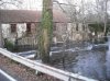
Next we headed over to a recent purchase by the state on 532 near Woodjins house. I knew there were a few stones there but was surprised when Jessica AGAIN found the first one and we noticed it was incised. The initials are RWH. Sorry for the glare in the photo's.

Closer view of the H.

RW

Then to the next stone that Jessica AGAIN found. She is annoying me!!!!!! This one is WYSIWYG. It is flat on the bottom and can be carried with a few fingers.

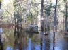
A view of the pond nearby.

Guy
With the quick removal of the snow by the rain, today was a perfect opertunity to stone search for a few stones I have been wanting to find. Unfortuantly, we found the water in some places to be quite high, but with a few detours, and passing on one location, we had a pretty good day. Our first stop was again to the Pine Crest Gun Club to narrow down the Friendship Bogs line in that area. With the acquisition of some recent info I was able to figure out where I went wrong in the past. At our first location we found the spot using some clues, but the stone and monument were gone. It is right along a road near the JCRR and that usually ends poorly. Then to the second location where I was surprised to find the stone is still there. This is about 160 feet off the road.
Next, Jessica found the corner of their property and the Friendship Bogs line. It is NJ 83-5T, surveyed again in 1983 hence the 83.
The Parker Preserve line was nearby and I was hoping the stone at that corner was still there, and again Jessica found it. The stone in the front with a pipe and concrete block around it.
It was really weird that when we returned to our car a vehicle was coming upon us, and up pulled two men asking me if I was still looking for history. I did not recognise them at first, and when I did it turns out that these same two me approached Jessica and I a year or more ago at the very same spot. The one man's ancestors lived at Martha and Harrisville and he has photo of them at Harrisville when they did. I have talked to him on the phone but have not yet had a chance to see the photo's.
Next we headed over to a recent purchase by the state on 532 near Woodjins house. I knew there were a few stones there but was surprised when Jessica AGAIN found the first one and we noticed it was incised. The initials are RWH. Sorry for the glare in the photo's.
Closer view of the H.
RW
Then to the next stone that Jessica AGAIN found. She is annoying me!!!!!! This one is WYSIWYG. It is flat on the bottom and can be carried with a few fingers.
A view of the pond nearby.
Guy
 I'll try to return tomorrow. I was hoping to make it much further back.