Went out today in a seemingly little visited patch of Bevan WMA .There is about 300 ft of road frontage where state land touches the road,the rest of the area has private land blocking entry from the road and the area that is state is not signed so the only folks I think that are going back there are the adjoining property owners if they are.I seen one deer stand all day and he was about a hundred feet onto Unimin sand property (I inadvertently wandered over the line because the hiking was easier)so either he has permission or he's an outlaw! In any case I took Sophie with me,she has absolutely no interest in stones but every patch of stagnant swamp water was taken to be her own playground/soaking hole.Each one she had to spread eagle in,I take it she thinks 46 degrees is unbearably hot.
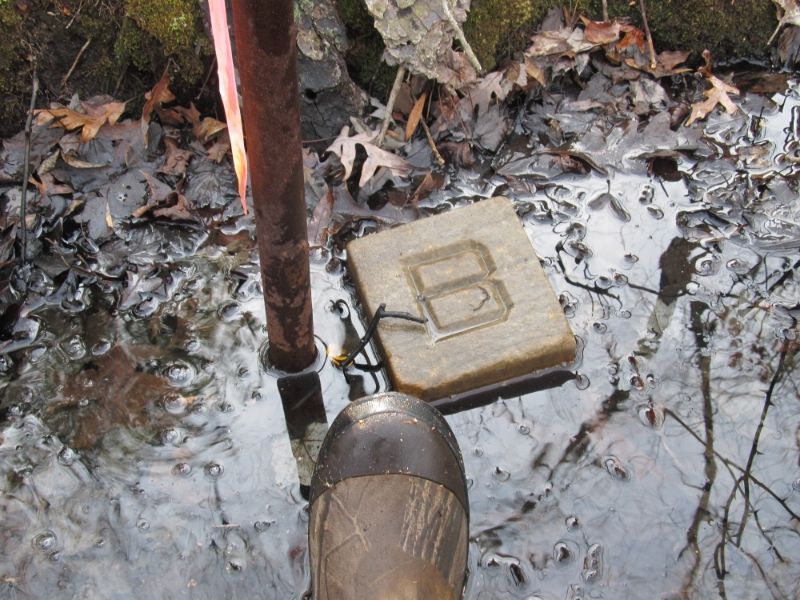
I started by heading to a state monument I had found maybe ten years ago but had not checked for a stone because I had no idea what a stone signified back then.Sure enough the monument was right where I left it on top of a small berm next to another stagnant canal (Sophie was in heaven)I proceeded to stab the ground and first stab hit pay stone.It was small and under about three inches of very stinky mud and when the canal is running is no doubt underwater.I did not take a pic because I had nothing to wash it off with and it just looked like mud but I could feel it. I then made a beeline several hundred feet west through a gorgeous vernal swamp type area,the Beast did not know what to do.She could not possibly wallow in every hole,but she tried.I popped out on what the tax map lists as Betty Tomlins corner.This was not posted but there was an old road that followed the old line and the corner was obvious due to the crook in the road.A very attractive old road it was.There was som orange survey tape hanging on a tree on the outside of the bend otherwise I may not have found this monument.A very large and very heavy old dead maple had fell eons ago right on top of it.I did not bother to try to stab around it because I could not get my hand under it and could barely see the top of the monument on one side .I would have had to lain in briars to even try.If there was a stone next to it it was buried under dirt and tons of wood.I then proceeded up the trail a hundred feet and there were very fresh posted signs across the trail signed Joseph Brewtser.There was a canal that approached the trail at this point and I turned up it looking across it at a row of posted signs on the other side.I was on state property and figured if any old stones were here they would be on one side of this canal/ditch or the other.Now I have never met Joseph Brewter but I did go to school with three of his daughter.....MY MY! Oh well back on subject.He runs a vault and monument business and his base of operations and home were only about 800 ft from me at this point.I am also friends with his grandson whom i used to work with and now works for Gramps so it may have been him I heard backing up a truck while I was in the piece out back.In any case I stayed on the state side of the ditch and about a hundred feet up the ditch I spied tape and then a pipe in the middle of the ditch.As I got closer I seen the stone lying in the middle of the ditch.Awesome! After I seen it I thought to myself "well after all the man does make monuments for a living,why not make some nice ones to mark his own property?

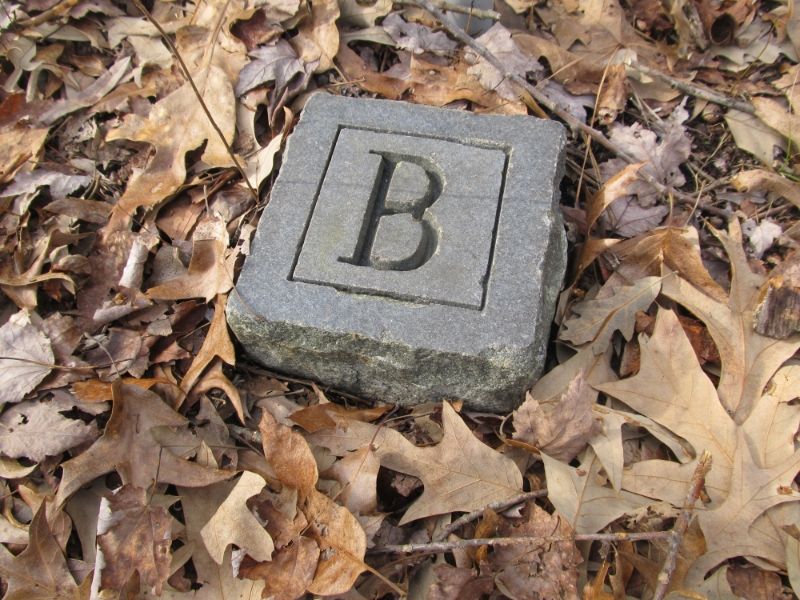
I then headed west again to a vernal pond I had visited maybe ten years ago looking for a monument I never found.Well today I found a bunch of pink ribbon,a pipe and this!

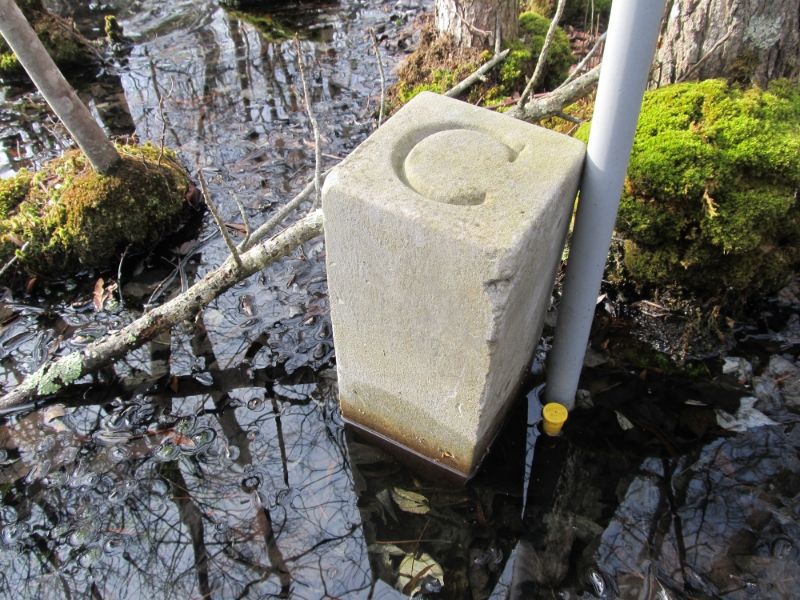
I knew there was supposed to be a monument further south in the middle of the pond but last time I was here I had good boots on and did not want to wade the pond and thought who would put a monument in knee deep water anyway.Well this pond is simply gorgeous.maples spread all through it,it looks like something out of the bayous.It's shaped like a Y.I could see Brewstres signs once again going right up the middle of the pond.An eyesore to be sure but they let me know i was on the right track,and also on the right side of his line .I looked out into the pond where the monument should have been and saw nothing but the signs were headed right to the spot so in I went.I had knee highs on and a dog looking at me as if to say "You Wuss'! I"m Nekked and can do this! so in we went.As I approached a clump of small maples in mid shin deep water I saw some tape appear and as I rounded a tree there was a nice big concrete monumet with a C on top.Now this is another one of Brewsters corners and a sign of his is on the tree next to the monument so I have no idea what the "C" is for..Here it is

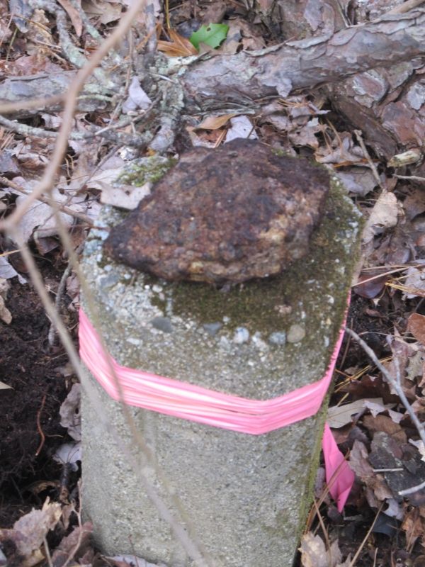
I then left Brewtsers property heading further west to see if there were any monuments bordering Unimin/State property.None were shown on topo but I thought they may be there anyway and I found two.The first one had a rotten chunk of stone buried next to it.

I was rpovided with a nice cut trail to both of these monuments,the second one had no stone.I kept going further west but all corners past that had wide old roads next to them and were overgrown with pine.The type of roads you usually find nothing on because the stones were plowed under when they bulldozed them.,The stones are probably in the berms where the dirt has been pushed aside.I never understood why the stae would pay good money to have their land surveyed and monuments placed and then pay someone to go out there to make a boundary road and plow them under????
I checked out some pine groves I had seen on the aerials,they were pitch and kinda thick,give em a few more years they may thin out and make a nice walk underneath.
It was a good day.I found some nice stones I really wasn't expecting and Sophie found some really nice stinky swampholes to roll in.She finally got that nasty shampoo clean dog smell off of her where Mommy had give her a bath last week!God she reeks
I started by heading to a state monument I had found maybe ten years ago but had not checked for a stone because I had no idea what a stone signified back then.Sure enough the monument was right where I left it on top of a small berm next to another stagnant canal (Sophie was in heaven)I proceeded to stab the ground and first stab hit pay stone.It was small and under about three inches of very stinky mud and when the canal is running is no doubt underwater.I did not take a pic because I had nothing to wash it off with and it just looked like mud but I could feel it. I then made a beeline several hundred feet west through a gorgeous vernal swamp type area,the Beast did not know what to do.She could not possibly wallow in every hole,but she tried.I popped out on what the tax map lists as Betty Tomlins corner.This was not posted but there was an old road that followed the old line and the corner was obvious due to the crook in the road.A very attractive old road it was.There was som orange survey tape hanging on a tree on the outside of the bend otherwise I may not have found this monument.A very large and very heavy old dead maple had fell eons ago right on top of it.I did not bother to try to stab around it because I could not get my hand under it and could barely see the top of the monument on one side .I would have had to lain in briars to even try.If there was a stone next to it it was buried under dirt and tons of wood.I then proceeded up the trail a hundred feet and there were very fresh posted signs across the trail signed Joseph Brewtser.There was a canal that approached the trail at this point and I turned up it looking across it at a row of posted signs on the other side.I was on state property and figured if any old stones were here they would be on one side of this canal/ditch or the other.Now I have never met Joseph Brewter but I did go to school with three of his daughter.....MY MY! Oh well back on subject.He runs a vault and monument business and his base of operations and home were only about 800 ft from me at this point.I am also friends with his grandson whom i used to work with and now works for Gramps so it may have been him I heard backing up a truck while I was in the piece out back.In any case I stayed on the state side of the ditch and about a hundred feet up the ditch I spied tape and then a pipe in the middle of the ditch.As I got closer I seen the stone lying in the middle of the ditch.Awesome! After I seen it I thought to myself "well after all the man does make monuments for a living,why not make some nice ones to mark his own property?

I then headed west again to a vernal pond I had visited maybe ten years ago looking for a monument I never found.Well today I found a bunch of pink ribbon,a pipe and this!

I knew there was supposed to be a monument further south in the middle of the pond but last time I was here I had good boots on and did not want to wade the pond and thought who would put a monument in knee deep water anyway.Well this pond is simply gorgeous.maples spread all through it,it looks like something out of the bayous.It's shaped like a Y.I could see Brewstres signs once again going right up the middle of the pond.An eyesore to be sure but they let me know i was on the right track,and also on the right side of his line
 .I looked out into the pond where the monument should have been and saw nothing but the signs were headed right to the spot so in I went.I had knee highs on and a dog looking at me as if to say "You Wuss'! I"m Nekked and can do this! so in we went.As I approached a clump of small maples in mid shin deep water I saw some tape appear and as I rounded a tree there was a nice big concrete monumet with a C on top.Now this is another one of Brewsters corners and a sign of his is on the tree next to the monument so I have no idea what the "C" is for..Here it is
I then left Brewtsers property heading further west to see if there were any monuments bordering Unimin/State property.None were shown on topo but I thought they may be there anyway and I found two.The first one had a rotten chunk of stone buried next to it.

I was rpovided with a nice cut trail to both of these monuments,the second one had no stone.I kept going further west but all corners past that had wide old roads next to them and were overgrown with pine.The type of roads you usually find nothing on because the stones were plowed under when they bulldozed them.,The stones are probably in the berms where the dirt has been pushed aside.I never understood why the stae would pay good money to have their land surveyed and monuments placed and then pay someone to go out there to make a boundary road and plow them under????
I checked out some pine groves I had seen on the aerials,they were pitch and kinda thick,give em a few more years they may thin out and make a nice walk underneath.
It was a good day.I found some nice stones I really wasn't expecting and Sophie found some really nice stinky swampholes to roll in.She finally got that nasty shampoo clean dog smell off of her where Mommy had give her a bath last week!God she reeks

