Burden Hill Preserve, A PBX Hike

Teegate

Administrator
Site Administrator
Sep 17, 2002
25,637
8,243
All,

On 11/15 all members of PBX received this edited email from Bob about our next adventure.

Boys,
Sometimes Boys, you gotta explore new territory! It’s what exploring is all about. On Saturday, December 15th, we’ll meet far, far Down Jersey near the little hamlet of Peck’s Corner at 8:30 AM. We are going to explore a remnant of the narrow forested belt that once stretched from Monmouth County to Salem County. See the link below:


http://www.njconservation.org/burdenhill.htm


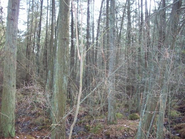
This area has some of everything in it, including the pinelands, so we will still be true to our name. We even get to cross a lost cedar swamp. It should be very interesting!
Happy Trails!………….bob

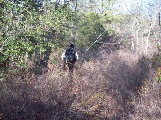
By 9AM this morning we all had arrived and headed into the woods. It turns out we headed right into what appeared to be an old dump so the first portion of the hike was depressing. However, things changed, the weather warmed, and the day continued to get better. This photo taken on the power lines heading out of the Salem nuclear plant shows the members who attended.
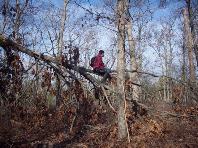
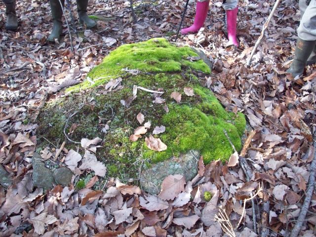
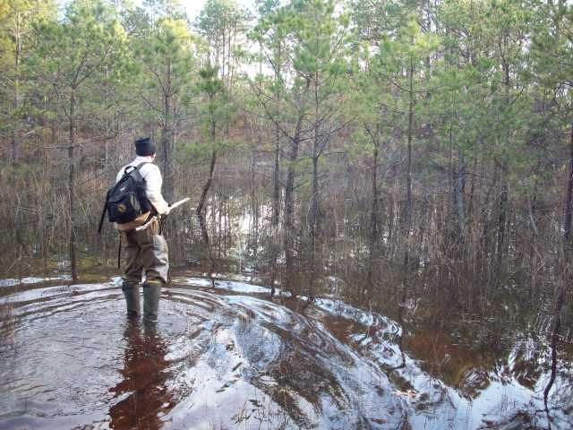
IMG_2024.JPG


Taking in the view.

IMG_2020.JPG


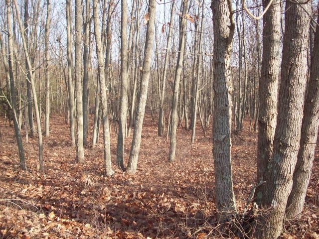
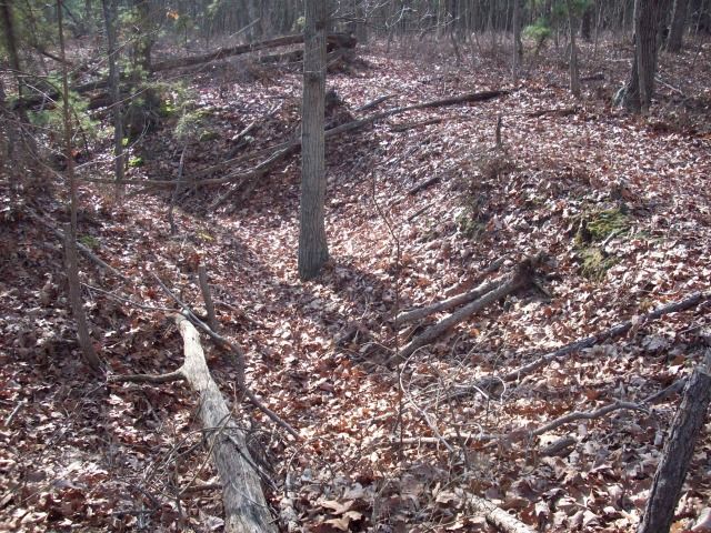
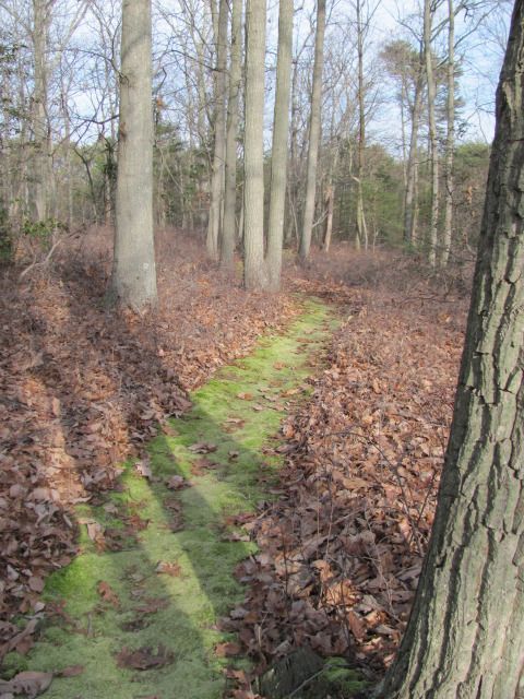
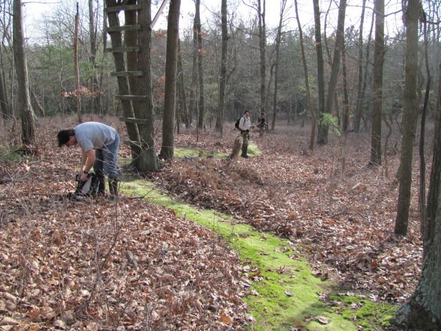
The most fascinating find for me is the way the hunters clean the paths leading to their hunting area's. After pushing through the leaves it was like following the yellow brick road without making a sound when we came upon the various paths like this.
IMG_2027.JPG


IMG_2028.JPG


They were very considerate.

IMG_2032.JPG


Finding nobody home.

IMG_2036.JPG


After a long day of hiking Jessica just wanted to get home. Unfortunately, the car would not start. I took her home.

IMG_2039.JPG


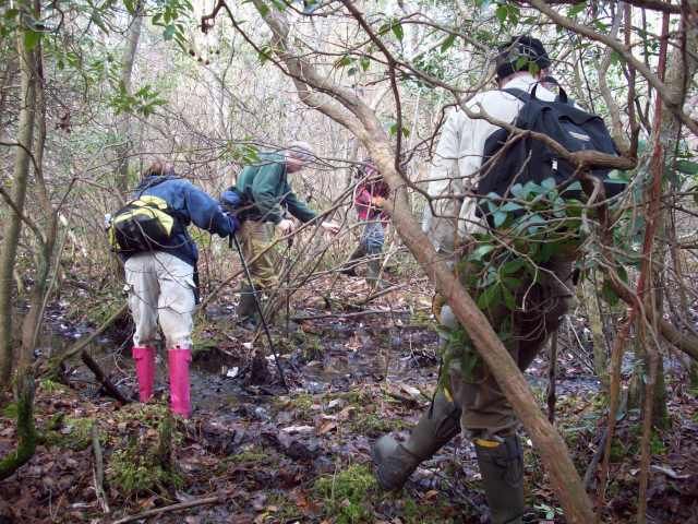
It was a great day with good friends. In the end the consensus for the hike was an 8.5 out of 10.

Guy
 
  • Like
Reactions: John

bobpbx

Piney
Staff member
Oct 25, 2002
14,207
4,303
Pines; Bamber area
Thanks Guy, I had a good time today!

It is an interesting area. We found evidence of mining for the top layer of sandstone on top of some of the hills near Peck's corner. It is why we surmise the area is named burden hill--maybe because of the sandstone overburden? It's just a guess.
 

manumuskin

Piney
Jul 20, 2003
8,555
2,469
59
millville nj
www.youtube.com
I figured up the mileage after cutting my driving off the track and I walked 7.47 miles.Felt like more.I think these new rubber boots are quite heavy.Not meant for long hikes but very warm.socks were soaked to the point of ringing them out and it was all sweat.
 

Boyd

Administrator
Staff member
Site Administrator
Jul 31, 2004
9,545
2,804
Ben's Branch, Stephen Creek
Good report, nice to see that you are broadening the area of your explorations.

It is why we surmise the area is named burden hill--maybe because of the sandstone overburden? It's just a guess.

I don't know anything about that area, however "Burden" is not an unusual last name. I know someone named Bill Burden myself. Maybe Jerseyman will enlighten us? :)
 

Teegate

Administrator
Site Administrator
Sep 17, 2002
25,637
8,243
I know a man who lives there and he said we could walk all over his property, hunt deer, dig up and take his property stones, and even use his house for overnighters. I will send him an email and tell him we will be there. Better yet, lets go unannounced.
 

Boyd

Administrator
Staff member
Site Administrator
Jul 31, 2004
9,545
2,804
Ben's Branch, Stephen Creek
He sounds like a nice guy. The man I know who lives there shoots first and asks questions later. :D

I think Belco would be a better outing actually. Not as large an area as you are used to, but there are plenty of obstacles to traverse and lots to see.
 

Spung-Man

Explorer
Jan 5, 2009
978
666
64
Richland, NJ
loki.stockton.edu
Wow, another forgotten Pine Barrens outlier! Some botanists bristle at this, but I agree with McCormick & Andreson's (1963) map.


This looked like a great adventure. I will stir the pot. Memory has it that the original name was something like Bordens Hill, but I can't seem to find that reference right at the moment. I thought it was mentioned in a recent botanical report, which is misfiled.

S-M
 

Hewey

Piney
Mar 10, 2005
1,042
110
Pinewald, NJ
We were blessed with another beautiful day for a PBX hike! I have always wanted to do some exploring in deep south west Jersey. Burden Hill was definitely a great area to do it. At moments it felt like you are in the heart of Wharton, and at other moments it felt like your were in the Highlands of North West Jersey. We did 7.5 miles for the day, and finished the day off back at the vehicles with a nice tailgate.

Most of the day was easy going through hardwood forest.
741.jpg


In a few areas we did go through some thick spots that looked more like the heart of the pines. Bob, making his way through the thick stuff.
744.jpg


Jeff, Guy, Jessica, and Bob crossing a swampy area that we crossed back over later in the day.
746.jpg


Jeff taking a break.
750.jpg


Areas that are dug out we think for the mining of sandstone.
752.jpg


A large piece of sandstone on the edge of one of the diggings.
753.jpg


A nice mix of Virginia and Pitch pine.
757.jpg


Rhodo Lake.
758.jpg


The only cedar we encountered on this trip at a waypoint named "Lost cedar".
759.jpg


Bob checking out a flooded area of pine.
760.jpg


Savannah, young cedar, and cotton grass towards the end of the hike.
762.jpg


Chris
 
  • Like
Reactions: John

Teegate

Administrator
Site Administrator
Sep 17, 2002
25,637
8,243
Very nice Chris! You did a nice job showing the depth of the mining. I find it very difficult to get that to show up and yours turned out quite well.

Guy
 

bobpbx

Piney
Staff member
Oct 25, 2002
14,207
4,303
Pines; Bamber area
Yes, nice photos Chris. I like the thought that this state has so many areas left to explore. I will be getting down that way a lot when I retire.
 

amf

Explorer
May 20, 2006
152
45
Swedesboro
That pond used to be in a friend's family - it was their summer getaway spot. I believe at one time they tried to grow cranberries there. The large cleared area was a largely illegal sand and clay pit, that ultimately was stopped when the guy dug up some swamp pinks.
 

manumuskin

Piney
Jul 20, 2003
8,555
2,469
59
millville nj
www.youtube.com
I'll be back out there friday or saturday with Sophie.There are some nice water holes visible on Birds eye that we missed further south that look to be Aqua blue/green like the one hole,no doubt from suspended clay particles in the water.Will be exploring the whole area though may wait to go near Rhodo lake till after deer season is over for obvious reasosns.I can't believe we did not encounter any hunters there.
 

pineywoman

Explorer
Aug 24, 2012
427
48
Wow! It looks like you guys had a GREAT time. I'm jealous! Thanks for sharing your experience!
 

Spung-Man

Explorer
Jan 5, 2009
978
666
64
Richland, NJ
loki.stockton.edu
OK, I called Beverly, the librarian at the Salem County Historical Society, who said there is an 1876 land survey indicating ownership of the land by a Borden, but thinks this a corruption of Burden. She prefers the orthodox burden interpretation of a difficult task due to a steep grade. I cannot remember where the reference to Borden came from, but it seemed pretty convincing when I read it. Maybe this is a job for Jerseyman...
 

bobpbx

Piney
Staff member
Oct 25, 2002
14,207
4,303
Pines; Bamber area
OK, I called Beverly, the librarian at the Salem County Historical Society, who said there is an 1876 land survey indicating ownership of the land by a Borden, but thinks this a corruption of Burden. She prefers the orthodox burden interpretation of a difficult task due to a steep grade. I cannot remember where the reference to Borden came from, but it seemed pretty convincing when I read it. Maybe this is a job for Jerseyman...

Thanks for the effort Mark. I did forget to mention that there is a hill that is named Burden a mile and a half (+-) North of where we explored. It is on historical topos as well.

http://maps.njpinebarrens.com/#lat=39.53006234274146&lng=-75.37633895874023&z=14&type=hist&gpx=
 

Spung-Man

Explorer
Jan 5, 2009
978
666
64
Richland, NJ
loki.stockton.edu
Bordens Hill.jpeg

The above diagram was excerpted from page 34 of: Everts, and Stewart, 1876: Combination Atlas Map of Salem and Gloucester Counties, New Jersey. Philadelphia, PA: Gloucester County Historical Society 123 pp. (Reprinted 2001). Burden Hill is described as Bordens Hill. Turnip Hill is near Pecks Corner.

Bordens Hill 2.jpeg

Both hills (red arrows) are named as above on Hopkins, 1873: 25, Combined Atlas of the State of New Jersey and the City of Newark.
 

RednekF350

Piney
Feb 20, 2004
4,953
3,107
Pestletown, N.J.
I was a little slow on the draw here but allow me to add to the thread.
The area is nearly a monoculture of chestnut oak, except for a few wet areas and old gravel operations.
It was a beautiful, clean woods and it was a pleasure to have a little topographic relief thrown in for a change.

As hunters and novice trappers, one thing Chris and I always look for in any woods is critter tracks. We both had our eyes to the ground most of the day and we impressed with the amount of evidence of deer and other critter activity that we were seeing.

The only pics I took were of a well manicured trail leading through the woods to a deer stand. We found other similar trails and it looks like the hunters have been keeping the trails clear for many years, allowing a thick carpet of moss to flourish. This makes for a deadly silent approach to the stand in the dark.

Thanks for all of the planning Bob and Guy and all of the tweaking that went into the final route.

Scott

img_1522.jpg


img_1521.jpg
 
  • Like
Reactions: John
Top