Exploring near Pestletown and along Fleming Pike.

Teegate

Administrator
Site Administrator
Sep 17, 2002
25,656
8,267
All,

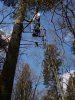
Scott (rednekf350), Jessica, and I started out at 8:30 this morning exploring the area of Wharton near the Pump Branch off of Pestletown Road. We first visited the first location of the Rosedale gun club that Scott posted this photo of a few weeks back.

http://forums.njpinebarrens.com/gallery/displayimage.php?album=lastup&cat=10177&pos=7

We also visited a semi new gaging station and a few brand new test wells. The wells are new in the past week.

Here is the station:

http://www.njpinebarrens.com/teegate/main.php/download/178-1/IMG_5168.jpg

And the new wells.

http://www.njpinebarrens.com/teegate/main.php/download/192-1/IMG_5172.jpg

We also visited these. I am in the process of finding out what they are exactly used for.

http://www.njpinebarrens.com/teegate/main.php/download/195-1/IMG_5173.jpg

We then went hunting for markers and stones, and did semi well. Our first stop was to see one of the Control Survey markers on Fleming Pike. This is one of two in the area with the other missing.

http://www.njpinebarrens.com/teegate/main.php/download/210-1/IMG_5179.jpg

We then searched for a state stone with an accompanying native stone. We were surprised at where the native stone was located.

The state stone:

http://www.njpinebarrens.com/teegate/main.php/download/215-2/IMG_5180.jpg

And 12 feet away in the middle of the road we found the native stone.

http://www.njpinebarrens.com/teegate/main.php/download/219-1/IMG_5182.jpg

Notice where it is:

http://www.njpinebarrens.com/teegate/main.php/download/222-1/IMG_5183.jpg

One final stop and we found this stone still with the yellow paint from someone finding it previously.

http://www.njpinebarrens.com/teegate/main.php/download/225-1/IMG_5188.jpg

Guy
 

RednekF350

Piney
Feb 20, 2004
4,959
3,122
Pestletown, N.J.
Great search today Guy.
I posted a photo from this morning in my gallery and am attaching one here.
I just got back from my first crack at Geocaching with my wife.
She thought it was great.
We found one out of two that we looked for and I learned a lesson already.
Always check the coords on a Quad map first.
We trekked a half mile through Maple Island Swamp with the dog to the cache location, only to find the spot was about 12' from a roadbed.
Great day in the woods.
Scott
:)
 

Attachments

  • reducer.jpg
    reducer.jpg
    75.2 KB · Views: 381

Teegate

Administrator
Site Administrator
Sep 17, 2002
25,656
8,267
RednekF350 said:
Great search today Guy.
I posted a photo from this morning in my gallery and am attaching one here.
I just got back from my first crack at Geocaching with my wife.
She thought it was great.
We found one out of two that we looked for and I learned a lesson already.
Always check the coords on a Quad map first.
We trekked a half mile through Maple Island Swamp with the dog to the cache location, only to find the spot was about 12' from a roadbed.
Great day in the woods.
Scott
:)


I was getting light headed up there :D

Thanks for the photo. Good to see that after all that walking, she enjoyed herself.

Guy
 

Teegate

Administrator
Site Administrator
Sep 17, 2002
25,656
8,267
BEHR655 said:
Maybe we will find the one at Washington after all.
Sorry I was not able to make it today.

Steve

One day in warmer weather it would be interesting to hike right down the Pump Branch. The water is about a foot deep, the bottom is clean and hard sand, and there are some interesting cedar swamps along it. And Scott showed me where there are some of the biggest oak trees I have ever seen.

And interesting area with some interesting cellar holes. One is as big as the warehouse at Friendship, without the stones. Just the hole. It is near some bogs so it must have been a cranberry or some other warehouse.

Guy
 

Teegate

Administrator
Site Administrator
Sep 17, 2002
25,656
8,267
All,

In my above post there was a photo of the stream gaging station, but I did not post a photo showing the pipe leading down to the water from it. For the record here it is, and if you look closely you can see a bubble coming up from the end of the pipe.

http://www.njpinebarrens.com/teegate/main.php/download/183-1/IMG_5169.jpg

I contacted someone who I knew could tell me more about how these gages work, and he came thru for me as he always does. The solor panels run a small compressor that pumps air into the water through the pipe. By monitoring how much pressure it takes to push the bubbles out, they can monitor the water level. That info is then transmitted back and you and I can view the info on their website.

http://waterdata.usgs.gov/nj/nwis/uv/?site_no=0140940810&PARAmeter_cd=00065,00060

As for the two pipes with the tape on them shown here:

http://www.njpinebarrens.com/teegate/main.php/download/195-1/IMG_5173.jpg

They are hydrologic transect that were just installed to understand subsurface hydraulic gradients near streams. Since they are in a remote area they are just using tape to cover them. When the wells are in a more conspicious place, they are now covering the pipes with the blue plastic protectors shown here.

http://www.njpinebarrens.com/teegate/main.php/download/192-1/IMG_5172.jpg

Guy
 

bobpbx

Piney
Staff member
Oct 25, 2002
14,261
4,371
Pines; Bamber area
TeeGate said:
One day in warmer weather it would be interesting to hike right down the Pump Branch. The water is about a foot deep, the bottom is clean and hard sand, and there are some interesting cedar swamps along it. And Scott showed me where there are some of the biggest oak trees I have ever seen. Guy

Does look nice. Can you post the topo view so I can see the general location?
 

RednekF350

Piney
Feb 20, 2004
4,959
3,122
Pestletown, N.J.
I walked right up on the taped-up conduits that I showed Guy when I was squirrel hunting back in February.
I walk that stretch of swamp 5 or 6 times a year for squirrel in the early and late seasons.
The conduits are within 80 yds of someone's baited deer stand and there was plenty of surveyors tape hanging over them.
If they thought they were remote, they were a little mistaken.
Sometimes when someone can't see a road or here traffic they feel like they fell off the face of the earth.
My wife and I just tried geocaching for the first time (her idea) this weekend (she loves it) and I can't believe how close to roads or trails all of the crap was that we found.
You would figure with the use of GPS people would be a little braver in setting out their caches.
My wife insisted on planting one and it is only mildly challenging because we were running out of daylight.
The day of a true woodsman getting by with some woods-sense, a map and compass or just a compass are over.
As long as their batteries hold out, any L.L. Beaner can be Grizzly Adams for a day.
Sorry about the Bean reference Guy. :)
Scott
 

Teegate

Administrator
Site Administrator
Sep 17, 2002
25,656
8,267
RednekF350 said:
Sorry about the Bean reference Guy. :)
Scott

No problem. It just was an easy place to find the items I use.

Guy
 

bobpbx

Piney
Staff member
Oct 25, 2002
14,261
4,371
Pines; Bamber area
TeeGate said:
One day in warmer weather it would be interesting to hike right down the Pump Branch. The water is about a foot deep, the bottom is clean and hard sand, and there are some interesting cedar swamps along it. And Scott showed me where there are some of the biggest oak trees I have ever seen. Guy

Does look nice. Can you post the topo view so I can see the general location?
 

wis bang

Explorer
Jun 24, 2004
235
2
East Windsor
RednekF350 said:
If they thought they were remote, they were a little mistaken.
Sometimes when someone can't see a road or here traffic they feel like they fell off the face of the earth.

The day of a true woodsman getting by with some woods-sense, a map and compass or just a compass are over.
As long as their batteries hold out, any L.L. Beaner can be Grizzly Adams for a day.

Sadly things do change. I learned my way around our hunting areas walking with my father and grandfather. It was truly interesting this past year to mark alot of our spots in my GPS and later on Street Atlas on my laptop.

Most of the 'stands' I find are close to a road except in State Forest lands. When the boundary is well marked, it usually gets a 'pathway' following it deeper into the area. After a lifetime of going to the same places, I have an internal map of a very large area. This is just too hard to repeat too many times so the GPS has opened up new areas. Too bad it means carrying so many batteries...
 
Top