Have you noticed a lack of road labels on Google maps recently? I don't use them all that often, but am working on my own streetmaps of the Northeast US right now and wanted to compare some things. Here's an example of the problem: there are some pretty major roads here.... what are they? No names and no icons showing route numbers (like the red, white and blue interstate highway shields).
https://www.google.com/maps/@41.3156125,-74.1204245,14z?entry=ttu

And this isn't just a cherry-picked screenshot, I can scroll around and zoom in and out all I want and no labels ever appear. Maybe there's a preference setting I don't know about? Or maybe I'm weird for wanting to know road names? Guessing that Google decided most people don't care and only want to follow directions (turn right in 1.2 miles, etc). I know that's what my kids do, they never even look at the screen, just listen to the directions.
For comparison, Bing Maps shows everything, along with lots of intrusive sponsored POI's
https://www.bing.com/maps/?cp=41.307847~-74.149845&lvl=14.2

Apple Maps has them too, but their color choices make it hard to see some of the roads

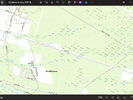
OpenTopoMap doesn't score very high with streetnames either, they don't even show interstate icons.
https://boydsmaps.com/#14.00/41.307514/-74.127049/usopentopo/0.00/0.00

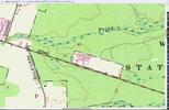
And while I don't like their overall style, at least the USGS has basic road info
https://boydsmaps.com/#14.00/41.307514/-74.127049/ustopo2023/0.00/0.00

Lots of work left to do on my version, but it will have plenty of road information. Creating the route icons and exit numbers is a big job, I am doing it "from scratch" for the most part. But they're something I find essential for the way I use maps.

https://www.google.com/maps/@41.3156125,-74.1204245,14z?entry=ttu
And this isn't just a cherry-picked screenshot, I can scroll around and zoom in and out all I want and no labels ever appear. Maybe there's a preference setting I don't know about? Or maybe I'm weird for wanting to know road names?
 Guessing that Google decided most people don't care and only want to follow directions (turn right in 1.2 miles, etc). I know that's what my kids do, they never even look at the screen, just listen to the directions.
 For comparison, Bing Maps shows everything, along with lots of intrusive sponsored POI's

https://www.bing.com/maps/?cp=41.307847~-74.149845&lvl=14.2
Apple Maps has them too, but their color choices make it hard to see some of the roads
OpenTopoMap doesn't score very high with streetnames either, they don't even show interstate icons.
https://boydsmaps.com/#14.00/41.307514/-74.127049/usopentopo/0.00/0.00
And while I don't like their overall style, at least the USGS has basic road info
https://boydsmaps.com/#14.00/41.307514/-74.127049/ustopo2023/0.00/0.00
Lots of work left to do on my version, but it will have plenty of road information.
 Creating the route icons and exit numbers is a big job, I am doing it "from scratch" for the most part. But they're something I find essential for the way I use maps.


