Kayaking Lake Oswego

scubabruce

Scout
Jul 1, 2011
86
21
ATCO, NJ
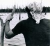
I've just started kayaking the pine barrens seriously with my 11.5 ft perception tribe. I recently found the stream that feeds Lake Oswego (not the stream past the dam). According to satellite photos, the feeder stream runs all the way close to route 539 near Warren Grove. It appears to split way before that point with the left hand fork running to some cranberry bogs near Sim's place? This fork appears to run close to Jennings Rd.

A few days ago I decided to paddle my kayak upstream along this feeder stream. I got a good distance upstream and took the left hand fork for a ways before the current and shallow water got the best of me. I stopped and walked inland for a short distance and think I found Jennings Rd. I then took the right hand fork. This was blocked by a large tree at the beginning. I climbed out of the kayak and went over the tree (waste deep water - no fun) and continued for about half a mile before giving up due to obstacles, current and shallow water. My question is has anyone attempted to make this run going downstream toward Lake Oswego, and if so, what was their starting point?

I'm retired, have a 4X4 truck and a landscape trailer, and I'm looking to kayak if anyone's interested.
 

Teegate

Administrator
Site Administrator
Sep 17, 2002
25,603
8,181
Welcome to the site! If you search the site you can find quite a few discussions on this. In any event, Bob, Jeff, and I did make it all the way to Sim Place from Oswego Lake and back again in one day. It was quite an adventure. You can read about it here.

http://forums.njpinebarrens.com/threads/oswego-lake-to-sim-place-2009.5615/

Remember, Sim Place is private so once you get up that far you are on private property once you leave the water.

Guy
 

scubabruce

Scout
Jul 1, 2011
86
21
ATCO, NJ
That was a totally amazing story - I really appreciate your sharing it. I remember going over that tree too. There seems to be another fork that goes off to the left. You can see it in the satellite photos. Did you ever try that one?

The area is one of the most pristine I've seen in NJ.
 

Pan

Explorer
Jul 4, 2011
554
246
Arizona
I used to love canoeing in the Barrens. Once I went with a canoe club on New Years Day. I think it was their tradition to go canoeing every year on that day. I brought my inflatable kayak. The water was partly frozen but the sun was bright and it was fun. Here's a photo of me cutting up on a 1980 canoe trip in the Barrens, in this case my friend brought his own canoe on his car top. We also used to rent canoes - Mick's, I think was the name of the place.
 

Attachments

  • May 1981, NJ PB canoe trip, Maniac with paddle.jpg
    May 1981, NJ PB canoe trip, Maniac with paddle.jpg
    835.6 KB · Views: 498

Pan

Explorer
Jul 4, 2011
554
246
Arizona
Another photo from that 1980 canoe trip. That's me again.

And there's my IK parked on the shore of Lake Oswego, Oct. 21, 1990.

UH OH! I am hijacking this thread. I'm sorry. Just say the word and I'll delete my posts and start another thread instead.
 

Attachments

  • Canoing in the Barrens Spring 1980.jpg
    Canoing in the Barrens Spring 1980.jpg
    795.8 KB · Views: 412
  • Lake Oswego, Sea Eagle Explorer, 21Oct1990.jpg
    Lake Oswego, Sea Eagle Explorer, 21Oct1990.jpg
    896.2 KB · Views: 485
  • Like
Reactions: scubabruce

Pan

Explorer
Jul 4, 2011
554
246
Arizona
"I'm retired, have a 4X4 truck and a landscape trailer, and I'm looking to kayak if anyone's interested."

Hey, I'd love to go with you, but unfortunately I now live several thousand miles away.
 

scubabruce

Scout
Jul 1, 2011
86
21
ATCO, NJ
An interesting day, Saturday 7/9/11 right after the heavy rains on Friday. I tried the upper Oswego River again. I found a good launching area up river off Jenkins Road near the CCC ruins as discussed in other posts. There actually was another guy there (silver silverado) but I didn't see him on the river.

Launching area - travel east on Oswego Rd past the recreation area - bear right onto Jenkins till you see the ruins. Make a right here (note the stone by the tree).

oswego r 002.jpg


This road makes a "U" and comes back out at Jenkins. At the bottom of the "U" there is a short trail to the river. You can back right up to the river.

Trail to river

oswego r 005.jpg

This is close to where the river forks as shown on satellite photos. The current was really humming!!! I went upstream and took the left fork (I think - Papoose Branch?) for about an hour until I came to a tree over the river. I might have been able to get under it if the water was lower. Since I was alone and beat from fighting the current, I turned around.

Old dam coming back

oswego r 007.jpg


CCC ruins

oswego r 008.jpg


oswego r 009.jpg


Blue ribbons on trees - I don't know what's going on here - anybody know?

oswego r 003.jpg


I drove past the wading river - never saw it so high. Mick's was closed due to the high water. I went over to BHP - they weren't renting either. They said they lost two kayaks on the Mullica that had gotten wedged under trees and had sank . They were going to have to cut the trees to get them out.
 

Pan

Explorer
Jul 4, 2011
554
246
Arizona
Good to see those photos of the Pines. I remember seeing ribbons on trees down there too. Maybe off the road motorcyclists marking a route?
 

Teegate

Administrator
Site Administrator
Sep 17, 2002
25,603
8,181
If you go to the CCC camp area in May there has been Lady Slippers there. Also, on the other side of the road are ruins of what must have been a water tower or some other sort of tower. Check that out if you go again and have not viewed it.

Guy
 

Teegate

Administrator
Site Administrator
Sep 17, 2002
25,603
8,181
Bob mentioned that to me at our last PBX hike and I checked it out a few weeks ago. That is Haines property and he has done that at various location around his property.

Guy
 

manumuskin

Piney
Jul 20, 2003
8,552
2,465
59
millville nj
www.youtube.com
Trail to river

This is close to where the river forks as shown on satellite photos. The current was really humming!!! I went upstream and took the left fork (I think - Papoose Branch?) for about an hour until I came to a tree over the river. I might have been able to get under it if the water was lower. Since I was alone and beat from fighting the current, I turned around.

Believe me,you did not canoe up the papoose.You know doubt took a left hand fork around an island.the Upper oswefgo as far as I have been braids around swamp islands in several spots.I have been as far up as papoose and think i might know where you think you went up it at.papoose is actually another quarter mile past that point.The papoose is hardly walkable let alone canoeable:)
Al
 

scubabruce

Scout
Jul 1, 2011
86
21
ATCO, NJ
OK I just pulled the NJPB map of the area and hit the terrain button - now I know what I did. The first trip I took the first right fork of the upper Oswego. This is shown on the map as an unnamed tributary and makes contact with Alan Rd. The second trip I didn't take this tributary and stayed to the left heading toward Sims place.
 

manumuskin

Piney
Jul 20, 2003
8,552
2,465
59
millville nj
www.youtube.com
i doubt you went up that creek.there is a short stretch of channel along the ne edge of the old bog just east of oswego lake but for the most part that stream has no channel but is just wet medders with no visible stream even though the topo shows a stream.I have crossed it in several places on foot and there is no stream except along that bog and wether you can get into it from oswego itself I don't know.I never noticed it coming into oswego when i wen by.I think you may have taken a right hand fork around an island when the main branch went around it to the left.Papoose is a hard stream to walk and though quite deep in places can be stepped over in many spots.I've seen places in papoose eight feet deep but in my skinnier days I could have jumped it.
Al
 

Pine Barron

New Member
May 25, 2010
5
0
First post in about 8 or 9 years up here (actually I used to post on the ghosttowns yahoo group forum); but since I know about the blue flags and I just paddled up a little past Allen's Bridge yesterday it seems like a fitting place to chime in!

In short, the blue flags simply mark trees that are part of project to measure some structural attributes of pitch pine for forest fire fuels research. Blue was picked because it's far less obtruse and not very visible from the landing on the river there; however, it will be take down at the end of the summer when all measurements are finished. There's some other plots scattered around and you can find five of them I'll treat you to breakfast at Lucille's!

Anyway...back to the Oswego River...

Yesterday we paddled up the eastern part of the Oswego River nearly to Sim Place. Personally, I think its the most adventurous and beautiful paddle in the pines, although I say adventurous because there's a fair number of obstacles to pull the boat over or where its ideal to stick a foot out and shove yourself through some shallows.

We put in by the CCC camp and got ast far up as perhaps a 10th of a mile past Allen's Bridge. This was the farthest up I've ever been, although I aspire to get all the way up to Sim Place. There were some nice islands in the stream full of Meadowbeauty, the four petaled pinkish flower with a yellow center, lance leaved centauries, pipeworts, marsh St. John's Wort, and some really neat blueish purple mushrooms in the cedar swamp if you veer off towards the false Papoose Branch. Regarding the dam that has been mentioned, I think I heard there's some ruins not too far from there...anybody know of this?

Mike
 
Top