Hello all, first post here and I thought I'd go straight to the experts of the Pine Barrens for this information:
What are the lowest runnable water levels on the Mullica, Batsto, Oswego, and Wading rivers for a kayak?
Below I made a list of each river, the USGS gauge link, what section(s) I most frequently run, and what I *think* to be the lowest runnable water level (taken from my personal experience, and peoples trip reports online). I'm completely open to different gauges to use, different water level numbers, or better methods to find out if a river is runnable a certain day (besides driving down there to tell for myself).
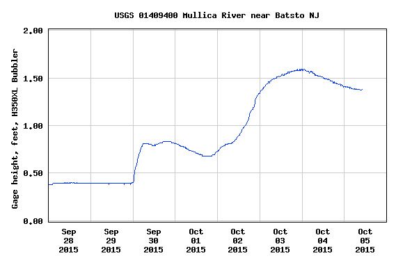
MULLICA RIVER (Atsion Lake to Pleasant Mills)
USGS Gauge: http://waterdata.usgs.gov/nwis/uv?01409400
0.95 feet minimum (lowest I've run it lately is 1.15' and it was perfect)
WADING RIVER (Speedwell to Hawkin, or Hawkin to Evans bridge)
USGS Gauge: https://waterdata.usgs.gov/monitoring-location/01409810/#parameterCode=00065&period=P7D
10.3' minimum (lowest I've done was 10.42' and for the first couple hundred yards we had to get out of our boats a couple times and pull them, but pretty good after that)
OSWEGO RIVER (Oswego Lake to Harrisville Dam)
USGS Gauge: http://waterdata.usgs.gov/nj/nwis/uv?01410000
2.82' minimum ***besides a couple spikes due to rain, this gauge has been at this level all summer long...and everyone says you can only run the Oswego early or late in the season...is this true? Or has it been a freak occurrence this season?
Gauge has been moved. Forum user AirCooled has said 10.45' is the bare minimum to run the Oswego.
BATSTO RIVER (Hampton Furnace to Batsto Village)
NO GAUGE, I use the Mullica gauge to judge this river (http://waterdata.usgs.gov/nwis/uv?01409400)
0.95 feet minimum ***any better source for judging the Batsto?
Any help would be greatly appreciated. I've tried calling the local canoe rental places, but WAY too many times now they've told me the water level is OK, zero complaints...they just had a guy do it yesterday....and then I get stuck on a river dragging my kayak behind me 20+ times to make it to the end...
What are the lowest runnable water levels on the Mullica, Batsto, Oswego, and Wading rivers for a kayak?
Below I made a list of each river, the USGS gauge link, what section(s) I most frequently run, and what I *think* to be the lowest runnable water level (taken from my personal experience, and peoples trip reports online). I'm completely open to different gauges to use, different water level numbers, or better methods to find out if a river is runnable a certain day (besides driving down there to tell for myself).
MULLICA RIVER (Atsion Lake to Pleasant Mills)
USGS Gauge: http://waterdata.usgs.gov/nwis/uv?01409400
0.95 feet minimum (lowest I've run it lately is 1.15' and it was perfect)
WADING RIVER (Speedwell to Hawkin, or Hawkin to Evans bridge)
USGS Gauge: https://waterdata.usgs.gov/monitoring-location/01409810/#parameterCode=00065&period=P7D
10.3' minimum (lowest I've done was 10.42' and for the first couple hundred yards we had to get out of our boats a couple times and pull them, but pretty good after that)
OSWEGO RIVER (Oswego Lake to Harrisville Dam)
USGS Gauge: http://waterdata.usgs.gov/nj/nwis/uv?01410000
Gauge has been moved. Forum user AirCooled has said 10.45' is the bare minimum to run the Oswego.
BATSTO RIVER (Hampton Furnace to Batsto Village)
NO GAUGE, I use the Mullica gauge to judge this river (http://waterdata.usgs.gov/nwis/uv?01409400)
0.95 feet minimum ***any better source for judging the Batsto?
Any help would be greatly appreciated. I've tried calling the local canoe rental places, but WAY too many times now they've told me the water level is OK, zero complaints...they just had a guy do it yesterday....and then I get stuck on a river dragging my kayak behind me 20+ times to make it to the end...
Last edited:


