More Roads Closed

ecampbell

Piney
Jan 2, 2003
2,840
958
A road has been posted here, off of Hampton Road (Glossy Spung) going up to the breached causeway at the skit. At the end of this road is a parking area which people use to fish, picnic and paddle. I use it and so do many others. It is a nice short paddle from Carranza road. Nothing up that road is under threat from vehicles. The causeway is blocked by a tree and I have never seen anyone driving on it, it is too narrow. It is being undermined by animals and slowly washing away. The road along the Skit to Hampton Furnace has been blocked by trees for years. Once again this is the result of selfish people with no consideration for others.
Posted.jpg

P8190007s.jpg


The road from the causeway to Hampton Furnace
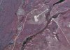
P8190009s.jpg


The causway
P8190014s.jpg

Animal burrows on the causway
P8190012s.jpg


Another road at Friendship Bogs at Sandy Ridge has been gated. This road is undrivable except for a short section to a canoe launch. Now you must haul over a gate and hoof it.
Gate.jpg


P8190015s.jpg


The MAP is being implemented slowly and quietly every week.
 

Attachments

  • Posted.jpg
    Posted.jpg
    1 MB · Views: 168

46er

Piney
Mar 24, 2004
8,837
2,143
Coastal NJ
The MAP is being implemented slowly and quietly every week.

Is that the modified MAP that was implemented after the last go round? If it is not, the only legal way I know of to stop further progress is to have an injunction issued to whomever has authorized the closures. With no organization with the means to do so, it would appear it will continue as you say.
 

Teegate

Administrator
Site Administrator
Sep 17, 2002
25,602
8,178
They apparently are gating off the wetland ending roads that basically lead to nowhere to try and keep vehicles from starting to use them.
 

ecampbell

Piney
Jan 2, 2003
2,840
958
Vehicles and people have been using them for decades, and it continues. Why shouldn't they use them and enjoy their forest and streams. It's hiking, fishing and paddling access.
 

Teegate

Administrator
Site Administrator
Sep 17, 2002
25,602
8,178
I should have said off-road vehicles who would try to start using them in place of other locations.
 

1Jerseydevil

Explorer
Feb 14, 2009
567
214
I know this road well, at least I used to. It's probably been 15+ years since I've been there. The road is actually an elevated dike that made the cranberry bogs. The road is not a dead-end as Guy implies. It's hard to see in the aerial but connects with another road that leads back to Carranza rd. At no point were you in wetlands but on the elevated dike. Yes, the wetlands surrounded it. The woods are dense with literally no place for vehicles to go except stay on the road. It is/was a nice place to visit.

Now with all this being said the road/dike may have been breached and is washed out. If that is the case then I can see why it has been closed.

Is there a gate on this end? https://maps.njpinebarrens.com/#lat=39.75192685718867&lng=-74.60305709045411&z=17&type=nj1995&gpx=
 

ecampbell

Piney
Jan 2, 2003
2,840
958
I don't know because of the gate up by Carranza that would be a 1.1 mile hike one way in this heat.
The road is not washed out.
 

1Jerseydevil

Explorer
Feb 14, 2009
567
214
Yes, it would be a rather long hike in the heat. It's getting cooler and a longer hike may be possible. If you have a 4wd you can drive down the sand road to near where I have the marker unless the sand road is gated past that little sandpit.
 

1Jerseydevil

Explorer
Feb 14, 2009
567
214
JD, I"m pretty sure that was an old sand dune, not a dike. Note how white the sand is too. See the lidar. It was improvised into a road.


View attachment 12377


Interesting, that would explain why it's so sandy with little vegetation. The dike I'm referring to runs along the cranberry bogs that ecampbell took a picture of the non-opening gate. My marker is where a connector road/dike joins your sand dune road.
 

lj762

Explorer
Feb 18, 2017
358
227
Bass River State Forest
Those little plastic stakes snap so easily
They look like the Carsonite marker posts we use for trails, and on campsites. They are supposed to be able to take a hit from a tire at highway speeds, and pop back up. Perhaps. But I have replaced many of these that broke from being hit by slow-moving cars or trucks (or so I assume). Nor do they survive contact with a riding mower! (I did eventually find all the post pieces in that case.) They are totally wrong for blocking a road. Also, unless they have our secret method for anchoring, you can pull them up very easily.
 
  • Like
Reactions: manumuskin

Teegate

Administrator
Site Administrator
Sep 17, 2002
25,602
8,178
Yes, it would be a rather long hike in the heat. It's getting cooler and a longer hike may be possible. If you have a 4wd you can drive down the sand road to near where I have the marker unless the sand road is gated past that little sandpit.


I was there late last year and that was flooded at the end. I don't see how you can get through. I will have to go back and check it out.
 

Boyd

Administrator
Staff member
Site Administrator
Jul 31, 2004
9,502
2,765
Ben's Branch, Stephen Creek
Yes, feet. They are a direct readout of the source DEM (Digital Elevation Model) data that was used to create the imagery. If you are especially interested in elevation, this is a lower resolution version of the same map in Garmin's format. It consists of millions of 15-meter grid cells, and you will see the elevation as you move the mouse over them: https://boydsmaps.com/lidar-in-the-pines-sd/
 
  • Like
Reactions: bobpbx

bobpbx

Piney
Staff member
Oct 25, 2002
14,153
4,257
Pines; Bamber area
Yes, feet. They are a direct readout of the source DEM (Digital Elevation Model) data that was used to create the imagery. If you are especially interested in elevation, this is a lower resolution version of the same map in Garmin's format. It consists of millions of 15-meter grid cells, and you will see the elevation as you move the mouse over them: https://boydsmaps.com/lidar-in-the-pines-sd/

That's interesting. You know what's really cool, is while looking at a river in lidar, as you scroll downstream, you can watch the numbers drop for the land around the river. At Friendship the terrain close to the river is at 50', but down to 10' at Harrisville.
 
  • Like
Reactions: Boyd

ecampbell

Piney
Jan 2, 2003
2,840
958
They look like the Carsonite marker posts we use for trails, and on campsites. They are supposed to be able to take a hit from a tire at highway speeds, and pop back up. Perhaps. But I have replaced many of these that broke from being hit by slow-moving cars or trucks (or so I assume). Nor do they survive contact with a riding mower! (I did eventually find all the post pieces in that case.) They are totally wrong for blocking a road. Also, unless they have our secret method for anchoring, you can pull them up very easily.
Care to share?????
 
Last edited:

1Jerseydevil

Explorer
Feb 14, 2009
567
214
I was there late last year and that was flooded at the end. I don't see how you can get through. I will have to go back and check it out.

As mentioned it's been 15+ years since I've been there. Yes, the end of the sand dune road ends in water. It does continue on dry land for a while past the flooded section but eventually ends in a swamp.
If you go down the sand dune road from Carranza rd, just before where it's flooded, you should see a short connector on your left that connects the dike road that is now gated where ecampbell shot the photo. Since the dike is gated near Carranza rd, I'm wondering if they took the time to gate off the other end? It's possible the road was flooded just before the connector which is why maybe you didn't see it?
 
Top