Thanks. I just spent the better part of a couple hours reading the reviews on the Nuvi 750. I liked the sounds of it so much, I just ordered one from Amazon. They will have them back in-stock by the end of the week. It cost me a couple bills, but I'm fine with that. I'll retire my GPSMap 60CS to Geocaching only.
My map project
- Thread starter Boyd
- Start date
You are using an out of date browser. It may not display this or other websites correctly.
You should upgrade or use an alternative browser.
You should upgrade or use an alternative browser.
I istalled this on my Garmin 260, thank you for taking the time to do this it works wonderfully. This is all beyond my abilities so I am glad someone here is able to put something like this together and then share it with all. You very easily could have been selling this instead, I thank you sir.
PS: Hello Ray, long time no see.
PS: Hello Ray, long time no see.
New version in the works
Today I finally put together all the pieces of the new map which includes landcover textures. This has been a big project, and still has a ways to go, but the pieces are coming together. I just need to resolve a few issues with the new software I'm using.
In Guy's words, I am trying hard to "fill in the blank spots" on the map") . To my surprise, this version looks like it even works acceptably on the 60csx, and no separate version is required:
. To my surprise, this version looks like it even works acceptably on the 60csx, and no separate version is required:

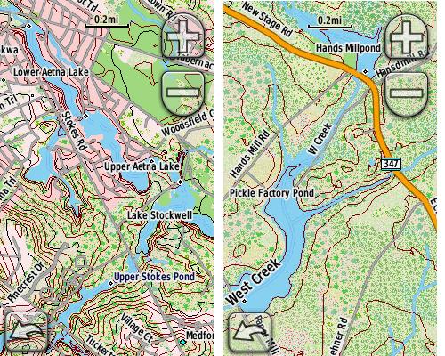
Here it is on the Nuvi:

And the Oregon:
You may want to consider this as an alternative to - not a replacement for - the old version of the map. It has a more photographic look which reveals some interesting things, but I have removed the state forest borders because that just clutters the picture too much. It is also a MUCH bigger map - 195MB vs. 35MB for the old version.
So this is where my efforts have been concentrated recently, and probably will be for awhile to come. I'm getting busy at work now, but if there's interest in this new map I'll try to make it available soon - definitely in BETA form, but it works. We'll have to see how Ben feels about hosting a big download like this too.
Today I finally put together all the pieces of the new map which includes landcover textures. This has been a big project, and still has a ways to go, but the pieces are coming together. I just need to resolve a few issues with the new software I'm using.
In Guy's words, I am trying hard to "fill in the blank spots" on the map
. To my surprise, this version looks like it even works acceptably on the 60csx, and no separate version is required:
Here it is on the Nuvi:
And the Oregon:
You may want to consider this as an alternative to - not a replacement for - the old version of the map. It has a more photographic look which reveals some interesting things, but I have removed the state forest borders because that just clutters the picture too much. It is also a MUCH bigger map - 195MB vs. 35MB for the old version.
So this is where my efforts have been concentrated recently, and probably will be for awhile to come. I'm getting busy at work now, but if there's interest in this new map I'll try to make it available soon - definitely in BETA form, but it works. We'll have to see how Ben feels about hosting a big download like this too.
Is there a new "updated" version of your software? I love refering to your topos when the garmin's maps doesn't show the roads. Also is there a way the 255w can recognize the road names?
This is the newest version. It includes the whole state of NJ plus portions of surrounding states, but the pine barrens have greatly enhanced detail: http://www.gpsfiledepot.com/maps/view/294/
Not sure what you mean by "recognize the road names". If you zoom in to .2 miles or perhaps 800 feet, you should see a lot of road names. I suggest that you set your map detail to "most" and use one of the 2d views (north up or track up).
But this map is not routable. In other words, it cannot be used to provide turn by turn directions. If you create a route on your 255w using City Navigator, then go to the map settings, disable City Navigator and enable my map of NJ, you will see your route on my map and you will get turn by turn directions. However, if you make a wrong turn, then it will not be able to properly recalculate the route while using my map.
WOW!! I bought the Oregon 450 about a month ago as a supplement to my nuvi 750 with paperless geocaching in mind. I've been really happy with it. We (myself, wife, and son) are much more active cachers nowadays - trying to go out at least once per week. We do kayaking, hiking, and biking throughout South Jersey.
I started realizing that the map on the Oregon stinks. So I start poking around this forum and find your map. I study the tech side of downloading and transferring and quickly realize how easy it is.
Now I can see everything! This is going to make exploring much more fun for us and we've got you to thank. Thanks so much Boyd for your efforts and your willingness to share this with everyone.
I hope to get to meet you on the 24th!
Glad you like the map! I have a number of other maps that will be compatible with your Oregon here as well: http://www.gpsfiledepot.com/maps/byuser/282/
Glad you like the map! I have a number of other maps that will be compatible with your Oregon here as well: http://www.gpsfiledepot.com/maps/byuser/282/
Cool. Everything we've done so far is in NJ and we don't intend to venture out of NJ much unless there is a specific reason to do so. With that being said, is there anything your other maps have to offer that isn't already covered in your complete NJ map? This thing is impressive!
Yes, the others are scans of "real" USGS topo maps and aerial imagery - Garmin calls these "custom maps" and they are different from the traditional Garmin maps such as my map of NJ. To use them, create a folder named CustomMaps inside the Garmin folder on your GPS, then drop the map file into it (the file will have a .kmz extension). You can only have ONE file of this type on your Oregon at a time.
Have a look at these - there are screenshots available at the following links:
http://www.gpsfiledepot.com/maps/view/269/
http://www.gpsfiledepot.com/maps/view/246/
http://www.gpsfiledepot.com/maps/view/270/
http://www.gpsfiledepot.com/maps/view/241/
http://www.gpsfiledepot.com/maps/view/273/
http://www.gpsfiledepot.com/maps/view/272/
http://www.gpsfiledepot.com/maps/view/271/
http://www.gpsfiledepot.com/maps/view/242/
http://www.gpsfiledepot.com/maps/view/411/
http://www.gpsfiledepot.com/maps/view/234/
Note that they will only work on your Oregon and not on the Nuvi.