New England's 'lost' archaeological sites rediscovered

46er

Piney
Mar 24, 2004
8,837
2,144
Coastal NJ
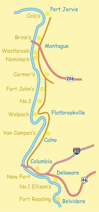
Might you know if there is a LIDAR site that provides coverage for all of NJ. I have been trying to research the pre-revolution forts along the Delaware River in the NW part of the state and come up empty on these maps.

forts_map.gif
 

Boyd

Administrator
Staff member
Site Administrator
Jul 31, 2004
9,921
3,070
Ben's Branch, Stephen Creek
Download the free trial of Globalmapper here. http://www.globalmapperforum.com/download/

Now go to the National Elevation Dataset and download the 1/9 arc second LIDAR DEM for your area of interest. http://ned.usgs.gov

Open the file(s) in Globalmapper and learn how to choose and create different shaders. You won't be able to save any of your work with the free trial, but you can take screenshots.

Extra credit: buy a domain and build a website to share your work with others. That's what I did.

...And then you can just wait for NJPB to take credit for it when you let them include it in their live maps. :D (sorry, just kidding but I couldn't resist the wisecrack. You know that I'm a big fan of this site and happy to do whatever I can to make it useful!)
 

46er

Piney
Mar 24, 2004
8,837
2,144
Coastal NJ
Thanks Boyd. I'm hoping fort remains will be easy to spot :D

Download worked, install does not. Error message that only a part of a read or write memory request was completed.
 

Boyd

Administrator
Staff member
Site Administrator
Jul 31, 2004
9,921
3,070
Ben's Branch, Stephen Creek
Sorry, can't help there. I am on an older version of Globalmapper and an ancient Dell Inspiron with Windows Vista. ;)

If you really can't get it to work, just go to the forums on that same site and I'm sure you'll find help.
 

Teegate

Administrator
Site Administrator
Sep 17, 2002
26,046
8,833
I have Globalmapper working in Parallels on Windows 7 with no problem.
 

Ben Ruset

Administrator
Site Administrator
Oct 12, 2004
7,619
1,878
Monmouth County
www.benruset.com
...And then you can just wait for NJPB to take credit for it when you let them include it in their live maps. :D (sorry, just kidding but I couldn't resist the wisecrack. You know that I'm a big fan of this site and happy to do whatever I can to make it useful!)


Hey, if you are even one quarter serious about that I'm really sorry. I never meant for anybody to get the impression that the LIDAR images came from any other source besides your own hard work and server bandwidth.
 

Boyd

Administrator
Staff member
Site Administrator
Jul 31, 2004
9,921
3,070
Ben's Branch, Stephen Creek
No, no, no, just kidding Guy actually, since he said the LIDAR came from NJPB. I would rate my level of seriousness at maybe 1% (at best). :)

At first I didn't think you had given credit but then I noticed it's shown when you click on the "controls" button. I am more than happy to do this for NJPB. You know how I feel about you and the site. It's all good.
 
  • Like
Reactions: Ben Ruset

Boyd

Administrator
Staff member
Site Administrator
Jul 31, 2004
9,921
3,070
Ben's Branch, Stephen Creek
Should have just kept my mouth shut, sorry. In kind of a strange mood and a little sleep-deprived after a long - but good - week running around NYC. ;)
 
Top