Last summer we did allot of hiking off of Push Line Road in the no mans land between Mannis Duck Pond and Jemima Mount. The area is high, with little water and few flies. While walking down one of the little used roads I barely noticed a subtle trail. It was obviously not a deer trail, had seen recent use and was only shoulder wide. Wanting to avoid ticks we decided to set it aside for the cold weather. That day came on December 25th.
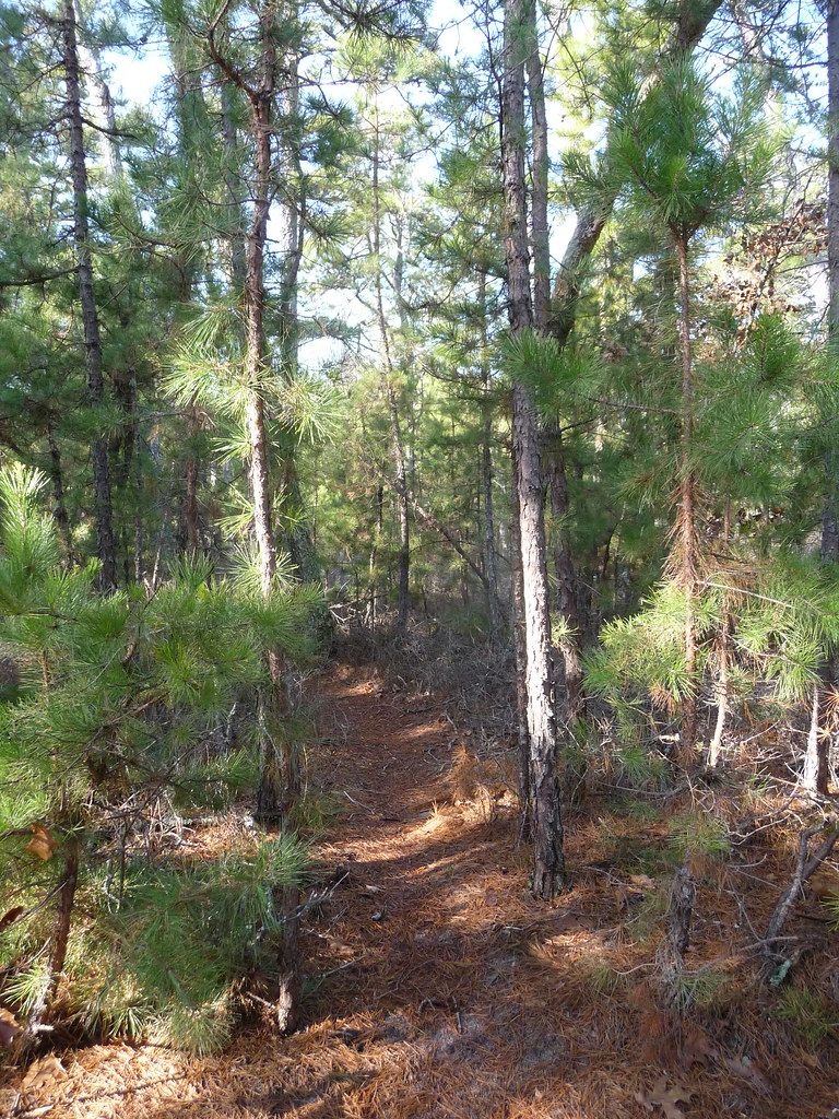
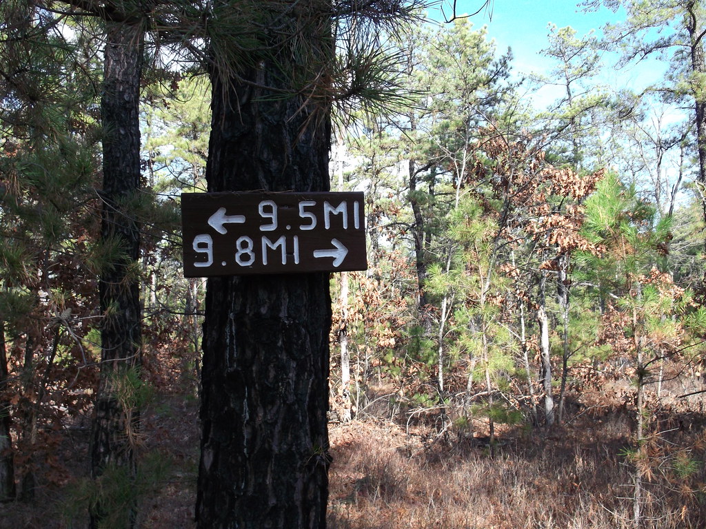
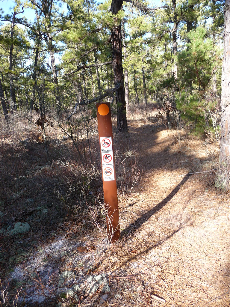
The trail had lots of twists and turns, soon we were seeing sawn logs, orange trail markers and then a mile post. A half mile in we came to a clearing with a large trail sign. Someone had gone to allot of trouble to lug that sign in there. At that moment we knew we had to hike it (we would miss too much by biking it, and the dogs wanted a walk).
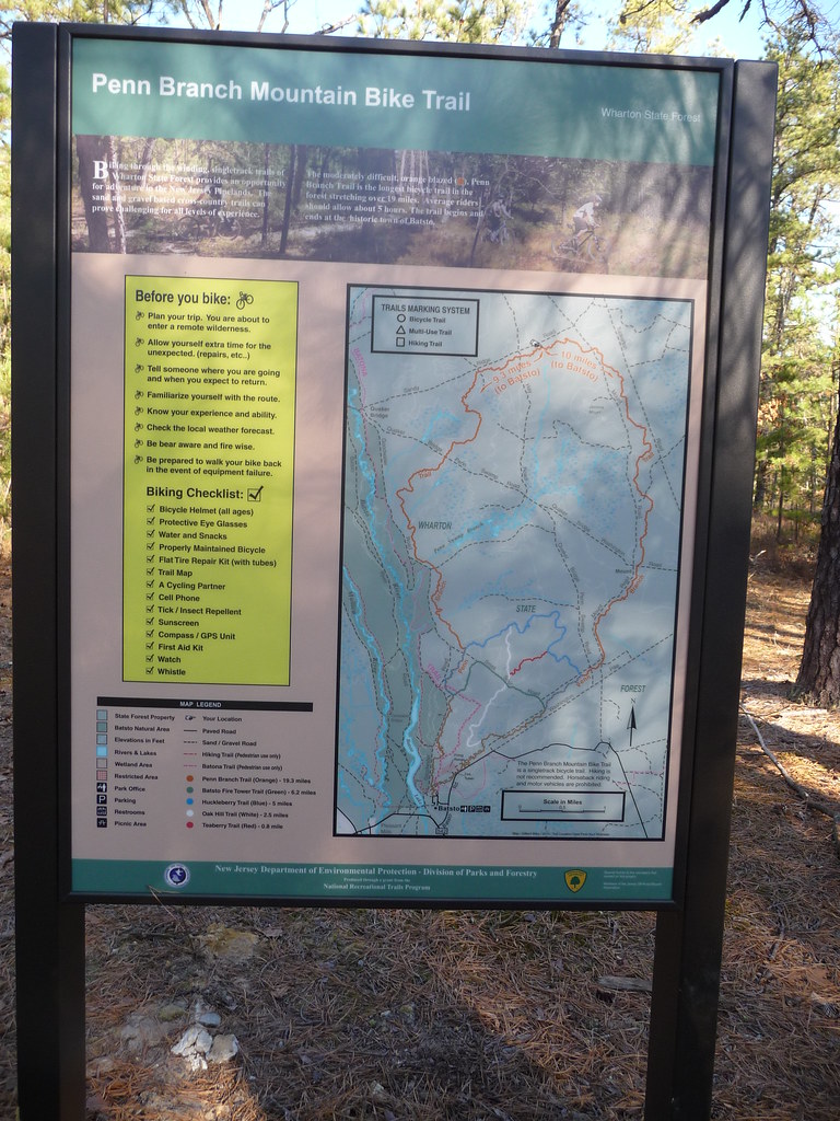
The Penn Branch Mountain Bike Trail starts and ends at Batsto. It is maintained by the Jersey Off Road Bicycle Association.
http://www.jorba.org/
Hiking this trail was very interesting and will lead to further excursions off of it. It covers 19 miles of mostly uplands and opens up many difficult areas for exploration. The terrain was varied with miles of briars changing to dense brush to open forest where rolling hills could be made out. The forest in the north west part of the trail is very open and crossed with lots of old roads, some tracks which can barely be made out, just begging to be walked. That area also had an amazing number of old deer stands. On weekends it is heavily used by mountain bikers, I stopped counting at 25 on one 2 hour hike.
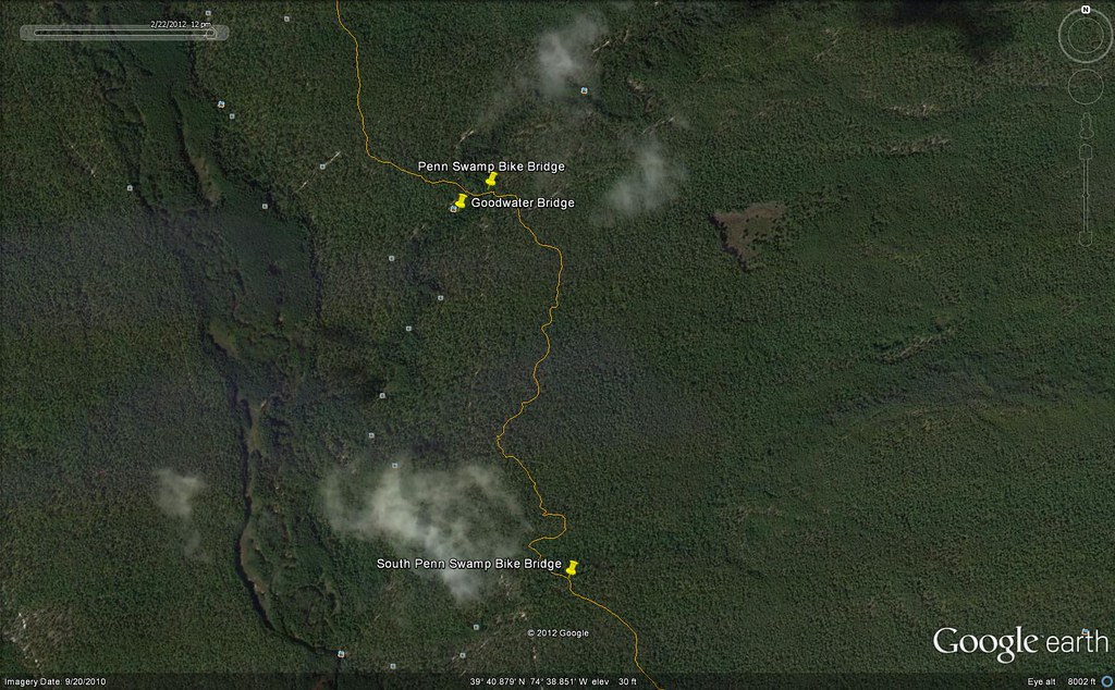
It has allot of twists and turns, which were deliberately made yet unnecessary to get through the woods. Apparently mountain bikers like switchbacks. They are also hydro phobic, going to great lengths to avoid wet areas. They avoided using existing roads and trails to the extent of building a bridge just 200 feet from the Goodwater Bridge. Their bridge cannot be seen from the road.
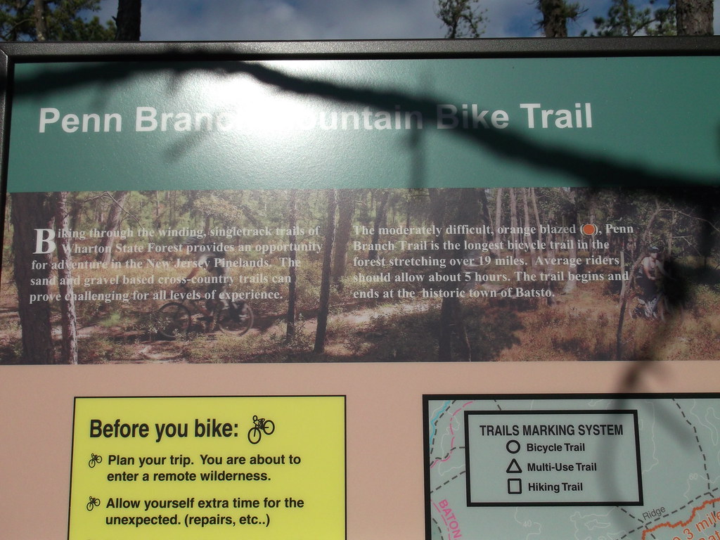
I used this photograph of the sign as my trail map.

The sun was low in the sky and the sigh faces south making photography difficult.
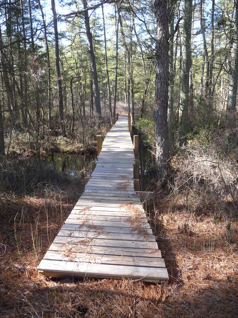
The "Crooked Bridge" by the Goodwater Bridge. It is solid but it sure is sloppy.
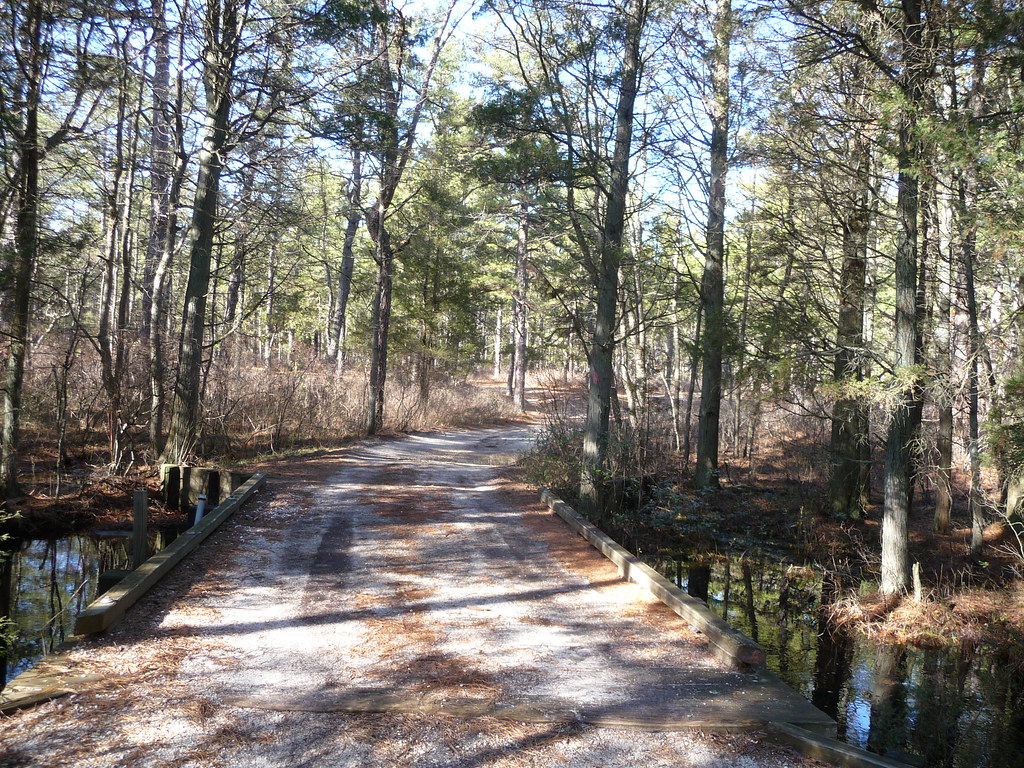
The Goodwater Bridge.
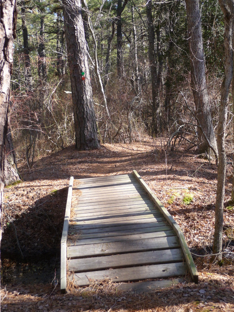
Another less crocked bridge south of Goodwater.

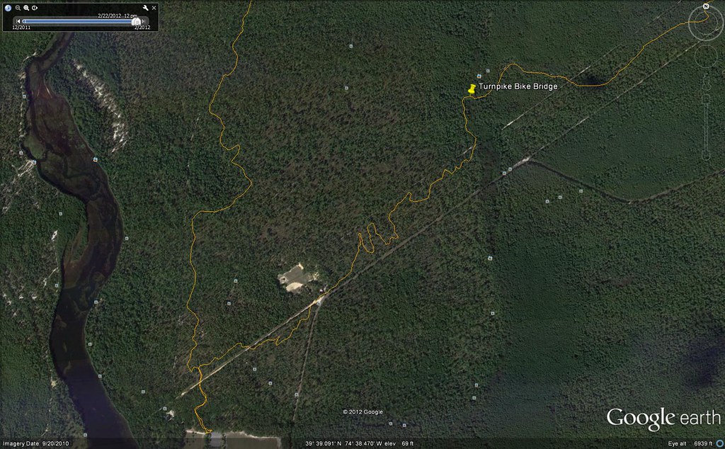
The third bridge on the trail near Batsto. This one looks professional.
There was allot of old stuff scattered about the old roads in the north west quadrant. This rim is much larger and heavier than it appears. It and it's tire appear to be old.

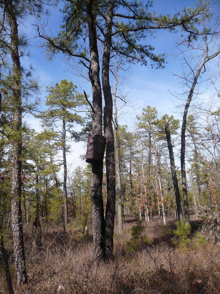
A novel deer stand. I guess once you get in it you won't fall out but the barrel might be noisy.
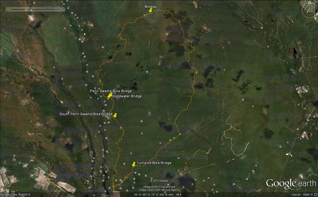
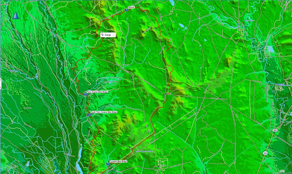
My track. They say the trail is 19 miles long but my track measured 17.7, encompassing 8.8 sq miles.
The bridge near Batsto, note the unnecessary switchback.
The trail on Boyd's LIDAR map. With the high contrast the mountainous terrain becomes visible.
I have a mountain bike, I think I'll dig it out of my garage and give it a try.
Ed
The trail had lots of twists and turns, soon we were seeing sawn logs, orange trail markers and then a mile post. A half mile in we came to a clearing with a large trail sign. Someone had gone to allot of trouble to lug that sign in there. At that moment we knew we had to hike it (we would miss too much by biking it, and the dogs wanted a walk).
The Penn Branch Mountain Bike Trail starts and ends at Batsto. It is maintained by the Jersey Off Road Bicycle Association.
http://www.jorba.org/
Hiking this trail was very interesting and will lead to further excursions off of it. It covers 19 miles of mostly uplands and opens up many difficult areas for exploration. The terrain was varied with miles of briars changing to dense brush to open forest where rolling hills could be made out. The forest in the north west part of the trail is very open and crossed with lots of old roads, some tracks which can barely be made out, just begging to be walked. That area also had an amazing number of old deer stands. On weekends it is heavily used by mountain bikers, I stopped counting at 25 on one 2 hour hike.
It has allot of twists and turns, which were deliberately made yet unnecessary to get through the woods. Apparently mountain bikers like switchbacks. They are also hydro phobic, going to great lengths to avoid wet areas. They avoided using existing roads and trails to the extent of building a bridge just 200 feet from the Goodwater Bridge. Their bridge cannot be seen from the road.
I used this photograph of the sign as my trail map.
The sun was low in the sky and the sigh faces south making photography difficult.
The "Crooked Bridge" by the Goodwater Bridge. It is solid but it sure is sloppy.
The Goodwater Bridge.
Another less crocked bridge south of Goodwater.
The third bridge on the trail near Batsto. This one looks professional.
There was allot of old stuff scattered about the old roads in the north west quadrant. This rim is much larger and heavier than it appears. It and it's tire appear to be old.
A novel deer stand. I guess once you get in it you won't fall out but the barrel might be noisy.
My track. They say the trail is 19 miles long but my track measured 17.7, encompassing 8.8 sq miles.
The bridge near Batsto, note the unnecessary switchback.
The trail on Boyd's LIDAR map. With the high contrast the mountainous terrain becomes visible.
I have a mountain bike, I think I'll dig it out of my garage and give it a try.
Ed


