Filling out a survey report, and I always report the township. I had no idea that Plumsted Township actually extends down into a portion of Whites Bog.
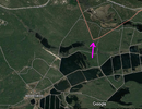
My imagery is different so it's a little hard to compare, but that wavy red and white Eastern line sure doesn't match the boundary I have (from the State) for Plumstead Township. The West boundary might be right, but I don't think Plumstead extends as far South as you are suggesting. I think the Southernmost point is approximately here. But who am I to argue with Google?
By the way Boyd, I found out that this Block 46, lot 16 in Plumsted Township is now owned by Ocean County Land Trust. Rowan is not updated for that, but the NJ tax map is. Go figure. 40.090662 74.484109.
It is lot 16.2. The county paid $652,500. for it. There are quite a few stones on the property which I will look for in the fall. The deed became effective on 2/4/2020.