The Jemima Cyclone

Boyd

Administrator
Staff member
Site Administrator
Jul 31, 2004
9,545
2,805
Ben's Branch, Stephen Creek
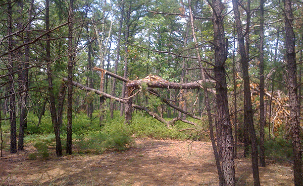
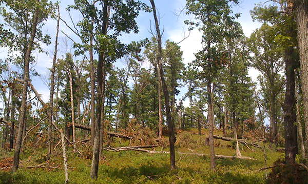
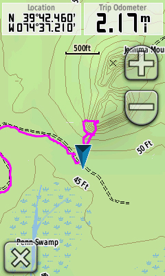
Well... maybe that's not the right term (microburst? straight line wind?), but there was certainly some kind of event around there recently! Was out wandering around the Penn Swamp and Jemima Mount area today (http://maps.njpinebarrens.com/#lat=39.707054594267866&lng=-74.61828231811523&z=15&type=p&gpx=) and noticed a number of downed trees as I headed towards Jemima. Hadn't planned to take any pictures, so these are not so great - from my iPhone.

jm01.jpg


jm02.jpg


jm03.jpg


jm04.jpg


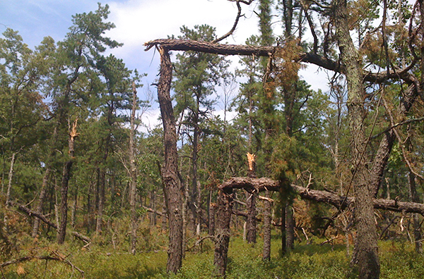
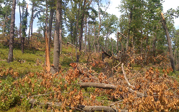
As I got to the Southern slope of the "mountain", the devestation was even more severe.


jm05.jpg


jm06.jpg


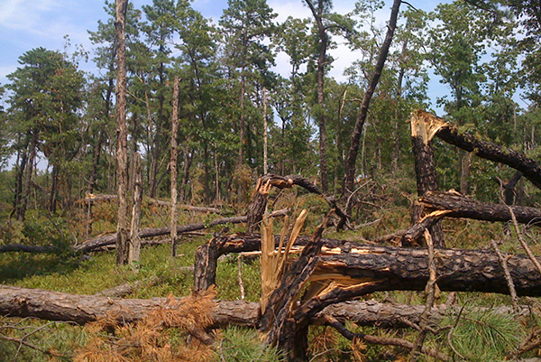
It must have been one hell of a blast to snap these trees off like matchsticks!

jm07.jpg


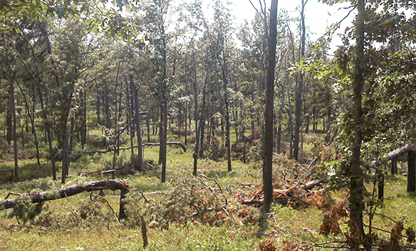
Here's a view from the top


jm08.jpg


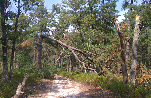
The downed trees were seen through the whole area of my track here - and even more - but especially in the loop on the Southern slope of Jemima Mount. I did not continue over the "mountain" to look around, but no doubt the damage extends further. It will probably be hard to get through in a vehicle because of the number of trees in the roads.


screenshot.jpg


Has anybody else explored this area or heard about the wind damage? When did this happen? Looks as though it's been within the past week or so. None of the trees were cleared from the roads in the area I hiked.
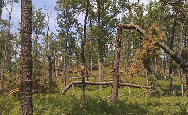
 

piker56

Explorer
Jan 13, 2006
640
53
67
Winslow
I wasn't in that exact area, but on my way to Quaker bridge on July 3rd there were areas where there were a lot of trees knocked over, all in the same direction. It was from the storm earlier that week (not sure of the date). Driving home from work that day there were some really big trees in Berlin over, all in the same area.
Greg
 

Teegate

Administrator
Site Administrator
Sep 17, 2002
25,637
8,243
Nice photo's even with your phone! Thanks for mentioning this.

Guy
 

Boyd

Administrator
Staff member
Site Administrator
Jul 31, 2004
9,545
2,805
Ben's Branch, Stephen Creek
Thanks Guy - but it ain't no Nikon. :)

Piker, you could be right but I assumed this happened more recently, since I'd expect somebody to have mentioned it around here, and also because it didn't look like anyone had attempted to move the trees off the roads or to go around them.

Check it out, I'm sure there are some interesting things to see out in the woods. And there is now a less obstructed view from the top of the hill.
 

turtle

Explorer
Feb 4, 2009
653
213
a village...in the pines
Boyd,

I'm pretty sure that is damage from the June 24th storm. There were several areas within Wharton that received some serious damage. There was also a life saving rescue in that area 2 days after the storm....it required a Coast Guard helicopter to lift out the injured party....the guy almost didn't make it. They couldn't get rescue vehicles in.
Everything ended up good, I didn't realize it looked that bad. Thanks for the pics.

turtle
 

manumuskin

Piney
Jul 20, 2003
8,555
2,469
59
millville nj
www.youtube.com
there are two areas just like this in the manumuskin preserve caused by a tornado back i believe in 97.i seen the tornado from mauricetown bridge and never thought more of it till several months later i was walking the sand roads in the preserve and came up on two areas about a mile apart that were ripped to shreds.the areas today are very open and grassy with logs strewn all about like a giant was playing pick up sticks.
Al
 

ecampbell

Piney
Jan 2, 2003
2,844
967
Boyd,

I'm pretty sure that is damage from the June 24th storm. There were several areas within Wharton that received some serious damage. There was also a life saving rescue in that area 2 days after the storm....it required a Coast Guard helicopter to lift out the injured party....the guy almost didn't make it. They couldn't get rescue vehicles in.
Everything ended up good, I didn't realize it looked that bad. Thanks for the pics.

turtle

I agree. We were heading up to Hawkin Bridge from Godfrey the morning after and the FF Service was clearing the road. When we were leaving a big Cat was there pushing back the debris. The next morning you still couldn't drive from QB to Lower Forge because of 2 large trees. I heard the storm to the south but it missed us here in Tabernacle.
 

woodjin

Piney
Nov 8, 2004
4,341
327
Near Mt. Misery
that is wild. Thanks for the pics of this strange event. I would almost assume this was the result of all the heavy snow we had this winter, but as you pointed out, it seems too recent. Jemima mount is a beatiful place.

Jeff
 

mudboy dave

Explorer
Oct 15, 2008
950
19
42
atco
opentrailsnj.org
yes, it was from the june 24th storm. it was confirmed that a weak tornado came through the center of Atco. You can still see the hundreds of thousands if not millions of dollars of damage if you ride down Atco ave. I gre up in Atco and have never seen anything like this. You can drive threw the wester side of Wharton and pretty much follow the line.
 

MartGBC

Scout
Sep 10, 2008
79
0
Glendora
Damage

The day after there was a tree blocking the road at Quaker Bridge. We had to take the road on the west side to Basto and there several trees down but passable going there. Chatsworth said they had a 10 min shower and that was it.
 

Mts83

Explorer
Oct 24, 2008
207
1
Sourland Mountains
www.wtfda.info
Very interesting Boyd, I found this link after you posted it in the more recent thread I made regarding the Ocean Co tornado. Looking at the damage it does appear to (from what I can see) be straightline wind damage as a result of a microburst, which was reported widespread during the 6/24 event- All the breaks appear to all be in the same direction. Elevation seems to have played a role here too, as Jemima sticks up higher than most of the surrounding land, where higher winds would be found. Even here to the south in Atlantic County I had several trees come down, along with golfball sized hail which damaged the cars and siding on the house (similar damage was reported in ioslated areas stretching up towards Pleasant Mills and Atsion as well). I always wonder how many events go unreported in the more remote sections of the pines, which you seem to had found one!
 

Gibby

Piney
Apr 4, 2011
1,640
442
Trenton
I know this is an old thread but I was curious if any other events like this have happened at other locations in the barrens?

I think something similar to this happened near Friendship recently. I came across a path through the woods today where the tops of the pines where sheared off ten feet or so off the ground for several hundred yards in a straight line. This path was at least a hundred feet wide. I didn't have my camera with me so it will be at a later date that I post any photos.
 

turtle

Explorer
Feb 4, 2009
653
213
a village...in the pines
Hey Gibby,
Exactly 5 years later to the day, the same type of event.... yes, there are areas southeast of friendship, along 563 that display the same damage. There was a short time that the NWS was examining "tornado" in Atco on this one too, but they determined straight-line winds. Interesting the pattern and path.
Terry
 
Top