The rectangular thing

Apr 6, 2004
3,613
556
Galloway
One from 1930, really lost by time. Have to wonder what happened to that river.

View attachment 19105
That's what I was pointing out, another on the stream, but yet, if you run through Boyd's aerials with the same spot held there, the creek shifted 50 feet.
That's because the maps are off from each other about 50 ft. Take a look at this corner of Rockwood and see how it shifts about 50 ft to the south-west:
 
Apr 6, 2004
3,613
556
Galloway

Attachments

  • sleep lidar.png
    sleep lidar.png
    713 KB · Views: 59
  • sleeper map.png
    sleeper map.png
    713.5 KB · Views: 59

bobpbx

Piney
Staff member
Oct 25, 2002
14,205
4,302
Pines; Bamber area
Bob and all, check this out: https://boydsmaps.com/#16.79/39.692783/-74.704187/mbx3dmidatl/0.00/0.00

This was the original Sleeper Branch (Mechescatauxin) before being cut off around this point:

I remember when I was first introduced to Westcoat bogs. I began looking at the aerials to see if PBX could explore that area where all the water is coming from, and it got so tangled in my mind that I gave up, because in looking at the aerials you are never sure where the water would be running through in a given month. Plus, I knew if I announced a trip there, it would be soundly rejected by the crew.
 

Teegate

Administrator
Site Administrator
Sep 17, 2002
25,637
8,243
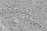
3d aerial lidar says yes.

View attachment 19116


I traveled to Rockwood Road today and had to park a half mile away because the road was flooded as I expected. I probably could have made it all the way but I have decided to not do that anymore.

Anyway, I visited the location in Bob's photo here.

1674227766097.jpg


The dugout is there and easy to see but I doubt there was a bridge there. They most likely could drive right through it. It is only 6 inches deep.

This is where the dugout section starts. It was tough getting through there.
IMG_7356a.jpg


IMG_7355a.jpg


And the water. It looks worse than it really is.

IMG_7354a.jpg


Someone sawed a tree down nearby. It may have been a hunter opening up his view.

IMG_7353a.jpg
 

dennis2

Scout
Sep 22, 2020
54
28
Deptford, NJ
There's a very similar looking building at 39.665657, -74.664018. Fairly identical. I was hoping to go check this out soon but I broke my big toe and am sidelined for the next several weeks.
 

Teegate

Administrator
Site Administrator
Sep 17, 2002
25,637
8,243
There's a very similar looking building at 39.665657, -74.664018. Fairly identical. I was hoping to go check this out soon but I broke my big toe and am sidelined for the next several weeks.
We visited that on a PBX hike. Not an easy one to get to. I have a video somewhere. I will look for it.
 

Teegate

Administrator
Site Administrator
Sep 17, 2002
25,637
8,243
Bob will have to help us out with this one. I can't find it.
 
Top