
Trail Tracker App Aims To Increase Safety In Ocean County Parks
The trail tracker functions like a GPS and can pinpoint people's exact location throughout Ocean County's 27 parks and conservation areas.

I bought one of these thing-a-ma-bobs when I was in Forestry Field Camp at Rutgers over 40 years ago. Clinometer and adjustable declination built right in and no batteries required. Our professors hid cases of cold beer in the woods of Stokes State Forest and we had to orienteer our way to the suds. I don't reckon they're doing that today.If satellite ever goes down were all bug food!
")

Was Big Buck still running the camp? And why go through all that trouble bushwhackin' for beer when you had Brady's Pub nearby? You got spaghetti with it too! And by the way, my old Silva Ranger is still going strong. My GPS is my backup!I bought one of these thing-a-ma-bobs when I was in Forestry Field Camp at Rutgers over 40 years ago. Clinometer and adjustable declination built right in and no batteries required. Our professors hid cases of cold beer in the woods of Stokes State Forest and we had to orienteer our way to the suds. I don't reckon they're doing that today.
This compass and a 7.5 minute quad map and you can go anywhere. And make it back ! It's in my pocket when I hunt in PA as a GPS backup.
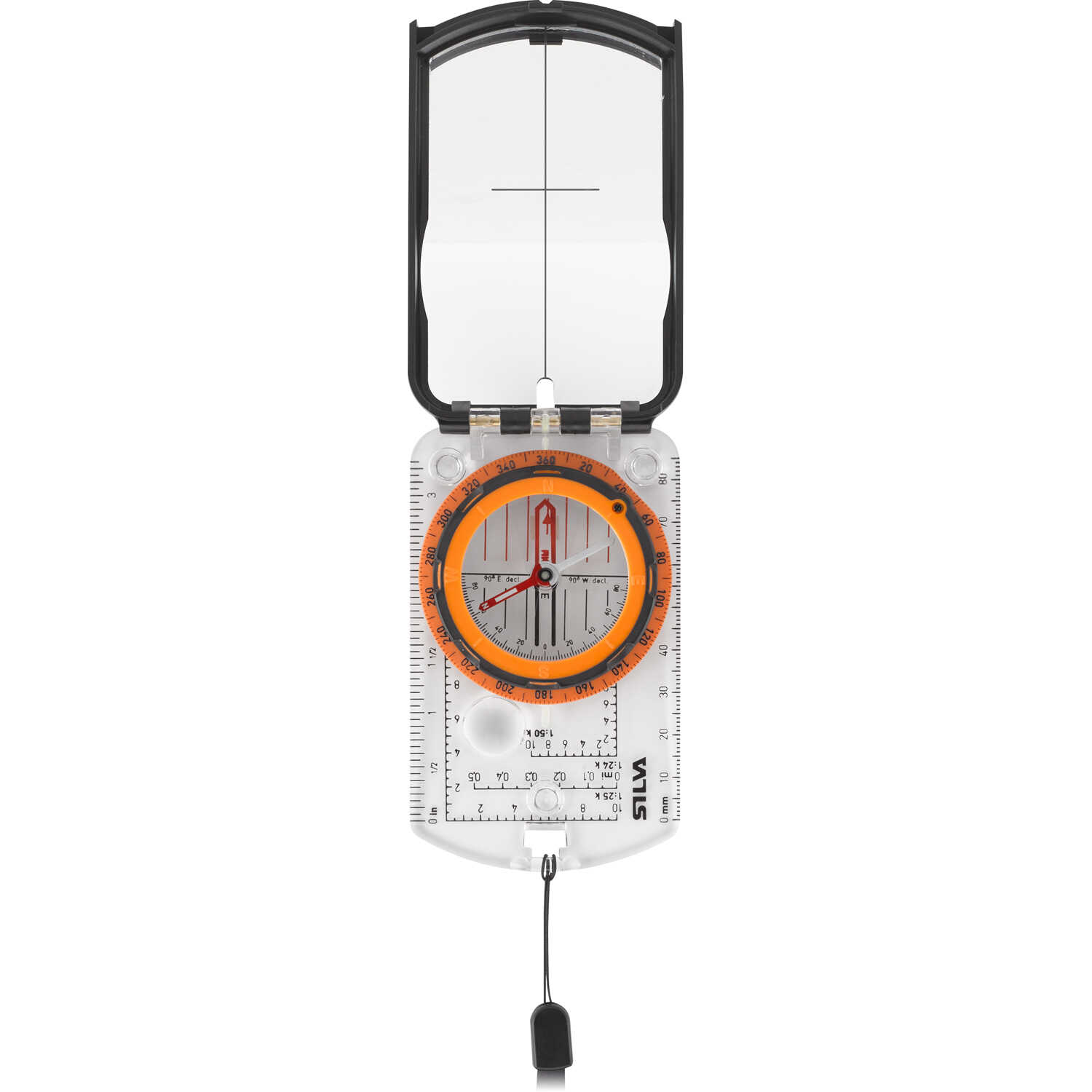
Silva® Ranger® 2.0 Compass
Rotating compass dial with graduations every 2°. Swedish steel needle pivots on a liquid damped, sapphire jeweled bearing. Built-in magnetic declination adjustment screw. Mirror-sighting with luminous points. Needle orienting arrow and lines. Map magnifier. Clear protractor baseplate has inch...www.forestry-suppliers.com
I don't remember Big Buck, German. My professors back then were Grace, Tate and George Zimmerman who I believe was still working on his PhD at that time.Was Big Buck still running the camp? And why go through all that trouble bushwhackin' for beer when you had Brady's Pub nearby? You got spaghetti with it too! And by the way, my old Silva Ranger is still going strong. My GPS is my backup!
When using a compass to determine where you are and where you want to go, most people align the map so north is up. It's more than just convenience that the topo maps are always drawn with north up, but it must pain you to read them.Still have my Silva Mod Huntsman but haven't used it in ages. Not sure when I got it, but wouldn't be surprised if it was older than yours! Hate to shock anyone, but the compass rotates in the frame, so North doesn't have to be at the top!
View attachment 16521

 But given today's technology, I just don't see why I should limit myself to always using them that way on a computer screen. When using a compass and paper map (which I did until I got my first GPS at the age of 49), I would often rotate the physical map so that the direction I was facing/travelling was at the top. Seriously, didn't you ever do that?
Big Buck was the camp ranger. I believe it was Grace, perhaps just to frighten us, who described him as a fearsome figure, used to ruling the scouts with an iron fist and not likely to take kindly to visiting college students breaking the rules ( as if we would have even considered itI don't remember Big Buck, German. My professors back then were Grace, Tate and George Zimmerman who I believe was still working on his PhD at that time.
I do remember Brady's Pub and drove buy it this year for the first time in over 40 years. The building is still there and looks the same. It is now the Lakeside Tavern.
One of my best memories of Forestry Field camp was being able to fish the lake in the Kittatinny Mountain Scout Reservation. Other than pounding beers at night at Brady's, I spent most of my free time catching crappie and largemouth bass in the lake. The action was non-stop and probably the best freshwater fishing I ever experienced.
I found this sad note today about the reservation. Apparently closed for quite some time:
Kittatinny Mountain Scout Reservation, KMSR
Kittatinny Mountain Scout Reservation Historywww.cnjc-bsa.org
 ). Zimmerman was our liaison to Brady, and arranged the all-you-could eat spaghetti nights at the pub. I remembered Tate making fun of my stand-up canoe paddling technique, which allowed me to spot the bass from father away. I believe this was summer of 80. Good times!
I use a compass to align paper maps with the north as well, but only so the map is oriented with the topography around me. I find that easier to read rather than a pain, allowing me to confirm I'm going "that way".When using a compass to determine where you are and where you want to go, most people align the map so north is up. It's more than just convenience that the topo maps are always drawn with north up, but it must pain you to read them.
My Silva housing also rotates but I comfort myself in the knowledge that at least the needle is pointing north or at least some where thereabouts.Still have my Silva Mod Huntsman but haven't used it in ages. Not sure when I got it, but wouldn't be surprised if it was older than yours! Hate to shock anyone, but the compass rotates in the frame, so North doesn't have to be at the top!
View attachment 16521
