Trip to various spots in cape may and cumberland counties

dragoncjo

Piney
Aug 12, 2005
1,575
301
43
camden county
Went down to cape may national wildlife refuge today. Walked the woodcock trail and came across an abudance of birds including thrashers, thrushes, rufous towhees, bluebirds, sparrows(wasn't able to identify what kind), and tons of flickers and red bellied woodpeckers. From there i went to eldora nature preserve on delsea drive. There were tons of vultures flying low overhead along with a couple red tailed hawks. While hiking at eldora I saw way up in the sky 5 hawks. I'm normally pretty good at identifying hawks however these ones had me totally confused. Three of them were def. red tails or vultures. Two of them appeared to be bald eagles with the classic white head and tail. However, what threw me off was that the upper portion of the wing was brown and the last bottom third was pure white just like the tail. I have a picture of them but they are so high up the picture is of low quality. If you zoom enough you can see it though. Any ideas on what it could be?


After I left eldora I turned down a road called moore's beach. This road was really cool and stretched into the delaware bay. I went down this road and several others including thompson's beach road. The amount of birds i saw from my car on these road's was incredible. About six blue herons, 6 great egrets, a flock of hooded mergansers, one bald eagle which flew out in front of my car, 4 red tailed hawks, and a male bobwhite which was sitting on the side of the road along a meadow. Also further down the road I started encounter strange things. I came across a bunch of black vulture which were feasting on three deer heads. No bodies just three heads within a ten foot area. Also at the end of the road there is an observation deck and parking lot. Adjacent to the lot in the marsh was this.
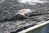
Apparently it had died of old age because it looked quit plump and had no visible injury. On my way out I managed to snap a picture of a northern harrier and some black vultures which were watching over yet another dead deer skull.
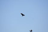
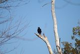
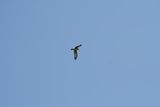



This was the fourth deer skull I found in about a 500 yard area, not a hunter so i guess this was weird to me. One thing I have to say about that area by the delaware bay is that it doesn't seem like new jersey. I felt like I was in the everglades with wildlife flying out from everywhere as I went around each turn in the road. I have to say it caught me completely off guard, I had no idea an area like that existed in new jersey. It is completely desolate and undeveloped which is really strange around here, for miles all your eyes can see is marshland. I can't wait to get down there again. Has anyone every been down by thompson's beach road? Are there any worthwhile trails to hike along that road? The area seem kind of sketchy to me, so desolate and the people I did see... well let's just say I wish new jersey allowed me to have a carriers permit.. I would feel safe then.
Also I apologize if this isn't technically a pine barrens exploration, very close though.
Chris
 

RednekF350

Piney
Feb 20, 2004
5,057
3,328
Pestletown, N.J.
You can walk Thompsons Beach Road, from the parking lot you are talking about, right out to the bay . Beautiful area in winter.
Skeeters will suck you inside out in the summer.
If you want to blend in down in that neck of the woods, I will lend you one of my F-350's, some Trebark camo clothes and I will give you a baggie of my best chew.
I blend peach flavored tobacco from Texas with Beech-Nut and douse it with a shot of Old Grand Dad.
You can barter your way out of any kind of redneck ass whippin' with that.
Scott
 

dragoncjo

Piney
Aug 12, 2005
1,575
301
43
camden county
Haah good stuff, my run of the mill jeep cherokee fits in ok. I would like the f 350 though I would love to buy one but can't fork up that kind of loot for something that looses a quarter of its value when it leaves the lot. Its not the rednecks i'm worried about, I like rednecks alot better than the yuppies I use to have to deal with at work everday. The people I'm worried about are the two guys that just looked like they crossed the mexican border a week ago, all bandanad out riding up my ass on a road that has no outlet. Doubt those dudes are looking for wildlife. I went to the end of thompson road and there was that observation deck and boat launch area. Are there trails that lead out further into the bay than that?
 

Gerania

Explorer
May 18, 2004
280
30
Marlton
I don't know the roads down there at all well, but I do know that if you go out to the water on some roads and trails at low tide that you can be cut off as the tide changes. Be very alert

dragoncjo The people I'm worried about are the two guys that just looked like they crossed the mexican border a week ago said:
I hate when stuff like that happens. A person can definitely be in the wrong place at the wrong time. People have threatened to kill me on two occasions and hey, they didn't even know me! So much for probable cause.

Gillian
 

RednekF350

Piney
Feb 20, 2004
5,057
3,328
Pestletown, N.J.
dragoncjo said:
I went to the end of thompson road and there was that observation deck and boat launch area. Are there trails that lead out further into the bay than that?

Do a Google Earth on the Thomsons Beach area and you will see the old road bed leading directly to the beach. You will need to enter Port Norris NJ as a search point.
Scroll south and east and you will see Thompsons Beach.
The barricaded road starts right in the parking lot and its muddy as hell. It is a continuation of the road you came in on.
I noticed that there are two boat ramps, one on each side of the parking lot.
Nice place to launch for perch fishing or crabbing but the lot is too remote to leave a vehicle unattended all day.
Google Earth scales 0.78 miles from the lot to the beach. I was there two weeks ago and there were 3 trucks in the lot and no one around, so I assumed they walked out to the beach.
Or maybe they were chopped into little pieces by angry bandanna wearing natives and fed to the vultures. :)
There were beach houses all along Thompsons Beach many years ago that the D Bay has now recalimed. I was out there about 20 years ago and the last of the homes were still occupied.
I believe the parking lot and observation deck is part of the massive public improvement project that PSE&G is mandated to complete to compensate for environmental damages at the Salem Nuke plant.
They started about 8 years ago with an elaborate boardwalk system through the marshes in Port Norris right behind the packing plants on the river.
If you return to Thompsons and decide to walk it out to the beach, you do have to watch the tides because the road does flood out.
Use www.saltwatertides.com and you can get tides for the nearby Maurice River at East Point which is only a mile away.
Good luck and bring several burly friends with you when you go.
Scott
 

Boyd

Administrator
Staff member
Site Administrator
Jul 31, 2004
9,828
3,009
Ben's Branch, Stephen Creek
RednekF350 said:
Good luck and bring several burly friends with you when you go.

Geez... I've been there and a variety of other places in that general vicinity and I never noticed anything strange. But now you guys are making me paranoid about going back! :eek:
 

dragoncjo

Piney
Aug 12, 2005
1,575
301
43
camden county
I think he is just busting my balls. The area is just real desolate and I saw some shady characters down there, thats all, no big deal.
 

dragoncjo

Piney
Aug 12, 2005
1,575
301
43
camden county
Yeah come to think of it I did see the road that leads through the marsh to the beach. It looked extremely muddy and was blocked off. PSEG had some signs about it being a restoration site. The place looked like it was doing pretty good in the way of wildlife, so I guess their doing a good job so far.
 

RednekF350

Piney
Feb 20, 2004
5,057
3,328
Pestletown, N.J.
dragoncjo said:
Yeah come to think of it I did see the road that leads through the marsh to the beach. It looked extremely muddy and was blocked off. PSEG had some signs about it being a restoration site.

Here is the link to the PSE&G restoration.
http://www.pseg.com/environment/estuary/sites/directions_nj.jsp
It is huge in scope and the website has detailed maps and information about each site up and down the D bay coast.
I know they were eliminating a lot of old salt hay farms and dyking as part of their work which may explain why the roadbed looks like it goes under water more than when it was used to access the beach.
Scott
 

RednekF350

Piney
Feb 20, 2004
5,057
3,328
Pestletown, N.J.
Boyd said:
Geez... I've been there and a variety of other places in that general vicinity and I never noticed anything strange. But now you guys are making me paranoid about going back! :eek:

The per capita income in the Heislerville-Dorchester-Leesburg area appears to be approximately $39.57.
Ratio of trucks that run to trucks on blocks, 1:3.
I always keep that in mind when leaving a vehicle or a vehicle and empty boat trailer in a remote spot for extended periods. (Hansey Creek Road ramp for instance) Small crimes of opportunity.
No offense to those that live down there.
It is a tough area in which to make a living, steeped in oystering, fishing and crabbing tradition.
Just as tough as the pines were and are to those who try to survive off its resources.
Scott
 

dragoncjo

Piney
Aug 12, 2005
1,575
301
43
camden county
Thanks for the info scott, the tide chart will def help. I noticed on my way down one of the roads that it was about 8 inches higher than the water, this during low tide. That rode back to the beach may have not been that wet. But due to a recent snowstorm, than thaw, than freeze, than thaw, it probably just had that slick wet appearence. Also being a huge ball buster myself I appreciate your work. Take care
Chris
 

aserdaten

Scout
Jul 26, 2003
63
0
Ormond Beach, Florida
RednekF350 ---

Where do you find those maps on the PSEG website? There didn't seem to be any reference to them when I checked it out. Maybe I'm just getting blind in my "advanced age". Thanx for any help y'all might be able to offer this good-ole boy.
 

RednekF350

Piney
Feb 20, 2004
5,057
3,328
Pestletown, N.J.
Aserdaten,
Try this first under estuary enhancement programs:
http://www.pseg.com/environment/estuary/sites/overview.jsp

Then try this under status of each enhancement site:
http://www.pseg.com/environment/estuary/pdf/maurice_status.pdf

I drove through Bivalve, Shellpile and Port Norris today with my wife while enjoying a few frosty Yuengling roadies. I had to pick up my little boat in Delmont, so I did the grand tour.
The boardwalk system is extensive in Bivalve but I am not a birder, so I don't know if it is good observation area and worth the effort of PSE&G.
You do get a great view of a lot of non-descript salt marsh for sure.
Scott
 

amf

Explorer
May 20, 2006
155
50
Swedesboro
All those roads used to have little bayside communities on them; the marshes behind the shore were all diked off & managed for salt hay farming. Upkeep & environmental regs ultimately killed 'em off, & PSE&G took the opportunity to use restoration of these areas as part of their nuke permit mitigation.

At dead low tide, you can occasionally find remnants of roads further out in the bay than where they end now. Makes you think that sea levels just MAY be rising...

amf
 
Top