Up high...

46er

Piney
Mar 24, 2004
8,837
2,143
Coastal NJ
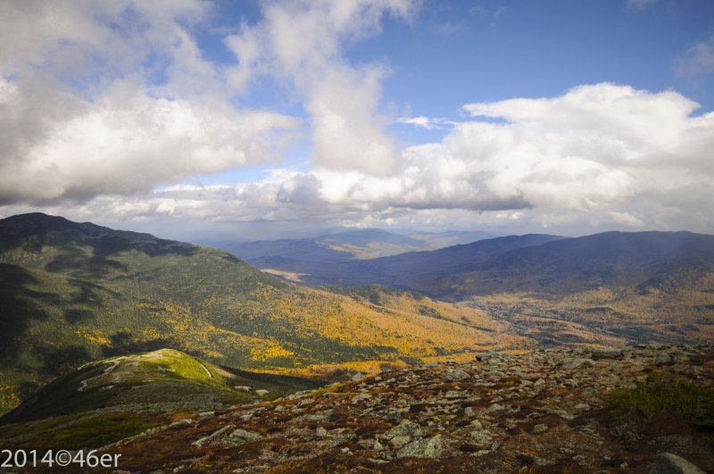
A stop on our New England road trip; 2028 miles covered. The White Mountains of NH are an amazing place. These are from about mid-way up Mt Washington.

157803138.jpg


157817950.jpg


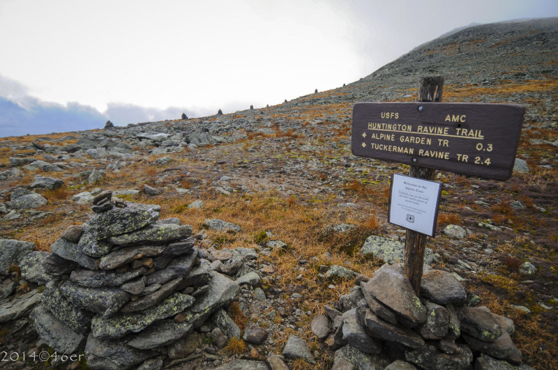
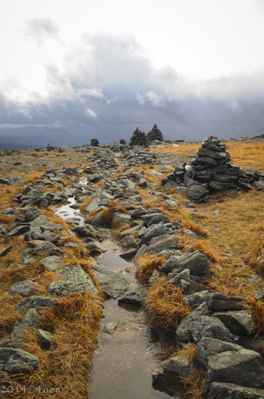
Trail work up here is lift and drop. Very, very tough walking especially on the ankles.

157827003.jpg


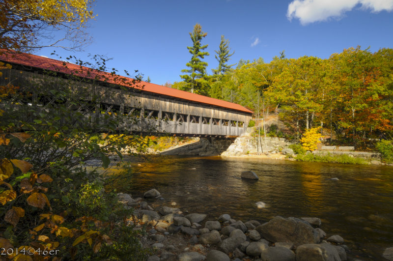
and the obligatory covered bridge, this one off the Kancamagus Highway NH.

157817953.jpg
 

RednekF350

Piney
Feb 20, 2004
4,944
3,080
Pestletown, N.J.
Beautiful pictures 46er. Sounds like an awesome road trip.

My wife-to-be/still-is wife and I climbed Mount Washington in August 1979 using the Tuckerman's Ravine Trail. We stayed half way up in the AMC Shelters and hit the peak the second morning.
Here I am 35 years ago enjoying windchills in the 30's in the middle of August.

 
  • Like
Reactions: wks and Spung-Man

46er

Piney
Mar 24, 2004
8,837
2,143
Coastal NJ
Beautiful pictures 46er. Sounds like an awesome road trip.

My wife-to-be/still-is wife and I climbed Mount Washington in August 1979 using the Tuckerman's Ravine Trail. We stayed half way up in the AMC Shelters and hit the peak the second morning.
Here I am 35 years ago enjoying windchills in the 30's in the middle of August.

It was a good trip, traveled some amazing roads, met some nice folks, ate some great food and saw some blindingly bright leaves, lots of them. Took interstates thru CT, MA, NH and ME to Acadia, stayed a few days then all local roads; RT 2 to Gorham for the White's for another few days, then west again thru NH and VT thru the Appalachian Gap to the Essex ferry across Lake Champlain to the ADK's and then home after a few more days. We had 20' visibility on Washington with gusts to 60mph, temps in the 30's spittin' ice nuggets. Wonderful :D Going back next year, perhaps in June for the 'Race to the Clouds'. The racers make it up the 8 miles in 6-7 minutes. It took us 45 with some tourist stops. We've been up Pikes Peak but Washington has that beat.

157803141.jpg
 
  • Like
Reactions: wks

manumuskin

Piney
Jul 20, 2003
8,552
2,465
59
millville nj
www.youtube.com
i was on that bridge when i was there last year.Washington road scared the crap out of me above timberline.I drive WV,TN,NC all the time but this was different.My problem was when I would try to catch the view while driving everything would start spinning.I had to lay on the brakes going up or I'd of been off the edge.I quickly figured it out.If i wanted to oggle the view I had to pull over or stop in the middle of the road which wasn't a problem since I got there when the gates opened and there was hardly anyone there.Traffic was worse coming down and surprisingly i had no problem coming down.When driving I had to strictly keep my eyes on the road above timberline.If i looked over the edge I got vertigo.had to stop and then look.Must've been the lack of trees that got me.Only p[lace around here with a view tha open is the marsh and there no height issue there.Guess I"m a flatwoods hillbilly after all.
 
  • Like
Reactions: wks

Spung-Man

Explorer
Jan 5, 2009
976
656
64
Richland, NJ
loki.stockton.edu
Ah, another friend of the Pleistocene! Permafrost, perennially frozen ground, is still present atop Mt. Washington. An old friend, Mike Walegur, also predicted that the high peaks of New York, the Presidential Range of New Hampshire, and several peaks of Maine likely have permafrost too, but no one has of yet provided direct observation of this phenomenon.

 
  • Like
Reactions: wks

46er

Piney
Mar 24, 2004
8,837
2,143
Coastal NJ
I quickly figured it out.If i wanted to oggle the view I had to pull over or stop in the middle of the road which wasn't a problem since I got there when the gates opened and there was hardly anyone there.

The guy at the toll house was very emphatic about the conditions up top saying several times that visibility was 15-30 feet with high winds and gust to 60mph, almost as if he was suggesting we turn around. Glad we didn't :eek: 
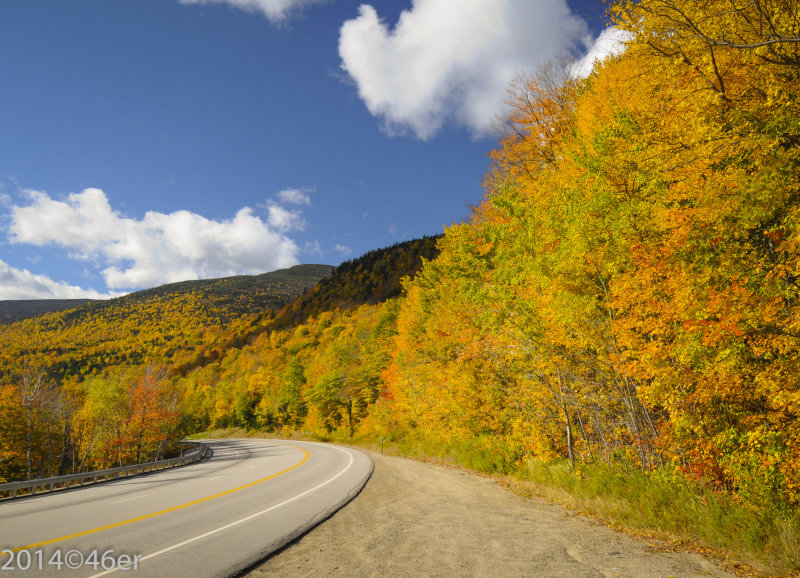
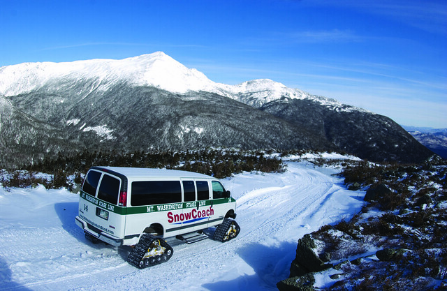
When I pulled over for some pics the wind was very strong, hard to open the truck door and had to be very cautious as the gusts would push me along; it is a looong way down. Wife was very concerned when I got out about the truck rolling off the edge. Showed her the wheels were cut so it would just roll into the mountain, not off it. Didn't help her. I would like to get up there in winter for a tracked van trip to the top.

5063013956_bb484f0cba_z.jpg
 
  • Like
Reactions: wks and manumuskin

wks

Scout
Feb 12, 2021
52
44
61
Queens New York
Nice photos of New Hampshire. I have a few as well.

Mtwash1.jpg


Looking at Mount Washington from very late September 2005.

Mtwash2.jpg


One of the cog steam engines climbs toward the summit.

Mtwash3.jpg


I am on the ride heading to the summit.

Mtwash4.jpg


I am at the summit on unusually mild weather conditions. Normally cold there.
A very nice day for photography.
 
Last edited:
  • Like
Reactions: BeachandBarrens

wks

Scout
Feb 12, 2021
52
44
61
Queens New York
They still have passenger service there.
They mainly use diesel engines now.
Rarely steam engines are used though.

Their website shows service schedules for 2021.
 

Wick

Explorer
Mar 6, 2016
408
296
Forked River
I was at the top in August. I watched the trains pull up to the top and leave. Spoke to the engineer about how it all works. Pretty interesting and ballsy if you ask me. They were definitely diesel powered that day
 
  • Like
Reactions: wks

Zach McGarvey

Explorer
Feb 11, 2018
248
168
37
Woodbury / Vineland NJ
In August of last year, we took the train up and back one day, and then the following day hiked to the summit via Pinkham Notch and Tuckerman's Ravine. The day we took the cog train the visibility was terrible, maybe 25 feet at the top. I can't remember the date, but it was the day of the big storm in the first week of August. Definitely a diesel locomotive on the day we went. The day we went on foot was clear and sunny, and the trail had already dried pretty well from the night before. There is a great camping spot about half way up on the eastern approach called Hermit's Lake. There is a shelter as well as some very nice campsites. It's also really impressive how they've built the bridges along the Tuckerman Ravine trail-- apparently the materials get airdropped by a helicopter.

Next time I visit that area I'll camp for a few days at Fourth Iron campground. Had a chance last summer to explore the area and go for a swim but we stayed at a motel down the road in Bartlett.

That area is one of my favorites but I don't know that I could survive a winter.
 
  • Like
Reactions: wks

wks

Scout
Feb 12, 2021
52
44
61
Queens New York
A few of my photos from 1992 near Lincoln New Hampshire.

20200208205049_fV03ID4 (1)~2.jpg


A tourist railroad called The White Mountain Central Railroad.

20200208205032_2E8fL0e (1)~3.jpg


Short ride with a covered bridge and plenty of pine trees.

20200208205113_GKqSI6A (1)~2.jpg


Near Mount Washington.
 
  • Like
Reactions: Boyd

Zach McGarvey

Explorer
Feb 11, 2018
248
168
37
Woodbury / Vineland NJ
A few from that area, August 2020:


I don't have the original file on this computer, you have to click the google maps link to the location where I geotagged the photo.
 
  • Like
Reactions: wks

c1nj

Explorer
Nov 19, 2008
272
169
A neighbor of mine bought an old caboose and had it shipped to his yard.
He restored it and made a "man-cave" out of it.
Way cooler than a basement or garage cave.
 
  • Like
Reactions: wks

wks

Scout
Feb 12, 2021
52
44
61
Queens New York
Now I am at Lake Winnipesaukee New Hampshire.

20160801154950_winrr821 (1)~6.jpg


20160801154731_winrr811 (1)~2.jpg


20200209082552_TXixKuA (1)~2.jpg


20200209082528_fKReWw1 (1).jpg


20200209082318_f9Prz0A (1).jpg


20200209082151_SrZahrg (1)~2.jpg


20200209082242_Ei3s68f (1).jpg


20200209082405_eTIjIXa (1).jpg


20200209081921_IMG_20200209_081400 (1).jpg


20160801154902_winrr818 (1)~5.jpg


My photos from various trips to the lake years ago.
I should be posting New Jersey photos but these are colorful.
I will be taking New Jersey trips very soon as it gets colorful.
 
Last edited:
Top