Back in late November , Hewey from this site and I were exchanging texts while deer hunting one night and we talked about getting together in the woods for a few holiday beverages and some general jocularity. We both agreed to wait until the hunting slowed down a little and we would then plan a Sunday afternoon outing. Pinelandpaddler contacted both of us with the same idea a few weeks ago and that was the impetus to set a date. We quickly decided to expand the little gathering into a full blown PBX hike and I volunteered to plan it.
I have always loved the Friendship Bogs area of the pines for its remoteness and rugged beauty. I have also been fascinated by the amount of work that went into constructing bogs of that size and the backwoods surveying and engineering required to dam natural streams, construct reservoirs and regulate water levels. It is interesting to ponder the equipment and technology that was available at the time these bogs were built.
I decided to plan to explore north of Carranza and hike through and along the Ore Spong and the Featherbed Branches that feed parts of Friendship Bogs south of Carranza.
We had a beautiful day with temps in the low 40's and 13 of us men and women left the parking site at 09:15.
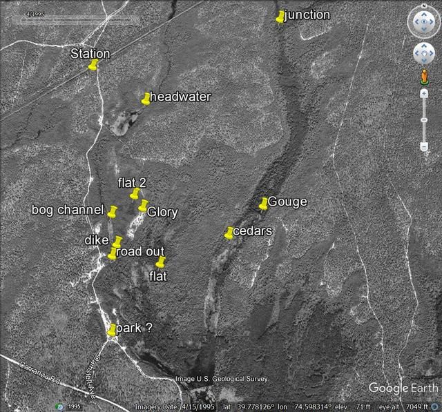
Our route. Counterclockwise from Park.
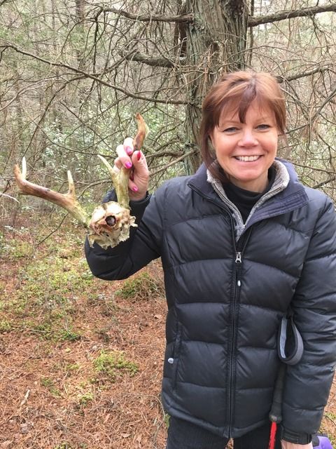
The first interesting find was a 7 point deer skull found by my wife just minutes after Hewey was talking about finding sheds.
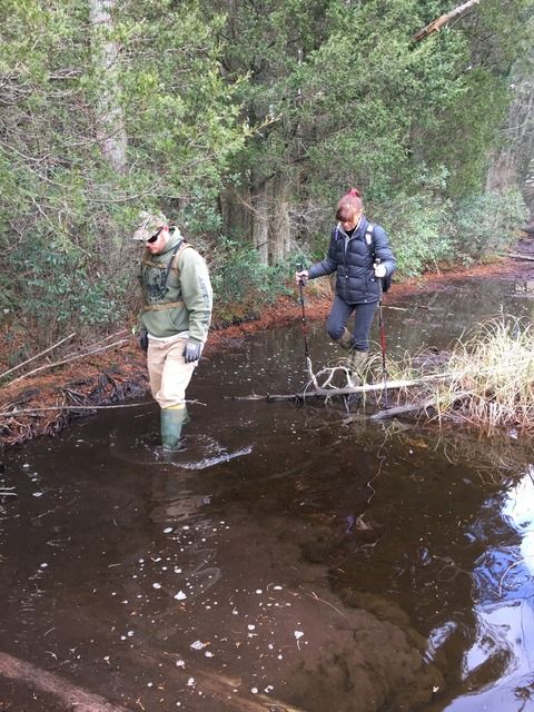
After a long, slow pull between the Ore Spong and Featherbed we arrived at a point of interest I had selected from the aerials. It was a linear feature and appeared to be water related. It turned out to be a dike with a corduroy road along its length. My wife and son plodding along the submerged road.
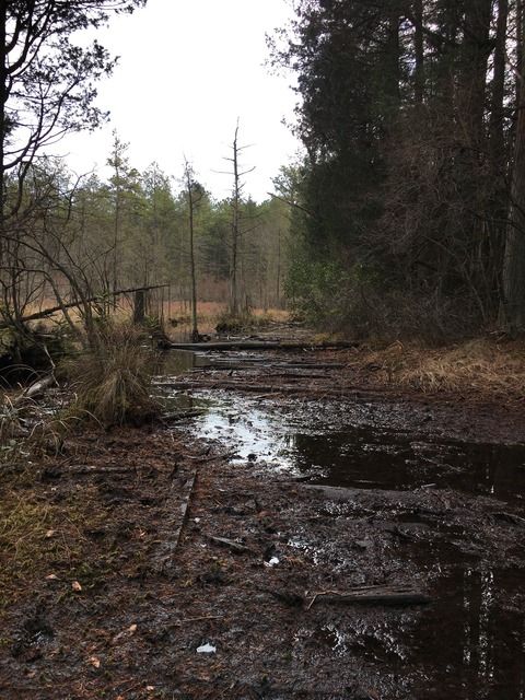
The road.
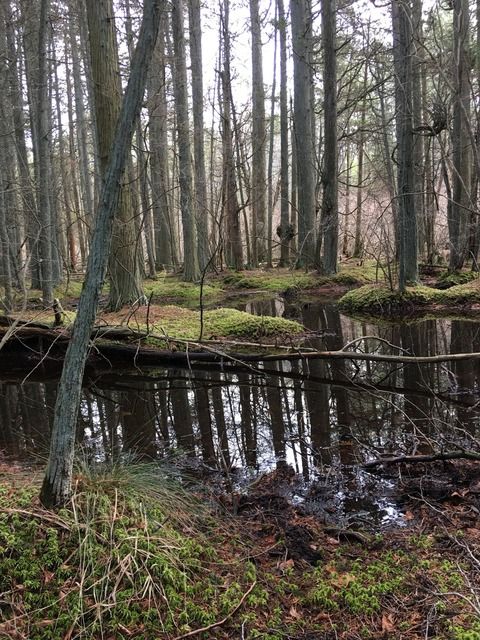
The Featherbed Branch turned out to be the high point of the hike. It was beautiful and serene with barely perceptible flow.
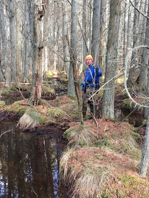
Guy holding up a tree.
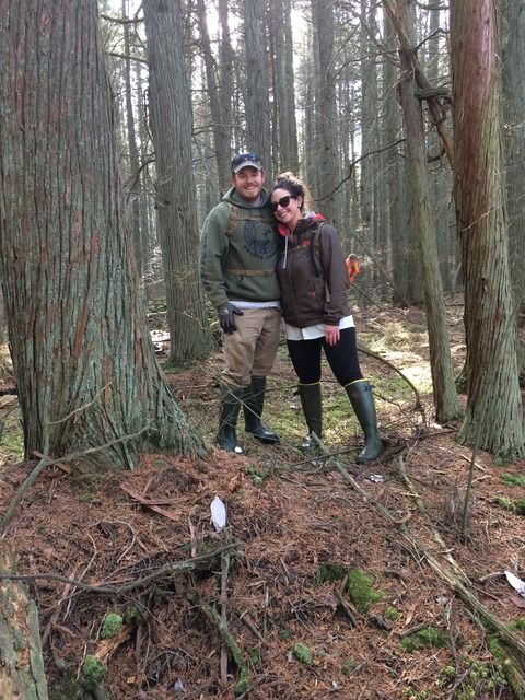
My son and his girlfriend.
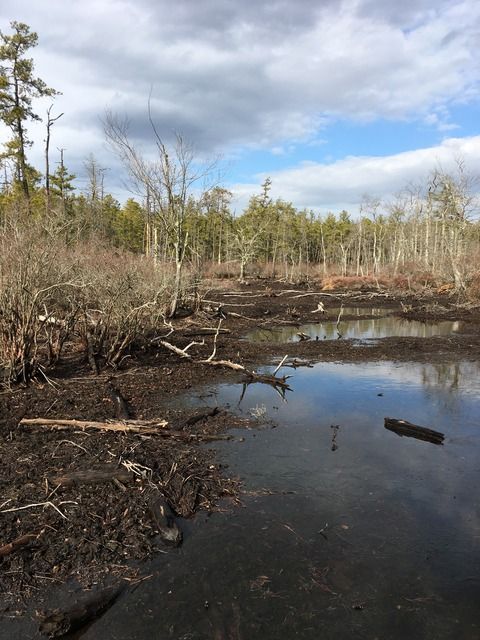
The Ore Spong north of the Jersey Central Railroad. Water table was way down !
The northernmost bog on the Ore Spong.
We struggled to complete a 4 mile+/- loop in less than 6 hours which speaks something about a lot of the terrain. Sadly, we had to bypass several waypoints at the end.
I shall return.
Thanks to Bob and Guy for assisting with the prep and thanks to Hewey and Pinelandpaddler for the ideas.
Most of all, thanks to all of the friends and family that attended this hike which reinforced the name Valued Friendship.
I hope to be doing this long after I am dead.
I have always loved the Friendship Bogs area of the pines for its remoteness and rugged beauty. I have also been fascinated by the amount of work that went into constructing bogs of that size and the backwoods surveying and engineering required to dam natural streams, construct reservoirs and regulate water levels. It is interesting to ponder the equipment and technology that was available at the time these bogs were built.
I decided to plan to explore north of Carranza and hike through and along the Ore Spong and the Featherbed Branches that feed parts of Friendship Bogs south of Carranza.
We had a beautiful day with temps in the low 40's and 13 of us men and women left the parking site at 09:15.
Our route. Counterclockwise from Park.

The first interesting find was a 7 point deer skull found by my wife just minutes after Hewey was talking about finding sheds.

After a long, slow pull between the Ore Spong and Featherbed we arrived at a point of interest I had selected from the aerials. It was a linear feature and appeared to be water related. It turned out to be a dike with a corduroy road along its length. My wife and son plodding along the submerged road.

The road.

The Featherbed Branch turned out to be the high point of the hike. It was beautiful and serene with barely perceptible flow.

Guy holding up a tree.

My son and his girlfriend.

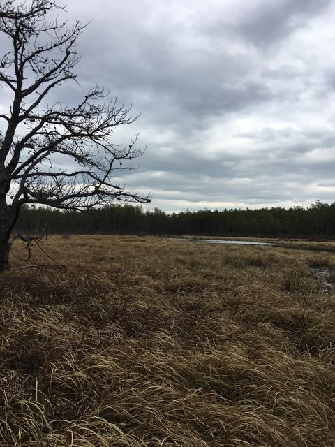
The Ore Spong north of the Jersey Central Railroad. Water table was way down !

The northernmost bog on the Ore Spong.

We struggled to complete a 4 mile+/- loop in less than 6 hours which speaks something about a lot of the terrain. Sadly, we had to bypass several waypoints at the end.
I shall return.
Thanks to Bob and Guy for assisting with the prep and thanks to Hewey and Pinelandpaddler for the ideas.
Most of all, thanks to all of the friends and family that attended this hike which reinforced the name Valued Friendship.
I hope to be doing this long after I am dead.


")
")


