Am I a Piney Now?

dennis2

Scout
Sep 22, 2020
54
28
Deptford, NJ
Long time lurker on this forum. Never had anything to add until now that I recently purchased the tiniest piece of the Pines possible, Block 103E-Lot 4, from Bass River Township. It’s a .04-acre slice of heaven at around 39.67732, -74.45872 about a half mile north on Shamong Road from where is crosses Oswego Road. Been spending all my spare time in the Pines for the last ten years now and when I saw this was for sale, I couldn’t help myself.

I was hoping for some help on history of this area. The BRT tax maps (http://www.bassriver-nj.org/uploads/3/7/8/5/37857841/26.pdf) from the early 1960’s make it clear that this was parceled out in anticipation of the proposed jetport, but I was wondering if the plan for this specific area was developed any further than that.

And there’s evidence of a lot of activity in the area. There are quite a few trails that need to be explored. There are three old foundations a bit northeast that I would guess were hunting cabins, and of course the massive cinderblock ruins east on Oswego Road, what ever that used to be.

Any and all information would be greatly appreciated!!!!!
 
  • Like
Reactions: Boyd

Boyd

Administrator
Staff member
Site Administrator
Jul 31, 2004
9,826
3,005
Ben's Branch, Stephen Creek
Yes, I'd say you're a Piney now. :) Glad that you've finally decided to participate in the fun here, will look forward to hearing more from you!
If I understand correctly, you are talking about that tiny little triangle at the crosshairs here (although your coordinates are just slightly North of there)?

https://boydsmaps.com/#17/39.67713/-74.45876/parcels

But I'm confused by the "three old foundations" which you say are Northeast of there. I assumed you were talking about these, which are to the West that parcel? I don't have any info about those, but also assumed they were old cabins.

https://boydsmaps.com/#17/39.67692/-74.46252/pinesHD

Also confused about the "massive cinderblock ruins" which I assume are these, but they are actually Southwest of that parcel and not East.

https://boydsmaps.com/#17/39.67395/-74.46036/pinesHD

Those ruins always fascinated me. I have seen them called the "pig farm" before (possibly in an old thread here?) but don't know anything about them. I remember asking Guy about those a long time ago, but he didn't seem to know much about them. Will be interested to hear what others have to say about these.
 
Last edited:

dennis2

Scout
Sep 22, 2020
54
28
Deptford, NJ
So glad to be a Piney!!! I'm gonna need a bumper sticker!

And you are correct on all three locations. I think the reason no one ever bought this tiny little triangle, and Bass River Township continued to own it until now, was that it is so ridiculously small that it has no value, except to me of course.

And the three foundations are more correctly located by you as well, which is not too terribly surprising. I went to check on them and they are pretty small, maybe ten feet square at best. My best guess is hunting cabins but not sure.

And the massive foundations. West (not East!!) of the intersection of Oswego and Shamong, southwest of the property. (This is why I'm not a mapmaker!!!!) These are pretty puzzling. Somebody had a big plan. They look to be fairly recent, but there are some pretty big trees growing through them. I searched this forum for info but came up short.

Going out there this Sunday. I'm curious as to whether the surveyors put in pins when they laid this out. I'm using Onx Hunt to try to locate the exact corners but my phone's GPS is at best plus/minus about ten feet. Also want to walk some of the trails there to see where they might lead.
 
  • Love
Reactions: Boyd

Boyd

Administrator
Staff member
Site Administrator
Jul 31, 2004
9,826
3,005
Ben's Branch, Stephen Creek
The one-meter LIDAR imagery might reveal some interesting features...

https://lidar.boydsmaps.com/#x111y055/shader/-390/712/-243/-390/1/-243/-1686/647/-900/49/2.5/2d

color.jpg


https://lidar.boydsmaps.com/#x111y055/solid/-391/749/-244/-390/1/-243/-1490/118/-900/56/2.5/2d

gray.jpg
 

Boyd

Administrator
Staff member
Site Administrator
Jul 31, 2004
9,826
3,005
Ben's Branch, Stephen Creek
I'm using Onx Hunt to try to locate the exact corners but my phone's GPS is at best plus/minus about ten feet.

+/- 10 feet would be +/- 3 meters. That would be excellent GPS accuracy from any consumer GPS device, I suspect it's actually a lot worse than that. You could get better results with an external bluetooth receiver that sends data to the phone. These cost about $100 for the Garmin GLO on up to over $5000 for really accurate devices from SXBlue. Some discussion of that topic here:


dennis2

Scout
Sep 22, 2020
54
28
Deptford, NJ
I had read your earlier post about the Garmin GLO and it looks like a nice unit. I'm going to try some best-guess legwork first. Try to get some sense of the dimensions from the survey, some probable locations from my phone, add in a pinch of hope and give it a try. You're most likely right and I'll end up with the GLO or something like it, but at least this will give me more good reasons to head to the woods!
 
  • Like
Reactions: Boyd

Boyd

Administrator
Staff member
Site Administrator
Jul 31, 2004
9,826
3,005
Ben's Branch, Stephen Creek
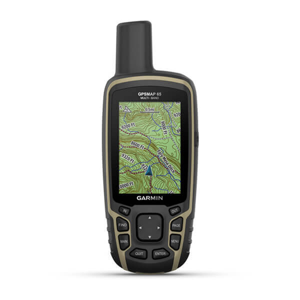
Garmin just introduced the GPSMap 65 series today, which appear to be updated versions of the GPSMap64 with more accurate multi-band receivers. These are brand new, so no user reports yet. However, they *might* offer more accuracy than we could previously get from consumer devices....


Last edited:
  • Like
Reactions: dennis2

Teegate

Administrator
Site Administrator
Sep 17, 2002
25,951
8,694
I will look into this later tonight. The state corner right across the road is exactly:

39.676812
-74.458417

Block 101 Lot 11

It may even be on the same side as you. I have to go out. Will check.
 
  • Like
Reactions: Boyd and dennis2

Teegate

Administrator
Site Administrator
Sep 17, 2002
25,951
8,694
I don't have anything on your lot. It appears you must have purchased it from the township.

I can say that all of the lots in that area were on a map or plan called Rowland Estates, Harrisville, NJ. The map was filed in the Burlington County Clerks office on 3/10/1909 as Map # 27.
 
  • Like
Reactions: Boyd

dennis2

Scout
Sep 22, 2020
54
28
Deptford, NJ
I don't have anything on your lot. It appears you must have purchased it from the township.

I can say that all of the lots in that area were on a map or plan called Rowland Estates, Harrisville, NJ. The map was filed in the Burlington County Clerks office on 3/10/1909 as Map # 27.
Yes, I purchased it from the township. According to the deed (which I just got this evening!!) the township took possession of the property in a foreclosure in 1996. I'll have to look that up to see who owned it before me. The property taxes are a little over $7/year so I can't imagine how far in arrears you would have to get before a foreclosure.

And I'm always amazed that you guys on this forum have access to so much information. How did you know about the Rowland Estates? I clearly need to up my game!!!!!!
 
  • Like
Reactions: Boyd

Teegate

Administrator
Site Administrator
Sep 17, 2002
25,951
8,694
I will up the game a little more. Here is some info I researched a while back on the Ed Greaves property around your property. The maps are not included so just take the text as it is. I have edited it recently to reflect some info changes.


As early as 1951 but after 1931 HistoricAerials shows there was a building or more along with disturbance at the Ed Greaves property on Oswego Road that we recently visited. If Ed Greaves was living there then he did not own the property. It wasn't until April 6, 1966 that he acquired it from a man named C. C. King who resided in Millville NJ. It was a quitclaim deed so there is a possibility Ed Greaves was paying him for the property until he satisfied it or maybe C.C. King just gave it to him at that point. In any event, it was not until that date that Ed Greaves actually owned it. The property was considered to be 59 3/4 acres but in reality it was less than that. When the state surveyed it they removed the "paper" roads and Shamong Road from the acreage making it much smaller.

Fast forward to May 22, 1978 where Ed Greaves made a will that upon his death the sole beneficiary of his property would go to Martha P. Hutcherson who lived in Eastover, South Carolina. On December 2, 1987 she exercised her right as the beneficiary of his estate and sold all of the property to the State of NJ for $29,651.40. In reality there were actually 4 separate lots making up the complete property for a total of 49.419 acres.

Tract 1 was 19.799 acres
Tract 2 was 18.667 acres
Tract 3 was 4.626 acres
Tract 4 was 6.326 acres more or less. The reason for the "more or less" is Tract 4 follows Beaver Run and is not exact.

Total 49.419 acres.


Notice the lots are angled. It is obvious they must have been using a compass to cut the property lines. They were using magnetic north and the line was off about 7.5 degrees which is the difference between magnetic and true north. If the buildings on that property were a little further north they may have been off of the property as I see often in that area.

And all of the paper roads in that area are 50 feet wide.
 
Top