batona trail hike
- Thread starter stizkidz
- Start date
You are using an out of date browser. It may not display this or other websites correctly.
You should upgrade or use an alternative browser.
You should upgrade or use an alternative browser.
Yes, You can ride bikes everywhere except on the area labeled "footpath" The observation decks are the old pumphouses with the roof removed and a deck installed with a scope on a base.
I have biked extensively in the Parker Preserve. There is some excellent riding there with many gravel pathways that make it easy for a bike. There are two entrances off RT 563 that are of interest. The one on the left heading from Chatsworth toward the Mullica will take you out to a beautiful reservoir (and there are 2 blue holes), and the one on the right provides the most riding opportunity with I believe two observation decks.
I saw on the map the Wading River. Did not venture over there. Looks like another day for exploration.
Yes, and you can paddle up the Wading into the preserve from Rt 563 for a ways (see my previous posts on the subject in the archives) before the obstructions become too severe. I also biked and walked to the river from the preserve (I recommend walking rather than biking). Check the trail maps that are posted at the preserve entrances off RT 563. I overloaded on chiggers during these expeditions so take precautions if you go.
Yea, I had no issues with chiggers last Friday there. I thought I saw the whole preserve. I was definitely wrong. I maybe saw 1/3. Definitely going back to check out. Thanks ScubaBruce. I usually bring my little one with me. He's too young to be in a paddle. Trust me will be something I will be looking to purchase in the future.
Observation "towers" are usually just a small deck to go bird watching. The trails are pretty easy. I used a stroller. If you go off the main trails its a bit more rustic and a little more difficult to trek through. Lined with pine needles, sticks, and the occasional spider web you'll go through. But biking would be fine. On a side note, I'm not sure if they allow bikes. I'll have to go through my notes. A must to go towards sunset. It is gorgeous.
There are a few benches to sit at. The bridge is closed down because it is unsafe to walk across. It's a neat place to explore.
Do you mean the suspension bridge?
The bridge that goes over the bog area. Signs state that the trail is closed...Bridge is unsafe. I recall a road wood sign near the trail. I'll have to go back and look at pics. I haven't uploaded them to my main computer yet.
I guess I didn't explore too much, but some trails and the bogs. I did not see ANY of what you have listed above.
Looks like I will be going back. Did not see any of the above. 


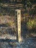
 View attachment 2663

A few of my findings.
View attachment 2663 A few of my findings.
Attachments
Shhhh...no idea what you are talking about. Looks like I'm going back to check out the rest of the wonders.
Looks like I'm gonna have to bump the thread! Went out to the Bass River office. Didn't make it in time though they were closed. But grabbed one of maps. Been looking at the map along with your pics and comments. Had a terrible time finding it. The GPS took us to some campground off of the other end of stage road. So I just explored for a bit. The "Parking Area"seems to have room for about one vehicle. Is that right? When it gets a little warmer Ill go exploring more. Out of curiousity, how high is Apple Pie Hill.
AP Hill is 205 feet high according to the topo.
A site says the tower is 60'.
http://maps.njpinebarrens.com/#lat=39.806517265089546&lng=-74.58879001411435&z=16&type=topo&gpx=
A site says the tower is 60'.
http://maps.njpinebarrens.com/#lat=39.806517265089546&lng=-74.58879001411435&z=16&type=topo&gpx=
yes, room for two cars and 3 blazes.Looks like I'm gonna have to bump the thread! Went out to the Bass River office. Didn't make it in time though they were closed. But grabbed one of maps. Been looking at the map along with your pics and comments. Had a terrible time finding it. The GPS took us to some campground off of the other end of stage road. So I just explored for a bit. The "Parking Area"seems to have room for about one vehicle. Is that right? When it gets a little warmer Ill go exploring more. Out of curiousity, how high is Apple Pie Hill.

don't wait too long, the chiggers and ticks are waiting too

We just had a group camp at Batona. Many people were from out of state and we got one guy to bring crampons, ice axe and rope for the accent of Apple Pie MOUNTIAN. we get a guy every year. i'm just guessing, 194 ft. ?
The GPS took us to some campground off of the other end of stage road.
If have a Garmin GPS (Nuvi or handheld) try my map, it's free and includes the Batona and other trails. Doesn't show the new section of the trail yet, but that will be included in my next update (someday...). http://www.gpsfiledepot.com/maps/view/294/
The new southern trail head is at N39 37.467, W74 26.587. From what I remember there is not much formal pull in parking but the road is quite wide so I don't think there is an issue. I do remember some serious holes in the road near by.
I have a GPX track file of the entire rerouted trail if you want it, 1.7 MB. You could pick off coordinates where you could access the trail on near by roads if you do it in sections.
BTW, there is a substantial group hiking from Carranza to Apple Pie Hill right now.
I have a GPX track file of the entire rerouted trail if you want it, 1.7 MB. You could pick off coordinates where you could access the trail on near by roads if you do it in sections.
BTW, there is a substantial group hiking from Carranza to Apple Pie Hill right now.
Looks like I'm gonna have to bump the thread! Went out to the Bass River office. Didn't make it in time though they were closed. But grabbed one of maps. Been looking at the map along with your pics and comments. Had a terrible time finding it. The GPS took us to some campground off of the other end of stage road. So I just explored for a bit. The "Parking Area"seems to have room for about one vehicle. Is that right? When it gets a little warmer Ill go exploring more. Out of curiousity, how high is Apple Pie Hill.
The bad news: It's a little tricky from Bass River, that park (and that end of the trail) has confused the heck out of me in the past. I walked two hours the wrong way the first time I was down there. With an almost 50 pound pack. And 13 very unhappy Boy Scouts.
The good news: Some persons deserving of a medal have clearly marked the trailhead now, complete with arrow pointing you the right way.
The Batona isn't really near the office at Bass River, the trailhead is just off of Stage Road at Coal Road.
Might be helpful for that end (worth it for the pictures to help you get started)-
http://southjerseytrails.wordpress....ay-1-bass-river-and-wharton-state-forests-nj/
Ignore the backpacking part, no need to backpack. It's crazy to backpack.
My until recently favorite day hike on the Batona (Carranza to Apple Pie Hill and back). Beautiful walk -
http://southjerseytrails.wordpress....nza-memorial-to-apple-pie-hill-tabernacle-nj/