Regarding "Battle Lane," I spoke to an elderly gentleman who was running Jenkin's bait shop down in Newport when I lived in Gandy's Beach and he mentioned an actual "battle" during the Revolutionary War down that way. I am highly skeptical but it is an interesting name for that area.Laurel Lake has been here for well over 200 years I believe and there is the remains of an old mill dam where gravelly run crosses battle lane (Would love to know how that road got it's name) As long as the lake has been there there are miraculously still cedar stumps under the dark waters. I aslso believe the hartman map shows a mill down near the dam at the lower end of the lake as well.

Dams on Buckshutem Creek
- Thread starter pinelandpaddler
- Start date
You are using an out of date browser. It may not display this or other websites correctly.
You should upgrade or use an alternative browser.
You should upgrade or use an alternative browser.

I had heard that but find no info on it. I heard it involved indians which is highly unlikely, the Lenape were peaceful and mostly gone by the revolutionRegarding "Battle Lane," I spoke to an elderly gentleman who was running Jenkin's bait shop down in Newport when I lived in Gandy's Beach and he mentioned an actual "battle" during the Revolutionary War down that way. I am highly skeptical but it is an interesting name for that area.
Awesome thread…
There was a Buckshutem Branch in Monmouth County by Wykoff Mills, now called Bannen Meadow Branch (Brook), so that name is not unique to Cumberland County (Buckshootem Bridge in Beekman 1915: 116–117). It is in what is now Howell Township, named in honor of Governor Richard Howell of Shiloh, NJ, although I'm not sure he ever lived in Howell to bestow such a Cumberland County namesake.
My sense is that the channel crossings are crossways built for forest product extraction by the early eighteenth century, especially for Atlantic whitecedar—as seen on Deep Run on Hartman's Map 5:

As I understand crossways were corduroy roads that linked hummocks as they crisscrossed a stream's broad shallow paleochannel. Some hummocks are remnants of windblown sands, sands that choked Buckshutem's channel (Manumuskin's "no channel to speak of"). Big beaver dams are often associated with beaver ponds that are of a distinctive shape (above left), like a riverine spung. However, it would not be a far fetch to assume that some crossways without those ponds were initiated by beaver activity. Permafrost hydrologist Hok Woo writes about beaver activity into Polar regions, so these critters have likely been here in the Pine Barrens for over 14,000 years—into the end of the ice age. We don't know if their kin the Giant Beavers ever built dams, as they went extinct at Pleistocene's end.
Break-dams, too, were built to impound floating pools to flood winter-cut logs down to the saw mill during spring high water. Beaver knew the best places to build dams, and people followed.
Spung-man
There was a Buckshutem Branch in Monmouth County by Wykoff Mills, now called Bannen Meadow Branch (Brook), so that name is not unique to Cumberland County (Buckshootem Bridge in Beekman 1915: 116–117). It is in what is now Howell Township, named in honor of Governor Richard Howell of Shiloh, NJ, although I'm not sure he ever lived in Howell to bestow such a Cumberland County namesake.
My sense is that the channel crossings are crossways built for forest product extraction by the early eighteenth century, especially for Atlantic whitecedar—as seen on Deep Run on Hartman's Map 5:
Break-dams, too, were built to impound floating pools to flood winter-cut logs down to the saw mill during spring high water. Beaver knew the best places to build dams, and people followed.
Spung-man
We don't know if their kin the Giant Beavers ever built dams
Bob's worst nightmare!

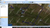
This area just to the ESE is interesting. My first thought when I saw the topo ridges was a long abandoned gravel pit. One that the topo caught up to.
Marks northern link Monmouth County: https://maps.njpinebarrens.com/#lat=40.19810793095733&lng=-74.25401254550779&z=15&type=topo&gpx=

On the aerial it looks like big, deep giant foot prints. Odd!

Marks northern link Monmouth County: https://maps.njpinebarrens.com/#lat=40.19810793095733&lng=-74.25401254550779&z=15&type=topo&gpx=
On the aerial it looks like big, deep giant foot prints. Odd!
Last edited:
Jenkin's was a very mysterious place. I was a steady patron through the mid to late 1990's.Regarding "Battle Lane," I spoke to an elderly gentleman who was running Jenkin's bait shop down in Newport when I lived in Gandy's Beach and he mentioned an actual "battle" during the Revolutionary War down that way. I am highly skeptical but it is an interesting name for that area.
Always dark and dank inside and it seemed everybody smoked. But they always had good bait and the skinny girl with the long brown hair and a Marlboro dangling from her lips was also mysterious and always friendly.
")
My cousin is a bay crabber and deals with Jenkins all the time.I"ve never been in there but he thinks the world of them.Jenkin's was a very mysterious place. I was a steady patron through the mid to late 1990's.
Always dark and dank inside and it seemed everybody smoked. But they always had good bait and the skinny girl with the long brown hair and a Marlboro dangling from her lips was also mysterious and always friendly.
Bob, I've been by that location on Casino a hundred times to visit dear friends a mile up the road and had no idea that the hill was there, relict plateau composed of Beacon Hill Gravel facies of the Cohansey Formation. Many thanks!This area just to the ESE is interesting. My first thought when I saw the topo ridges was a long abandoned gravel pit. One that the topo caught up to.
Marks northern link Monmouth County: https://maps.njpinebarrens.com/#lat=40.19810793095733&lng=-74.25401254550779&z=15&type=topo&gpx=
View attachment 16742
On the aerial it looks like big, deep giant foot prints. Odd!
View attachment 16743
@Spung-Man,Awesome thread…
There was a Buckshutem Branch in Monmouth County by Wykoff Mills, now called Bannen Meadow Branch (Brook), so that name is not unique to Cumberland County (Buckshootem Bridge in Beekman 1915: 116–117). It is in what is now Howell Township, named in honor of Governor Richard Howell of Shiloh, NJ, although I'm not sure he ever lived in Howell to bestow such a Cumberland County namesake.
My sense is that the channel crossings are crossways built for forest product extraction by the early eighteenth century, especially for Atlantic whitecedar—as seen on Deep Run on Hartman's Map 5:
As I understand crossways were corduroy roads that linked hummocks as they crisscrossed a stream's broad shallow paleochannel. Some hummocks are remnants of windblown sands, sands that choked Buckshutem's channel (Manumuskin's "no channel to speak of"). Big beaver dams are often associated with beaver ponds that are of a distinctive shape (above left), like a riverine spung. However, it would not be a far fetch to assume that some crossways without those ponds were initiated by beaver activity. Permafrost hydrologist Hok Woo writes about beaver activity into Polar regions, so these critters have likely been here in the Pine Barrens for over 14,000 years—into the end of the ice age. We don't know if their kin the Giant Beavers ever built dams, as they went extinct at Pleistocene's end.
Break-dams, too, were built to impound floating pools to flood winter-cut logs down to the saw mill during spring high water. Beaver knew the best places to build dams, and people followed.
Spung-man
I'm a tad confused. This looks to be about where the beaver pond was. Correct? Is this the beaver dam?
Edit: or did man improve upon the beaver dam at that location?
Last edited:
Mark, but what of the depressions? I know we are approaching the source for brick material and/or marl belt up there. Could the top have been dug in several places in the 19th century?Bob, I've been by that location on Casino a hundred times to visit dear friends a mile up the road and had no idea that the hill was there, relict plateau composed of Beacon Hill Gravel facies of the Cohansey Formation. Many thanks!
Edit: on second thought, I can't say they are depressions. They may just look that way due to the vegetation.
Last edited:
Edit: on second thought, I can't say they are depressions. They may just look that way due to the vegetation.
You should be able to tell if they are depressions by looking at the USGS hillshade imagery (unfortunately, my LIDAR map ends about 1/2 mile South of there). Enable elevation display and you can see exactly whether a feature is a hill or a pit as you move the map around.
https://boydsmaps.com/#17.00/40.194397/-74.234246/njgin2007/0.00/0.00
https://boydsmaps.com/#17.00/40.194397/-74.234246/us3depShade2/0.00/0.00
Ok I must report a defeat on my part. I tried to reach one of the dams today after working the hoot owl shift last night.The dam located here https://boydsmaps.com/#17.00/39.347326/-75.075200/lidar2022hd/0.00/0.00
I tried the approach from the south and walked the old road heading west from 555 till I was exactly south of the dam and the gps said something like 1800 ft to my waypoint.These woods eight or so years ago were gorgeous predominantly open oak woods with a scattering of large pine and patches of laurel.Then along came the state and destroyed the trees to save the fores in the name of the pine bark beetle.Something tells me there was a buck in it for someone.This section of woods they turned into chips and hauled em off but other sections of woods they dropped the trees and left them on the ground bark and all which is in no way going to stop the spread of the beetles. In any case in the eight years or so since the devastation event the pine trees have grown about fifteen ft tall and the space in between is packed with six feet high smilax. I could have cut my way through it with a pair of pruning shears but it would have been an all day job.Either the woods have gotten rougher or I have gotten softer in my old age but after leaving the road I may have made it a hundered feet or so north and then I said some pretty bad words and did an about face and headed back toward the road. I made it to about here https://boydsmaps.com/#17.00/39.344738/-75.075447/lidar2022hd/0.00/0.00 I decided I must go in from the north which means walking by that obnoxious dirt track and I know there is another beetle devastation area over there as well which i have not been in but will assume it's the same cellulose hell as the south side so I came home to plot away around it with appropriate waypoints and being as I"m hoot owl hungover I am wisely planning my next attack tomorrow. There does appear on aerials to be a bit of a channel just west of this feature so I may get to see some of the mostly hidden Buckshutem Creek. I will report on my findings tomorrow.I will be in better shape and have a few inches of snow to track my way back out by. I"m thinking this may be an old beaver dam that got a bunch of sand dumped on it in one of the big floods of the past.I have personally seen this swamp fill and pour over 555 in water three feet deep so maybe a monster flood dumped sand on an old dam which has long since rotted away and the sand remains? beaver dams are the only features I have seen like this that look like it was created by a drunken lumberjack.Then again could this be an old civil war breastwrok created during the Battle of Gettysburg in the event that if Lee won He was headed to destroy the old grist mill on Gravelly run located here? https://boydsmaps.com/#17.00/39.337770/-75.051574/lidar2022hd/0.00/0.00 Perhaps I"ll even find cannon redoubts?
I"ll report tomorrow.
You should be able to tell if they are depressions by looking at the USGS hillshade imagery (unfortunately, my LIDAR map ends about 1/2 mile South of there). Enable elevation display and you can see exactly whether a feature is a hill or a pit as you move the map around.
https://boydsmaps.com/#17.00/40.194397/-74.234246/njgin2007/0.00/0.00
https://boydsmaps.com/#17.00/40.194397/-74.234246/us3depShade2/0.00/0.00
Thanks, I just did as you say, and the light areas jump 30 to 40 feet higher. So as Mark says, they are plateaus. Now, they could have been even taller and shaved by man for some reason.
Interesting Al. I had a similar thought about sand ending up infiltrating the old sticks of a beaver dam, but I could not think how it would be done. Your thought makes sense. By the way, I justed noted the road crossing the creek is "Battle Lane". Also, did you notice that slope follows the margin of a cedar swamp. That's some sort of clue.Ok I must report a defeat on my part. I tried to reach one of the dams today after working the hoot owl shift last night.The dam located here https://boydsmaps.com/#17.00/39.347326/-75.075200/lidar2022hd/0.00/0.00
I tried the approach from the south and walked the old road heading west from 555 till I was exactly south of the dam and the gps said something like 1800 ft to my waypoint.These woods eight or so years ago were gorgeous predominantly open oak woods with a scattering of large pine and patches of laurel.Then along came the state and destroyed the trees to save the fores in the name of the pine bark beetle.Something tells me there was a buck in it for someone.This section of woods they turned into chips and hauled em off but other sections of woods they dropped the trees and left them on the ground bark and all which is in no way going to stop the spread of the beetles. In any case in the eight years or so since the devastation event the pine trees have grown about fifteen ft tall and the space in between is packed with six feet high smilax. I could have cut my way through it with a pair of pruning shears but it would have been an all day job.Either the woods have gotten rougher or I have gotten softer in my old age but after leaving the road I may have made it a hundered feet or so north and then I said some pretty bad words and did an about face and headed back toward the road. I made it to about here https://boydsmaps.com/#17.00/39.344738/-75.075447/lidar2022hd/0.00/0.00 I decided I must go in from the north which means walking by that obnoxious dirt track and I know there is another beetle devastation area over there as well which i have not been in but will assume it's the same cellulose hell as the south side so I came home to plot away around it with appropriate waypoints and being as I"m hoot owl hungover I am wisely planning my next attack tomorrow. There does appear on aerials to be a bit of a channel just west of this feature so I may get to see some of the mostly hidden Buckshutem Creek. I will report on my findings tomorrow.I will be in better shape and have a few inches of snow to track my way back out by. I"m thinking this may be an old beaver dam that got a bunch of sand dumped on it in one of the big floods of the past.I have personally seen this swamp fill and pour over 555 in water three feet deep so maybe a monster flood dumped sand on an old dam which has long since rotted away and the sand remains? beaver dams are the only features I have seen like this that look like it was created by a drunken lumberjack.Then again could this be an old civil war breastwrok created during the Battle of Gettysburg in the event that if Lee won He was headed to destroy the old grist mill on Gravelly run located here? https://boydsmaps.com/#17.00/39.337770/-75.051574/lidar2022hd/0.00/0.00 Perhaps I"ll even find cannon redoubts?
I"ll report tomorrow.
Last edited:
The road crossing gravelly run yes is Battle Lane.The road crossing Buckshutem Creek is route 555 (Dividing Creek or Narrow Lane rd.)Interesting Al. I had a similar thought about sand ending up infiltrating the old sticks of a beaver dam, but I could not think how it would be done. Your thought makes sense. By the way, I justed noted the road crossing the creek is "Battle Lane".
I hit the northern end of Buckshutem Dam today.Some gorgeous woods on the way there,primeval laurel thickets but the last fifty yards turned into a real mess,got tore up.Crawled in along the creek which had absolutely no flow.I found nothing resembling a berm,on heading out i went mor to the east and the swamp immediately opened up and found nothing there either.I was side stepping east in the swamp trying to find a way to punch north through a formidable briar wall when I eventually stumbled onto a sapling with a pair of blue and white ribbons tied to it.It still looked like a briar wall but realizing i was getting no where near the trail out by staying in the swamp I starting pushing through head high briars.I immediately felt the ground start to rise under me and thirty ft later fell into a clearing head first.Got up brushed myself off and looked left and right.It was surrounded by big laurel.I thought I saw a gap to the left and upon getting closer saw a very tight trail disappear into the jungle.I took me a hundred yards to the old rd not turned foor trail which led me another quarter mile through a laurel jungle to the big dirt rd.God bless hunters.I don't know how many times I"ve been in a jam and stumbled onto one of their trails that got me out. I am posting two youtube vids I took and a couple jpegs of my route. I tried to post my track on Boyds LIDAR but it will take my waypoints but not my track.You should be able to tell though by switching back and forth between lidar and aerials that I crossed and recrossed the feature and i saw nothing.I think perhaps there was a flood in the past that dumped sand along a beaver dam that is still there.The flood may have wiped out the beavers or with a new dam they just repaired the spillway but eventually they left.Then the swamp covered said dam with the nasty vicious buckshutem mud that is there today.Could the lidar be seeing through the soup and seeing a more solid feature now covered over?
Attachments
Good report Al. Buckscrotum dam. 
But hey, you mentioned a ditch across from where you were standing in the first video. If a ditch was dug, maybe that lidar is just showing the dirt thrown up out of the ditch. ??
Also, you said..."I think perhaps there was a flood in the past that dumped sand along a beaver dam that is still there.The flood may have wiped out the beavers or with a new dam they just repaired the spillway but eventually they left."
So, there is a beaver dam there at the squiggly lidar line? That's how I read that.
Were you using your phone with my app to navigate through that swamp? Or just your trusty Magellan? 
My app cannot import or export tracks, only waypoints. This is explained in the help files. I had originally planned to add that feature, and someday I might. But from what I can gather, nobody but you even uses the waypoint feature. So I'm not going to spend time adding further GPX features at this point, I have plenty of other code to write and maps to make.
My app cannot import or export tracks, only waypoints. This is explained in the help files. I had originally planned to add that feature, and someday I might. But from what I can gather, nobody but you even uses the waypoint feature. So I'm not going to spend time adding further GPX features at this point, I have plenty of other code to write and maps to make.
No Bob thats not what I meant.I saw no beaver dam. I think there may have been a beaver dam in the remote past like maybe 100 years or more ago and that one of the floods that hit this drainage occasionally (I have seen a few good ones) piled up sand along an existing beaver dam at the time.Of course the dam rotted away but the sand would remain.Then the swamp since then has accumulated mud and covered the sand berm.My question is could the LIDAR be seeing through the soupy mud and exposing a sand berm laid down on a beaver dam in the past that is now covered in Buckscrotem mud?The open grassy bog like conditions at this spot could be the remains of a historical beaver pond at this location.Most of the swamp is dense cedar with bottomless mud between the humps. This would be one of the wickeder swamps of South Jersey especially as you approach the occasioanlly observable stream but in most places it oozes under the roots and mud.Good report Al. Buckscrotum dam.
But hey, you mentioned a ditch across from where you were standing in the first video. If a ditch was dug, maybe that lidar is just showing the dirt thrown up out of the ditch. ??
Also, you said..."I think perhaps there was a flood in the past that dumped sand along a beaver dam that is still there.The flood may have wiped out the beavers or with a new dam they just repaired the spillway but eventually they left."
So, there is a beaver dam there at the squiggly lidar line? That's how I read that.