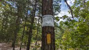
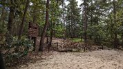
Well I drove through there yesterday. It was pretty much what I expected. Deadfall piled up to block off areas. Mostly in the grassy area after the bridge.I am curious to see what remediation will be conducted on quaker bridge road.
DEP Announces Virtual Public Meeting to Launch Wharton State Forest Visitor and Vehicle Use Survey
- Thread starter RednekF350
- Start date
You are using an out of date browser. It may not display this or other websites correctly.
You should upgrade or use an alternative browser.
You should upgrade or use an alternative browser.
? Was there a serious problem that an eyesore had to be created?Well I drove through there yesterday. It was pretty much what I expected. Deadfall piled up to block off areas. Mostly in the grassy area after the bridge.
In my opinion, no. It is a nice grassy area.? Was there a serious problem that an eyesore had to be created?
Last edited:
Well I drove through there yesterday. It was pretty much what I expected. Deadfall piled up to block off areas. Mostly in the grassy area after the bridge.
Apologies if this was elaborated on and I missed it, but the areas that were blocked off, were they existing roads?
In my opinion the spots that were blocked after the bridge were more used as parking areas. It was obvious they dont want you to park there. they did not block the actual road ( Quaker bridge rd) .
Just put a freaking barrier there! Stop the nonsensical bull. And make a proper parking lot so people can picnic and enjoy the day. Jeez!
Sorry I should have been more clear. To the best of my knowledge no roads were blocked. I was just passing through and noticed deadfall and small branches spread out in areas that weren’t last week. I didn’t really spend much time there.Apologies if this was elaborated on and I missed it, but the areas that were blocked off, were they existing roads?
Wanted to chime in and say I went to the 130 clean up at Whispering Pines. We did much of the same. Dragging deadfall across the trails. As an ORV enthusiast, that area did look like it was in need of some mitigation. There is a small bog there that has been ridden fairly hard and was starting to turn to sand. The overwhelming opinion was that they were keeping ORVs out. Where I come from, it's just regular trail maintenance you have to do from time to time or you end up with nothing but sand pits and whoops.
Call it conservation, call it trail maintenance, just dont tell them we showed up for a reason and participated or they might get cranky and stop helping us maintain the ORV areas.
I'll be logged in tomorrow for the meeting.
Call it conservation, call it trail maintenance, just dont tell them we showed up for a reason and participated or they might get cranky and stop helping us maintain the ORV areas.

I'll be logged in tomorrow for the meeting.
Not much to see. No public comments on the decision-making taken. Simply a demonstration of the survey and mapping tool, which opens tomorrow morning at 9AM and will be open for 30 days. Public comment on the idea of an access plan, permitting system, etc will supposedly be addressed at an unspecified future meeting.
That mapping tool is a joke considering we are talking roads. Should we polygon the entire forest?
Is that a rhetorical question ??That mapping tool is a joke considering we are talking roads. Should we polygon the entire forest?

Less than 300 people "tuned in".
That could be a good thing. How many do you think care about maximizing access, is the question.
That could be a good thing. How many do you think care about maximizing access, is the question.
Attendance was abysmal. Teams is also abysmal.
It sounds like requiring permits to use the "unimproved roads" (whatever they are) are almost a foregone conclusion on the State's end. This isn't going to end well for we, the proletariats.
It sounds like requiring permits to use the "unimproved roads" (whatever they are) are almost a foregone conclusion on the State's end. This isn't going to end well for we, the proletariats.


