Was looking for something else and stumbled on these pix that I took two years ago, comparing a cheap rugged Android phone that I use for testing with my Montana 600. There's just something very cool about this size and form factor for a GPS, it has a 5-inch screen just like the Montana 700 (the Montana 600 only has a 4-inch screen). It also has the same waterproof/shock rating as Garmin GPS'es. Now, I'm not suggesting that this cheap phone is better than a Montana, but it's just an example of how (IMO) Garmin has really lost touch. If they made a GPS with a similar size and a 5" screen, that might actually get me interested. One thing that makes the Montana bigger is the ability to use AA batteries, of course.
For comparison....
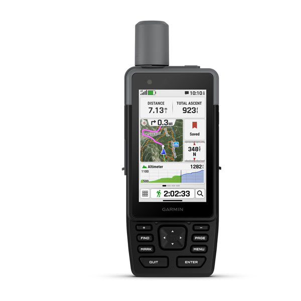
Montana 600:
weight: 10.2 oz.
size (width x height x thickness): 23.1 cubic inches
cost (when discontinued): $470
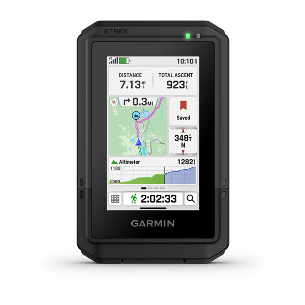
Montana 700:
weight: 14.5 oz.
size: 31.8 cubic inches
cost: $650
So, the Montana 700 is 38% bigger, 42% heavier and costs 38% more than the 600. And they offer no alternative if you want a touchscreen device. But "it is what it is", this is what you will need to accept unless you want to move to a pushbutton unit.
FWIW, this is how that phone stacks up.
Ulefone Armor X7 Pro:
weight: 7.9 oz.
size: 10.4 cubic inches
cost: ~$125
I mean - geez - not expecting any miracles from Garmin, but at least they could try to meet us halfway... how about a Montana with a bigger screen that is still the same size/weight as the 600 series? Or a model with a 4 inch screen that is smaller/lighter than the 600? Or
anything that costs less than $500????
So much for Saturday morning daydreaming...

[edit]
And one final thought.... that cheap phone actually
could be a Garmin GPS. How? Garmin could create an outdoor GPS app for iOS and Android that could run on any phone. They could easily be "best of breed" in GPS apps. But they clearly won't do that, because it would pretty much destroy what's left of their shrinking product line. They used to make an automotive app that turned your phone into something very similar to one of their Nuvi devices. I used that app and liked it a lot - although they intentionally crippled it so there was still a reason to buy one of their devices.
After a few years, they just killed the app and pulled it from the Apple and Android stores. Very disappointing - and a waste of around $200 I had spent for both the US and European versions of the app.