Help ID an old strutcture

jokerman

Explorer
May 29, 2003
337
12
Manasquan
walked out that way over the weekend but didn't come across the area of interest. I looked around where the service road turns into the sandy/gravelly area but may not have been in the right location. That sandy area is most definately an old gravel pit, but may have been also formerly part of the farm area nearby. The service road may also represent the old driveway to the farmhouse, wherever that was. The 1850ish map they sell at Howell Works shows the locations of the farmhouses along the south side of the river. I have found the location of 3 of them although evidence is scant due to salvaging and souvenier picking. One of them appears to have been located directly behind the airplane field where newer foundations are visible that would have been the outhouses. I think the farmhouse near the field was probably right at the back of the field and the foundation has been filled in. Would love to see the new spot you identified.
 

KCB

Scout
Mar 29, 2007
56
0
Spring Lake Hts. NJ
jokerman, I posted the directions earlier in the thread. Don't know if they are all that good but I am assuming paddler used them and found the area. I am not going to be working on wednesday so if you are around I'll take you to the spot.
 

jokerman

Explorer
May 29, 2003
337
12
Manasquan
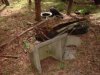
Very probable and likely since the farmhouse pre-dates Hospital Road. I think the portion of the service road from Hospital Road to the area of the airplane field (which is the location of the old farm there) may be secondary driveway for the old farm perhaps, just based on the fact that no mining appears to have been done in that specific area and since the road turns abruptly away from the field area. It's also very likely that the mining operations used that portion of the driveway since it was already cleared and they continued it west to the mining area. I also noticed on the aerial map that the road leading in from Herbertsville Rd, where you saw the foundations, continues through the mining area (sandy area), goes behind the farm area (airplane field) and continues up to what is now the water treatment plant. I think this road is probably the original road to the farm since Hospital Road is newer than the farmhouses in the area so the service road would be a later access driveway for the farmhouse, if it was one. This may be why there are farming debris along this trail towrds Herbertsville Rd. After Hospital Road was laid, the farm probably connected to Hospital Road since it was closer and the later mining operations used both roads (the service road and trail in from Herbertsville Rd.) for access. There probably was another outlet directly down from the sandy clearing where you can see the mining continued all the way from there down to the roadside.
 

jokerman

Explorer
May 29, 2003
337
12
Manasquan
jokerman, I posted the directions earlier in the thread. Don't know if they are all that good but I am assuming paddler used them and found the area. I am not going to be working on wednesday so if you are around I'll take you to the spot.

I just did the walk based on memory and realize now afterreading your post and seeing the "inverted triangle" that I stopped just around that area. I see now that it is much closer to Herbertsville (Squankum Road) then I originally imagined. Yes, maybe a group visit would be fun. I'm up for it.
 

KCB

Scout
Mar 29, 2007
56
0
Spring Lake Hts. NJ
now this looks like a garbage dump, it's the area behind the airplane field
 

Attachments

  • DSCF0013.JPG
    DSCF0013.JPG
    27.5 KB · Views: 225

Teegate

Administrator
Site Administrator
Sep 17, 2002
25,602
8,180
more junk

That one looks like the blades of a manual push lawn mower. Most of the young members of this site most likely never saw one. My neighbor had one up until about 15 years ago.

Guy
 
Top