Some things I've seen in Wharton this week.
Hampton Furnace
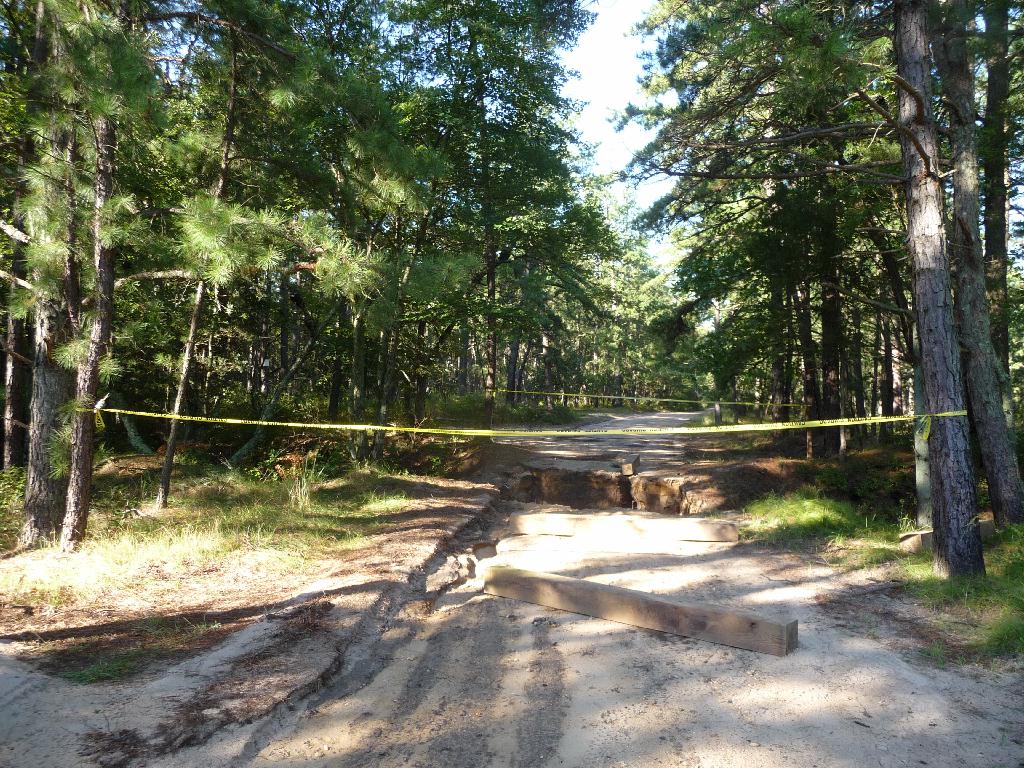
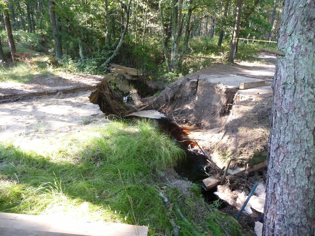
The small bridge near Riders Switch is washed out. This bridge washed out a couple of years ago and it was never repaired properly. The upstream side looked like the workmen went home one night and never returned to finish the job. Ties were still laying about which were meant to reinforce the walls.
http://maps.njpinebarrens.com/#lat=39.769104379769615&lng=-74.68092799186707&z=17&type=h&gpx=


The canoe launch there has washed out, but is usable.

The road along the Batsto there had 3 deep holes usually filled with water. Someone has dug out the bank allowing the water to drain into the river. Unfortunately every time it rains from now on it will take some of the road with it. Interestingly the opposite approach was taken by the Skit Bridge a short distance away where the bank was built up to keep the road from washing away.
There is a large tree down here, still connected about 10 feet up with no way around.
http://maps.njpinebarrens.com/#lat=39.74356026324067&lng=-74.65373039245605&z=14&type=h&gpx=
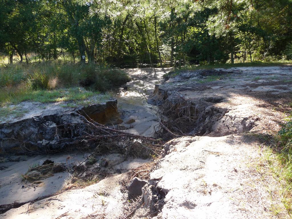
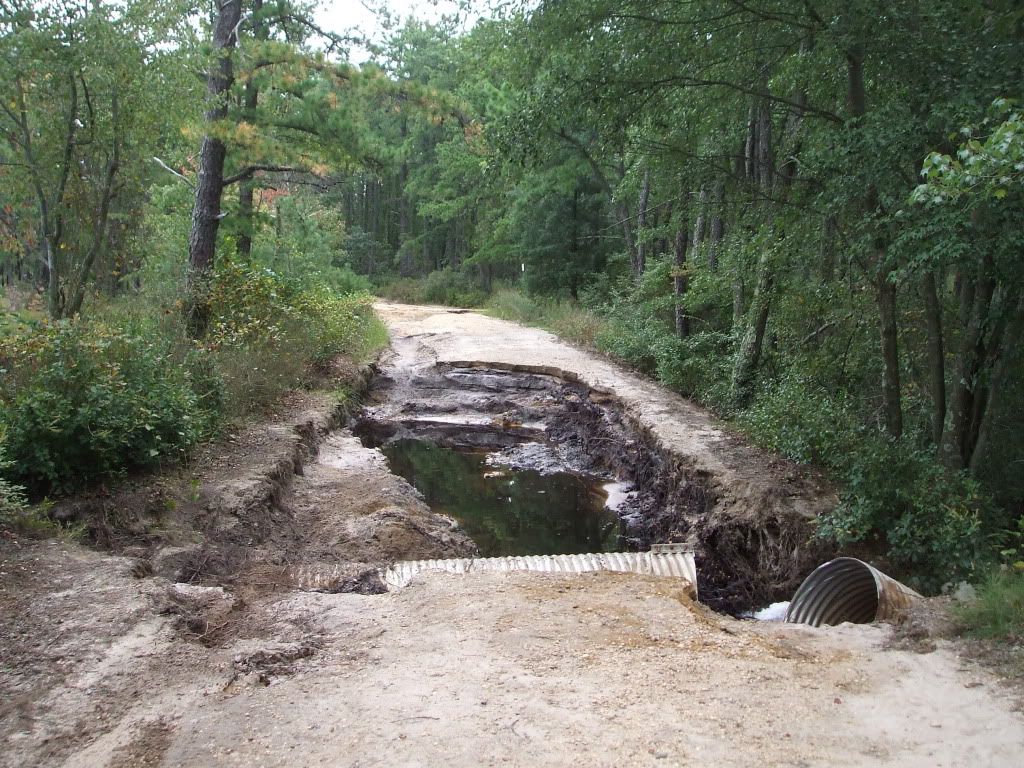
There is a significant wash out of Push Line Road. I use 4 low to get through it but a car would never make it. It is just west of the gravel hill. There is also a large tree down just west of the washout making the road impassable.
http://maps.njpinebarrens.com/#lat=39.73339606935888&lng=-74.65201377868652&z=14&type=h&gpx=
There is also a significant wash out just down the road from Batona Camp. It would stop a car but not a truck.
http://maps.njpinebarrens.com/#lat=39.78598287518245&lng=-74.62403297424316&z=14&type=h&gpx=
There are trees down every where which can be driven around. If you like big puddles Wharton is for you.
Ed
Hampton Furnace
The small bridge near Riders Switch is washed out. This bridge washed out a couple of years ago and it was never repaired properly. The upstream side looked like the workmen went home one night and never returned to finish the job. Ties were still laying about which were meant to reinforce the walls.
http://maps.njpinebarrens.com/#lat=39.769104379769615&lng=-74.68092799186707&z=17&type=h&gpx=


The canoe launch there has washed out, but is usable.

The road along the Batsto there had 3 deep holes usually filled with water. Someone has dug out the bank allowing the water to drain into the river. Unfortunately every time it rains from now on it will take some of the road with it. Interestingly the opposite approach was taken by the Skit Bridge a short distance away where the bank was built up to keep the road from washing away.
There is a large tree down here, still connected about 10 feet up with no way around.
http://maps.njpinebarrens.com/#lat=39.74356026324067&lng=-74.65373039245605&z=14&type=h&gpx=
There is a significant wash out of Push Line Road. I use 4 low to get through it but a car would never make it. It is just west of the gravel hill. There is also a large tree down just west of the washout making the road impassable.
http://maps.njpinebarrens.com/#lat=39.73339606935888&lng=-74.65201377868652&z=14&type=h&gpx=
There is also a significant wash out just down the road from Batona Camp. It would stop a car but not a truck.
http://maps.njpinebarrens.com/#lat=39.78598287518245&lng=-74.62403297424316&z=14&type=h&gpx=
There are trees down every where which can be driven around. If you like big puddles Wharton is for you.
Ed


