OldJohn:
In January 1791, Thomas Warrington acquired a 135-acre tract of land along both banks of Swedes Run from Joshua W. Satterthwaite, an intestate heir by marriage of Joseph Wright. The tract of land extended from Jacob Haines’ mill: “Beginning at a stake standing in the creek that comes from Jacob Haines Grist Mill forty links below the bridge….” Haines’ mill stood on the west side of the Straight Road to Coopers Ferry (now Route 130). There is no indication that a grist mill stood within the bounds of the 135-acre tract, so it is likely that Thomas Warrington built the stone mill building and the dam to create the mill pond, which constitutes the lake upstream from Swedes Lake. In 1796-97, Thomas requested that the Council of West Jersey Proprietors issue a warrant to the Surveyor General to resurvey his lot and verify its metes and bounds. The assistant surveyor found that the original deed failed to identify two additional acres, which the Proprietors then added to the property.
For more information on the Haines mill, see this thread:
https://forums.njpinebarrens.com/th...owing-residences-please-help.6381/#post-76243
Like Joseph Wright, Thomas Warrington died intestate, so the Burlington County Orphan’s Court ordered his real estate surveyed and divided among the heirs. Through a series of quitclaim deeds, John Warrington ended up owning the gristmill and other lands. John retained the title until he relocated to Pilesgrove Township, Salem County. He sold the mill and the adjoining land to Samuel Warrington in March 1854, but it appears by that time, the mill had ceased to produce flour, likely due to flour production at the nearby Haines mill and the Chesterville mill.
The 1849 Otley and Whiteford map of Burlington County identifies the mill as belonging to “J. Warrington,” which would be John.
View attachment 25113
The 1859 Parry, Sykes, and Earl county map identifies the house you saw being demolished as “S. Warrington,” which would be Samuel.
View attachment 25114
The dirt road you traveled off Taylor’s Lane was part of a road leading to the mill, illustrated on Smith’s 1888 map as “Warrington Mill Road.” It also shows the millpond.
View attachment 25115
The two county maps fail to depict the road, it being a very local road. It once stretched from Union Landing Road, over Taylor’s Lane, across the milldam, becoming 5th Street in Cambridge, and then Washington Street in Progress or Riverside.
At one time, Swedes Run provided power to at least four mills: the Chesterville Grist Mill on Bridgeboro Road; Haines’ grist and saw mill at Fairview; described above; and Warrington’s Mill.
In my postcard collection, I have a real photo postcard that shows the Warrington Mill in ruins and another postcard that shows the millpond, which card labels the pond “Sunset Lake.” I no longer place scans of my postcards online because I lose control of the image, and, believe me, they are not inexpensive to purchase! In my library, I also have a book written by an Eastern European woman who came to live in the Cambridge area and she describes where the mill once stood.
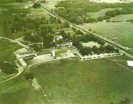
The Warrington Mill is not mentioned in Woodward’s 1883 county history, and it is virtually forgotten today except by one or two people. It is possible and likely that a sportsmen club used the millpond. Nearby is the Delran gun range, which might be a remainder of that club.
During the late 1920s or early 1930s, the Delaware River Sand Dredging Company, owned by the Reeder family of Bordentown, began pulling sand and gravel from what we know today as Dredge Harbor. This work continued for some years. They also owned the land for dredging where the housing development known as Riverside Park sits. When the Second World War ended, the company saw an opportunity to take advantage of the GI Bill of Rights mortgage guarantee and built dwellings for returning veterans. The Parsons purchased Dredge Harbor to create a boating center, even with dredging operations continuing.
As the dredges found stone in the Dredge Harbor basin, they placed them onshore. Some Eastern Europeans offered to buy the stone, and they proceeded to build houses, walls, and garages with that stone along River Road and in Cambridge.
This obituary might interest you relative to Dredge Harbor:
https://www.legacy.com/us/obituaries/courierpostonline/name/louis-persic-obituary?id=49286102
The Riverside Historical Society has photographs of the small dredge that operated on Swedes Run if you are interested in viewing those images. Just check the society’s website for their hours. They also have early photographs of the boating center at Dredge Harbor.
Regarding the township history on the Delran website, years ago I knew the man, now many years deceased, that wrote it, and I can’t begin to tell how many errors his text contains.
Best regards,
Jerseyman