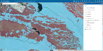
Yes, I think the 1949 is too monotypic (for lack of a better word) for that area. It is mixed in there. Undulating.Interesting to look at the topos through the years. The landcover on the Cook map is significant, it shows a pine forest adjacent to the road with a narrow band of wetlands along the stream then a larger wooded wetlands to the North along the Meschetac...(whatever) Branch.
https://boydsmaps.com/#15.00/39.689518/-74.715691/cook/0.00/0.00
Then the 1949 topo shows a huge swamp across that whole area, with no road and no stream. Is this just poor cartography, or was that whole area actually flooded? The earlier maps all showed those features, so it's not like they didn't know there was a road.
https://boydsmaps.com/#15.00/39.689518/-74.715691/pines1949/0.00/0.00
Cool, I see. Of course, elevation contours are just a low-resolution generalization of real terrain, which is much more complex. I used the older 3-meter LIDAR to generate 2-foot contour lines on my 2017 topo but wasn't very happy with that in the end. However, it shows your "foxhole" very clearly.
https://boydsmaps.com/#17.00/39.690055/-74.716839/pinesHD/0.00/0.00
Last edited:


