Oregon 450 sale at REI

Boyd

Administrator
Staff member
Site Administrator
Jul 31, 2004
9,549
2,809
Ben's Branch, Stephen Creek
You will need to zoom in pretty far for that map to appear. Maybe as much as the 300' level?

Also, I have seen a bug, where the map doesn't show when you first activate it, no matter what. Then if you exit to the menu and return to the map screen, it will show the next time. It may just be that it takes a LONG time to display the first time you access it and I'm not patient enough.

Will that map open in Google Earth for you? It should. If so, you could try saviing to another .kmz file. That may "scrub" out any info which could be creating a problem on the Oregon 450. Somebody else told me that my maps wouldn't display in Basecamp and they used this trick to fix them.
 

Teegate

Administrator
Site Administrator
Sep 17, 2002
25,653
8,265
You will need to zoom in pretty far for that map to appear. Maybe as much as the 300' level?

Also, I have seen a bug, where the map doesn't show when you first activate it, no matter what. Then if you exit to the menu and return to the map screen, it will show the next time. It may just be that it takes a LONG time to display the first time you access it and I'm not patient enough.

Will that map open in Google Earth for you? It should. If so, you could try saviing to another .kmz file. That may "scrub" out any info which could be creating a problem on the Oregon 450. Somebody else told me that my maps wouldn't display in Basecamp and they used this trick to fix them.


Well, the 2007 aerial of Greenwood did show up in Google Earth once but won't anymore. The 24K topo's open fine. I will try your trick and see what happens.

Guy
 

Teegate

Administrator
Site Administrator
Sep 17, 2002
25,653
8,265
I was able to get the 2007 greenwood aerials to open again in Google Earth, and I saved them as a kmz file and named it guy. I put it in the custom map folder and it will not display. I moved all over the area at .2 and even 800 feet.
Guy
 

Teegate

Administrator
Site Administrator
Sep 17, 2002
25,653
8,265
Success with the Greenwood 24K topo. Works well. Finally, a good topo on my GPS!


Guy
 

Boyd

Administrator
Staff member
Site Administrator
Jul 31, 2004
9,549
2,809
Ben's Branch, Stephen Creek
As I said, you may have to zoom in farther than that. Try 500 feet or 300 feet. Garmin has limited this kind of map, and with high resolution source data you have to zoom in farther before it will appear. This is "hardwired" into the format and isn't something I can control as a mapmaker.

Also - you can only have ONE of my .kmz files loaded anywhere on your Oregon (internal memory and/or storage card). To switch to a different map, you have to delete that file and copy the other one to the Oregon. Again, this is just the way Garmin has created this custom map format. Recently they gave a hint that they may make it more flexible in the future, but are not making any promises.

Did you get the Wharton map to work? If not, I will try to have a look tomorrow. But they were all tested on my Oregon 400t. Since the 450 is new, I don't know what might have changed. Kayak Karl was able to use the Wharton map and posted a screenshot here: http://forums.njpinebarrens.com/general-discussion/7182-short-trip.html
 

Teegate

Administrator
Site Administrator
Sep 17, 2002
25,653
8,265
As I said, you may have to zoom in farther than that. Try 500 feet or 300 feet. Garmin has limited this kind of map, and with high resolution source data you have to zoom in farther before it will appear. This is "hardwired" into the format and isn't something I can control as a mapmaker.

Also - you can only have ONE of my .kmz files loaded anywhere on your Oregon (internal memory and/or storage card). To switch to a different map, you have to delete that file and copy the other one to the Oregon. Again, this is just the way Garmin has created this custom map format. Recently they gave a hint that they may make it more flexible in the future, but are not making any promises.

Did you get the Wharton map to work? If not, I will try to have a look tomorrow. But they were all tested on my Oregon 400t. Since the 450 is new, I don't know what might have changed. Kayak Karl was able to use the Wharton map and posted a screenshot here: http://forums.njpinebarrens.com/general-discussion/7182-short-trip.html


The Wharton map would not work either. I will play around more tomorrow and see what I come up with. I do have one map at a time in it.

Thanks for all your help.

Guy
 

Teegate

Administrator
Site Administrator
Sep 17, 2002
25,653
8,265
Byrne aerials work. I must have not zoomed in enough on Wharton so I will try that tomorrow.


Guy
 

Boyd

Administrator
Staff member
Site Administrator
Jul 31, 2004
9,549
2,809
Ben's Branch, Stephen Creek
I never really experimented with it, but the map settings may affect at what zoom level the map will appear. I always have my map detail set to "most". If yours is set to "normal" (which is probably the default), that might be the problem. You will find this by pressing Settings > Map > Advanced Map Setup

menu.jpg


I am not sure whether the detail setting affects this kind of scanned map however. But it's something else you can try if it doesn't work. Note in Karl's screenshot he is zoomed in to 800 ft and in my screenshots it even shows at .8 miles

wharton02.jpg
 

Teegate

Administrator
Site Administrator
Sep 17, 2002
25,653
8,265
I just changed the setting to "most" and I am getting Lebanon at .2. It works well.

Guy
 

Teegate

Administrator
Site Administrator
Sep 17, 2002
25,653
8,265
I loaded in Wharton and it is now working. A couple questions.

How did you take a screenshot?

Can I have the Garmin topo's in and still use yours?

I am going to want to make my own maps for other area's. Did you use the Global Mapper program or another program to make them? If you don't mind can you email me a few quick tips on how make them? I have pieced tiles together before if that is how you do it.

Guy
 

Boyd

Administrator
Staff member
Site Administrator
Jul 31, 2004
9,549
2,809
Ben's Branch, Stephen Creek
That is interesting. I wasn't sure if that detail setting would affect this kind of map, but it's good to know in the future for troubleshooting purposes.

To enable screenshots, go to the display settings. There's an option to turn on the screenshot feature there. After turning it on, just tap the power button and you will snap a picture.

The nice thing about the Oregon and other new units is that there are no limits on the number of map files (except only one of the "custom maps"). You can load maps on the Oregon using Mapsource or Basecamp, just like your 60csx. This will create a file named gmapsupp.img in the Garmin folder on the Oregon (either internal memory or a card, depending on which you choose).

After loading your first map, open the Garmin folder on the GPS and rename the file something descriptive, but be sure to keep the .img file extension. For example, you could name the file GarminTopo.img. To play it safe, only use letters and numbers in the name and no blanks or other characters.

Now you can go back to Mapsource/basecamp and repeat the process if you want to add another map. Also a good idea to back up those files in a folder on your computer. That way, in the future you can just drag and drop the map files to manage them on the GPS. Pick filenames that will make it easy for you to remember what the maps are in the future.

I use GlobalMapper, but that is only because I already have it. Probably overkill to purchase for this purpose and there are several other nice programs for this - but as usual, they are for Windows and not the Mac. I have posted links to some of these here: http://forums.gpsreview.net/viewtopic.php?t=15841

Also a lot of information in Garmin's own forum, with helpful people - including the software developers themselves: https://forums.garmin.com/forumdisplay.php?f=205

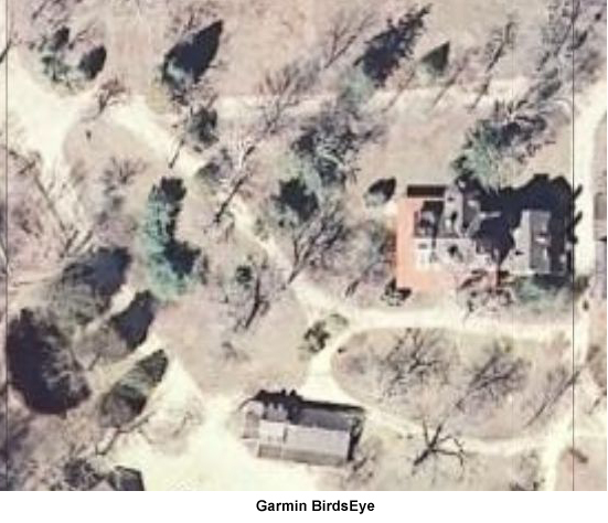
If you want to make maps from the NJ 2007 orthoimagery, I would give some serious thought to getting a BirdsEye subscription instead. It is the same data but only at slightly lower resolution (~2 feet per pixel vs 1 foot per pixel). I posted comparisons in another thread; it looks very nice to me. It's a lot easier than making custom maps and there are no limits as to the size of the map. I put all of the pines plus a big chunk of upstate NJ on a 16GB memory card and have it available everywhere I want to go in this state.

You don't need to renew your subscription after the first year to continue using what you've downloaded. And when you register your Oregon, you get a coupon for a 10% discount, so it ends up costing $27. It's all done in Basecamp, which runs on the Mac. The program is a bit buggy, but still worth it.

If you plug your Oregon in and then run BaseCamp, it should ask if you want to use BirdsEye (have not tried on the Mac, but this is what happens on the PC). Just answer yes and it will get you started. The nice thing is that you don't need to purchase anything to download the imagery to your computer. That part is free, so you can see what you think. It will let you send a small sample - about one mile x one mile - to your GPS. If you decide to purchase, you can do it at any time. That will then allow you to unlock everything you've already downloaded for use on your GPS.

After you've had a chance to absorb some of this, send me an e-mail if you have specific software questions. Or post here if you think they will help others.
 

Teegate

Administrator
Site Administrator
Sep 17, 2002
25,653
8,265
If you plug your Oregon in and then run BaseCamp, it should ask if you want to use BirdsEye (have not tried on the Mac, but this is what happens on the PC). Just answer yes and it will get you started. The nice thing is that you don't need to purchase anything to download the imagery to your computer. That part is free, so you can see what you think. It will let you send a small sample - about one mile x one mile - to your GPS. If you decide to purchase, you can do it at any time. That will then allow you to unlock everything you've already downloaded for use on your GPS.

I just was doing that in BaseCamp and it does ask if you want to purchase. I was thinking about doing that. I have not been able to get a sample though. The button will not highlight. I will play around with it and if I like how it works I will purchase it.

I got the screen capture to work.

http://teegate.njpinebarrens.com/08312010/48.jpg


Guy
 

Boyd

Administrator
Staff member
Site Administrator
Jul 31, 2004
9,549
2,809
Ben's Branch, Stephen Creek
FWIW, here are my comparison images that were posted in this thread: http://forums.njpinebarrens.com/ele...min-birdseye-aerial-imagery-subscription.html

batsto_nj2007.jpg


batsto_birdseye.jpg


The full resolution nj 2007 image is a bit better, but the ease of use plus the amount you can store on the GPS makes BirdsEye more attractive for me. You just need to be patient, because the downloads take awhile and BaseCamp starts acting very slow the more images you add to it. After transferirng them to a memory card, I delete them from BaseCamp. You end up with .jnx files on the card. These can be copied to a folder on your computer as a backup, and could be imported back into Basecamp later if needed (or that is what the developers say, I haven't tried).

See the Basecamp forum at Garmin for more info. There are a bunch of people there who just like to complain unfortunately. Basecamp has it's problems, no doubt. But it is usable and they are improving it. The software developers themselves help people solve problems in the forum.

Mac Basecamp forum: https://forums.garmin.com/forumdisplay.php?f=171

Windows Basecamp forum: https://forums.garmin.com/forumdisplay.php?f=179
 

Teegate

Administrator
Site Administrator
Sep 17, 2002
25,653
8,265
FWIW, here are my comparison images that were posted in this thread: http://forums.njpinebarrens.com/ele...min-birdseye-aerial-imagery-subscription.html


The full resolution nj 2007 image is a bit better, but the ease of use plus the amount you can store on the GPS makes BirdsEye more attractive for me. You just need to be patient, because the downloads take awhile and BaseCamp starts acting very slow the more images you add to it. After transferirng them to a memory card, I delete them from BaseCamp. You end up with .jnx files on the card. These can be copied to a folder on your computer as a backup, and could be imported back into Basecamp later if needed (or that is what the developers say, I haven't tried).

See the Basecamp forum at Garmin for more info. There are a bunch of people there who just like to complain unfortunately. Basecamp has it's problems, no doubt. But it is usable and they are improving it. The software developers themselves help people solve problems in the forum.

Mac Basecamp forum: https://forums.garmin.com/forumdisplay.php?f=171

Windows Basecamp forum: https://forums.garmin.com/forumdisplay.php?f=179

So when I buy the BirdsEye package, I get the photo's and not the aerials? I am really confused as to what is available.

Guy
 

Boyd

Administrator
Staff member
Site Administrator
Jul 31, 2004
9,549
2,809
Ben's Branch, Stephen Creek
In New Jersey, Garmin has used the NJ State 2007 digital orthophotography. This is freely available from the state for download:https://njgin.state.nj.us/NJ_NJGINExplorer/IW.jsp?DLayer=NJ 2007 Orthophotography (2009 redelivery)

I discussed this with Al in a long thread about making maps for his Magellan Triton. I have downloaded all of the full resolution imagery for the pines and have used it myself here plus a couple other maps: http://www.gpsfiledepot.com/maps/view/270/

byrne02.jpg


I sampled those images at 4 feet per pixel in order to cover a larger area since the "custom maps" format is limited. BirdsEye is about 2 feet per pixel. So when you use BirdsEye, you are downloading this same data, but it has been re-packaged in Garmin's own format.

Ben has used the same source for the 2007 NJPB Live Maps, but you can zoom in much farther with Birdseye. Compare the NJPB maps with the screenshots I posted of the Batsto mansion above: http://maps.njpinebarrens.com/#lat=39.64344537480125&lng=-74.64800119400024&z=17&type=nj2007&gpx=

In other states and countries, Garmin has used different sources for the imagery. I suspect they use the state provided ones in NJ because they are free, and also very good. The primary partner for the download service is a company called Digital Globe that sells satellite photos.
 

46er

Piney
Mar 24, 2004
8,837
2,143
Coastal NJ
Boyd,

Have you seen any of Garmins 24K topo's for the National Parks? I've used the Nat Geo paper maps for a number of years, but their maps will not work on the 450.
 

Boyd

Administrator
Staff member
Site Administrator
Jul 31, 2004
9,549
2,809
Ben's Branch, Stephen Creek
I think Garmin national park maps have been discontinued... they are not listed on Garmin's site anymore: http://www.garmin.com/garmin/cms/cache/offonce/us/maps/onthetrailmaps
My understanding is that they have been replaced by the Garmin 24k topo's. I have the NorthEast 24k topo on a pre-loaded data card. Personally, I find the style of the map really ugly. But for the most part, the data looks good. The shaded terrain is especially impressive (I posted about this elsewhere).

They should have much newer road data, from Navteq, just like the City Navigator maps, and they are routable as well. People report that they don't show very many trails. I have really not looked closely enough to have an opinion on that.
 

46er

Piney
Mar 24, 2004
8,837
2,143
Coastal NJ
I think Garmin national park maps have been discontinued... they are not listed on Garmin's site anymore

They are discontinued, but are available on EBay.

The 450 gets delivered tomorrow, I'll see how well the parks I need show on it. Headed to Acadia the end of the month and I have yours from FileDepot for that. Next summer we'll be heading back out west to Glacier and Yellowstone.
 

Boyd

Administrator
Staff member
Site Administrator
Jul 31, 2004
9,549
2,809
Ben's Branch, Stephen Creek
For Windows users: Garmin just posted an update to BaseCamp here: http://www8.garmin.com/support/download_details.jsp?id=4435

Looks like a nice list of bug fixes. Also note the system requirements. If you use BirdsEye, you are going to want a fast machine with a lot of memory. The 2GB figure they mention sounds conservative to me. This program will gobble up all of your resources very quickly. :)
 

Boyd

Administrator
Staff member
Site Administrator
Jul 31, 2004
9,549
2,809
Ben's Branch, Stephen Creek
Just read elsewhere that the REI Oregon 450 is now on backorder. If you want one of these and haven't ordered it yet, time is running out. :)
 
Top