
Maybe some of you are already familiar with OziExplorer which lets you make maps, plot routes, etc on your PC: http://www.oziexplorer.com/
Well they now also have a version of the program which runs on the "Pocket PC" platform, including Windows CE. I recently picked up a Mio c520 which is an "all-in-one" auto navigator similar to the TomTom, Garmin and Magellan units.
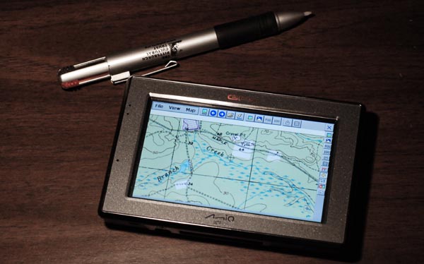
There are many hacks which you can do to these units to customize everything, because "under the hood" they're actually just Windows CE handheld computers with built-in GPS'es. Well I just learned that they will run OziExplorer CE very nicely once you "unlock" them. I think I have finally found my ideal GPS for exploring the pines!
You can make your own maps by scanning them, downloading from the internet or purchasing. There are some utilities which will even help you build them from Google Maps webpages. I had downloaded the ones shown here as Geo TIFF's awhile ago from Topozone.
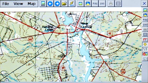
They look great on the screen and the software is really powerful with features I haven't even started to understand. You do need to use a stylus however since all the buttons are very tiny, but this doesn't really bother me. There's also a companion program which lets you design your own screen layouts and interface.
So you can have a regualr auto GPS with spoken directions and maps of the whole US, plus USGS Topo Maps and Google Earth photos all in one little package. Very Cool")
You can download a free demo version of OziExplorer CE here if you have a Windows CE device (like a PDA or smartphone): http://www.oziexplorer3.com/ozice/oziexplorerce1.html
Download the free trial of the full version for your Windows PC here: http://www.oziexplorer3.com/eng/oziexplorer.html
Well they now also have a version of the program which runs on the "Pocket PC" platform, including Windows CE. I recently picked up a Mio c520 which is an "all-in-one" auto navigator similar to the TomTom, Garmin and Magellan units.
There are many hacks which you can do to these units to customize everything, because "under the hood" they're actually just Windows CE handheld computers with built-in GPS'es. Well I just learned that they will run OziExplorer CE very nicely once you "unlock" them. I think I have finally found my ideal GPS for exploring the pines!
You can make your own maps by scanning them, downloading from the internet or purchasing. There are some utilities which will even help you build them from Google Maps webpages. I had downloaded the ones shown here as Geo TIFF's awhile ago from Topozone.
They look great on the screen and the software is really powerful with features I haven't even started to understand. You do need to use a stylus however since all the buttons are very tiny, but this doesn't really bother me. There's also a companion program which lets you design your own screen layouts and interface.
So you can have a regualr auto GPS with spoken directions and maps of the whole US, plus USGS Topo Maps and Google Earth photos all in one little package. Very Cool
You can download a free demo version of OziExplorer CE here if you have a Windows CE device (like a PDA or smartphone): http://www.oziexplorer3.com/ozice/oziexplorerce1.html
Download the free trial of the full version for your Windows PC here: http://www.oziexplorer3.com/eng/oziexplorer.html