Penn State Forest Hike

Glenn Walters

Explorer
Oct 2, 2013
190
64
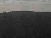
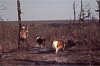
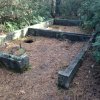
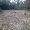
Took a walk in the woods this past Tuesday. Some awesome views of Bear Swamp Hill and the Pigmy Pines from Spring Hill. Great weather. Great time.
 

Attachments

  • IMG_0181.JPG
    IMG_0181.JPG
    2.9 MB · Views: 389
  • IMG_0182.JPG
    IMG_0182.JPG
    2.7 MB · Views: 533
  • IMG_0183.JPG
    IMG_0183.JPG
    1 MB · Views: 383
  • IMG_0185.JPG
    IMG_0185.JPG
    875.1 KB · Views: 378
  • IMG_0186.JPG
    IMG_0186.JPG
    863.5 KB · Views: 377
  • IMG_0187.JPG
    IMG_0187.JPG
    827.8 KB · Views: 341
  • IMG_0188.JPG
    IMG_0188.JPG
    677.2 KB · Views: 331
  • IMG_0189.JPG
    IMG_0189.JPG
    1.5 MB · Views: 403
  • IMG_0186.JPG
    IMG_0186.JPG
    863.5 KB · Views: 329
  • IMG_0189.JPG
    IMG_0189.JPG
    1.5 MB · Views: 355

Glenn Walters

Explorer
Oct 2, 2013
190
64
I entered from Old Tuckerton Road. Did a Square loop. Started on Bear Swamp then up to Spring Hill. Saw some old footings from fire tower and other structures. Found two deer stands. Pic of wooden one. There was a scary metal on too. lol Looked for spot that I pulled from archive pics on this site(first pic). Apparently the Pines claim a lot back in a few decades since that pic. scoured the entire hilltop to no avail. Still a great walk.
 

Attachments

  • IMG_0015.JPG
    IMG_0015.JPG
    154.7 KB · Views: 342
  • IMG_0162.JPG
    IMG_0162.JPG
    649.4 KB · Views: 370
  • IMG_0164.JPG
    IMG_0164.JPG
    2.8 MB · Views: 344
  • IMG_0165.JPG
    IMG_0165.JPG
    3.5 MB · Views: 395
  • IMG_0167.JPG
    IMG_0167.JPG
    3.6 MB · Views: 352
  • IMG_0169.JPG
    IMG_0169.JPG
    2.6 MB · Views: 349
  • IMG_0170.JPG
    IMG_0170.JPG
    1.5 MB · Views: 327
  • Like
Reactions: MikeBickerson

Teegate

Administrator
Site Administrator
Sep 17, 2002
25,603
8,181
I will post photos later today. The ruins you saw at Bear Swamp Hill are the foundations for the bathrooms that were there. Notice the hole in the photo. Just saying :D.

It was a very popular place before the plane crashed into the tower. I also have the same photo of Bear Swamp Hill that I took almost 40 years ago so we can compare. And the photo of Elizabeth Morgan was right after the plane crash which has fully grown up since then. I was there and can't remember exactly where it was.

Nice report.

Don't take this the wrong way. I am just trying to let everyone know about this.

I just wanted to let everyone know that if you post photos on this site you should try and cut the size back on them. You can do this in any photo program. Take notice that the size of the Elizabeth Morgan photo is 154K. Notice the one below it is 2.8MB. It is 18 times larger for one photo. So you could upload 18 Elizabeth Morgan photos and equal in size the one below it.

So I have taken that same photo and sized it to 1000 x 1000 pixels. Notice the size is now just 249K. This makes it easier to load and view and still be the same viewing size and very good quality.
 

Attachments

  • IMG_0164.jpg
    IMG_0164.jpg
    249.6 KB · Views: 335
  • Like
Reactions: Boyd

Boyd

Administrator
Staff member
Site Administrator
Jul 31, 2004
9,506
2,768
Ben's Branch, Stephen Creek
I just wanted to let everyone know that if you post photos on this site you should try and cut the size back on them.

I really wish everyone would take heed of this good advice. Some of us old pineys don't have access to cable or FIOS and are stuck with slow DSL connections. Those big photos can be a real problem, although it's good that you posted them as thumbnails instead of full size. :)
 

46er

Piney
Mar 24, 2004
8,837
2,143
Coastal NJ
Don't take this the wrong way. I am just trying to let everyone know about this.

I just wanted to let everyone know that if you post photos on this site you should try and cut the size back on them. You can do this in any photo program. Take notice that the size of the Elizabeth Morgan photo is 154K. Notice the one below it is 2.8MB. It is 18 times larger for one photo. So you could upload 18 Elizabeth Morgan photos and equal in size the one below it.

So I have taken that same photo and sized it to 1000 x 1000 pixels. Notice the size is now just 249K. This makes it easier to load and view and still be the same viewing size and very good quality.

Tee, is there any way that during the new user registration a page with this type of helpful info, like the FAQ, could be displayed to the person just before completing the registration? The info is in the FAQ, but folks may not take a look. Most FAQ's are like that ;)
 

Glenn Walters

Explorer
Oct 2, 2013
190
64
No. I never take good advice the wrong way. if its not too late can I change these ones. I completely understand. no need for me to hog all the space on the site. I will definitely do that in the future. I did figure it was an old bathroom. And I would have loved to see it when it was cleared out like that. the view must have been awesome. Sad what happened though. Wish I had seen it before the crash too. Its still a cool place to walk in the woods. and the view of the hill from Spring Hill is awesome. I will be back there often. So apparently the view of the pigmy pines from Spring Hill is the north side of Warren Grove, right?
 

Glenn Walters

Explorer
Oct 2, 2013
190
64
Can I delete them and repost them. I can do that if it works like that. It wont take me long and I don't mind
 

Teegate

Administrator
Site Administrator
Sep 17, 2002
25,603
8,181
Can I delete them and repost them. I can do that if it works like that. It wont take me long and I don't mind

At this point they are already up so just remember for the next time. I have a Mac but it appears the program "Paint" that comes with Windows will resize them. Just make them 800 to 1000 pixels across or so. IT IS IMPORTANT to remember to NOT replace your original files. Always save them as a new file or you will not have the full size photo again.
 

Teegate

Administrator
Site Administrator
Sep 17, 2002
25,603
8,181
Here are the bathrooms at Bear Swamp Hill around 1978. I would have to dig out my slides to find the exact development date. You can just see the base of it that are shown in your photo.


5a.jpg


And here is one showing the damaged trees about where the plane mostly ended up at after hitting the tower. Again, about 1978 or so.


39.jpg


Guy
 
  • Like
Reactions: h2ochild

SuperChooch

Explorer
Aug 26, 2011
391
428
47
Here are the bathrooms at Bear Swamp Hill around 1978. I would have to dig out my slides to find the exact development date. You can just see the base of it that are shown in your photo.


5a.jpg


And here is one showing the damaged trees about where the plane mostly ended up at after hitting the tower. Again, about 1978 or so.


39.jpg


Guy
Why did they have bathrooms out there? Just to support the fire tower?
 

Teegate

Administrator
Site Administrator
Sep 17, 2002
25,603
8,181
Somewhat. The Penn State Forest and Bear Swamp Hill in particular was a fairly popular spot for people to visit back then. It was considered a "recreation area" and was promoted as that. The road in from the east was fully paved right to the tower.

Here is a 1949 Whiting Topo.


rec.jpg
 

SuperChooch

Explorer
Aug 26, 2011
391
428
47
Somewhat. The Penn State Forest and Bear Swamp Hill in particular was a fairly popular spot for people to visit back then. It was considered a "recreation area" and was promoted as that. The road in from the east was fully paved right to the tower.

Here is a 1949 Whiting Topo.


View attachment 6726

Huh, I always thought of Penn as the less developed forest. I never pictured it as more of a destination in the past than it is today
 

Pinesbucks

Explorer
Apr 15, 2013
295
111
A long time ago andrews road was open all the way through to lake oswego from bass river as well. Allen road was paved. It was a destination point for many years as previously stated. That road leading up to bear swamp is still partially paved but has a bad washout in it. Going in I had to really hug it to the left in my frontier this year.
 

Teegate

Administrator
Site Administrator
Sep 17, 2002
25,603
8,181
Allen Road was closed after the town gave the road to Haines because of an incident at the bridge and a threat of a lawsuit. I have the deed transfer around here somewhere. And I suspect the Feds were happy about limiting the traffic in the area of the bombing range.
 
  • Like
Reactions: SuperChooch
Top