Prescribed Burning Today - Wharton, other sites

Teegate

Administrator
Site Administrator
Sep 17, 2002
25,786
8,432
Burning today in the Maple Lake WMA (former Estell Manor Game Preserve, which was briefly named the Lenape Farms WMA before being merged into Maple Lake).

https://boydsmaps.com/#15.00/39.402178/-74.804846/legacy24k/0.00/0.00

Good day for a burn, not much wind and rain is coming tonight. They put up some temporary warning signs yesterday but I don't know if they actually started, didn't notice any smoke at my place nearby. Yesterday there was also a temporary sign on Tuckahoe Rd that said something like "warning: low visibility, smoke in road". Didn't see or smell any smoke, not sure if it was left over from Wednesday or a warning for something that hadn't happened yet.

https://boydsmaps.com/#15.00/39.403815/-74.827011/legacy24k/0.00/0.00

That is odd because their website does not show burns today down that way.
 

Boyd

Administrator
Staff member
Site Administrator
Jul 31, 2004
9,671
2,874
Ben's Branch, Stephen Creek
Well, it was still smoldering this morning. Then, when I went for my noon walk I could hear chainsaws and equipment in the distance. Also heard a very loud helicopter after I got home but didn't go out to look. A lot of big Coast Guard choppers fly right over me, but this sounded closer. My property borders on another part of the Maple Lake WMA. Possible that it was still smoldering after burning yesterday, but they were definitely still in the area today.

Meant to post earlier, but they have also burned this section of the Peaslee WMA, North of the road - basically the same area they burned last year. I think they did this at the end of last week, it was smoldering when I drove past and I think that was Saturday.

https://boydsmaps.com/#15.00/39.407218/-74.894067/legacy24k/0.00/0.00

Also noticed they have burned and plowed some new trenches North of First Ave around here (also Peaslee)

https://boydsmaps.com/#15.00/39.337650/-74.843126/legacy24k/0.00/0.00

Also along Hunters Mill Rd around here (IIRC). I believe these were done earlier this week.

https://boydsmaps.com/#15.00/39.310826/-74.878016/legacy24k/0.00/0.00

note: fixed wrong link above ^
 
Last edited:

stiltzkin

Explorer
Feb 8, 2022
496
717
Medford
Here is Penn State Forest in progress just north of Oswego Lake. About 10AM yesterday.

psfburn.jpg


And another area in Greenwood, about the same time.

greenwood-burn.jpg


Imagery copyright Planet Labs Inc.
 

Boyd

Administrator
Staff member
Site Administrator
Jul 31, 2004
9,671
2,874
Ben's Branch, Stephen Creek
They are busy down here today. Hunters Mill Road is closed here with a barricade at Route 49 so you can't enter to go South. On my morning drive, I took 49 North/West to this road through Peaslee and after passing four cars going the other way, wondered what was going on. Turned out that Hesstown Road was closed and blocked by a couple (un-labelled) trucks with flashing police lights. Westbound traffic on Hesstown Rd has to detour South on the unpaved road to reach Rt 49.

Must be doing something big to justify closing a moderately-heavily used road like this. On the way back I noticed there were no signs warning that the road was closed ahead. So, somebody could drive about three or four miles down Hesstown Rd and then learn they need to take a two mile detour on an unpaved road.
 

Boyd

Administrator
Staff member
Site Administrator
Jul 31, 2004
9,671
2,874
Ben's Branch, Stephen Creek
Ah, that explains it, thanks. Would be nice if they posted some signs, the people I passed detouring on that dirt road looked a bit concerned, especially the guy from PA in a regular car. :D
 
  • Angry
Reactions: manumuskin

manumuskin

Piney
Jul 20, 2003
8,617
2,532
60
millville nj
www.youtube.com
Ah, that explains it, thanks. Would be nice if they posted some signs, the people I passed detouring on that dirt road looked a bit concerned, especially the guy from PA in a regular car. :D
It's things like this that will have me hurling nasty words out the car window.Very inconsiderate usually things like this happen because morons are running the show. That north south rd long time ago had some really nasty holes about here https://boydsmaps.com/#15.00/39.378696/-74.902800/legacy24k/0.00/0.00 I take it thats been remedied now?
 

Boyd

Administrator
Staff member
Site Administrator
Jul 31, 2004
9,671
2,874
Ben's Branch, Stephen Creek
Al, your link is the same as the one I posted, at the intersection with Hesstown Road. But actually, I would call the condition of that North/South road very good by pinelands standards and wouldn't be worried driving on it in a regular car. But that's me and I know the road.

I'm fine with the Enduro events as long as they follow all the rules, and this one was not problem at all for me - I was just killing a little time on a Sunday morning drive. But for somebody just passing through, it's rather rude to block off a County Route (Hesstown Rd) where you either have to turn around and go back four miles or else detour on a dirt road you know nothing about. If I had never taken that road before, I'd be wondering just how far it went, what was up ahead and where the hell I'd be at the other end. :D

There was no signage anywhere, just a couple guys sitting in unmarked trucks with flashing lights, blocking the road. The people detouring looked genuinely thankful when I pulled off to the side to let them pass. But to be fair, maybe this only happened for 10 minutes and I just happened to catch it?
 

stiltzkin

Explorer
Feb 8, 2022
496
717
Medford
Where do you get this timely coverage? Planet labs? do they update certain areas regularly?
On the Planet.com site now but can't find their viewer????

You would need to request an account first and have it approved. I was able to get a free Education and Research account with university affiliation. It provides access to their 3m imagery, with a monthly download limit, but it's some huge amount of coverage I would never get close to hitting. They have 0.5m imagery available as well, but not in the free tier.

The images I posted are from SuperDove, their constellation of a few hundred mini satellites. They've been launching them on SpaceX flights. Generally new imagery is available daily, at least in the areas I've been interested in. Since it's satellite photography, though, atmospheric conditions need to be fairly clear in order to get good images. When you have a day like yesterday, with 100% cloud cover, the results are unusable:

whiteout.jpg

Imagery copyright Planet Labs Inc.
 

stiltzkin

Explorer
Feb 8, 2022
496
717
Medford
Double posting but I'll just also mention: one of the best features of their viewer is the comparison tool, which allows you to put imagery from two different dates side by side and then drag a slider back and forth between them to directly show the differences. This is very useful for viewing changes in an area over time.

For example, here's the Mullica River Fire, June 5 vs June 29, 2022:

comparison.gif

Imagery copyright Planet Labs Inc.

Perhaps a potential future mode to complement Map Sync on your site, Boyd? ;)
 

manumuskin

Piney
Jul 20, 2003
8,617
2,532
60
millville nj
www.youtube.com
Al, your link is the same as the one I posted, at the intersection with Hesstown Road. But actually, I would call the condition of that North/South road very good by pinelands standards and wouldn't be worried driving on it in a regular car. But that's me and I know the road.

I'm fine with the Enduro events as long as they follow all the rules, and this one was not problem at all for me - I was just killing a little time on a Sunday morning drive. But for somebody just passing through, it's rather rude to block off a County Route (Hesstown Rd) where you either have to turn around and go back four miles or else detour on a dirt road you know nothing about. If I had never taken that road before, I'd be wondering just how far it went, what was up ahead and where the hell I'd be at the other end. :D

There was no signage anywhere, just a couple guys sitting in unmarked trucks with flashing lights, blocking the road. The people detouring looked genuinely thankful when I pulled off to the side to let them pass. But to be fair, maybe this only happened for 10 minutes and I just happened to catch it?


I went maybe a quarter mile down that road a couple years ago to see a tar kiln but haven't tried driving it through in maybe ten years.last time I tried that low area maybe a half mile south of Hesstown had a very nasty looking hole in it.Thats where i tried to link to.It was something that looked dicey even for my at the time four wheel drive Vitara.Might try it today with my Xterra.More clearance and better tires. Thats kinda like where Boyd Country and Manumuskin country melt together:)
 
  • Haha
Reactions: Boyd

smoke_jumper

Piney
Mar 5, 2012
1,555
1,082
Atco, NJ
Double posting but I'll just also mention: one of the best features of their viewer is the comparison tool, which allows you to put imagery from two different dates side by side and then drag a slider back and forth between them to directly show the differences. This is very useful for viewing changes in an area over time.

For example, here's the Mullica River Fire, June 5 vs June 29, 2022:

View attachment 19551
Imagery copyright Planet Labs Inc.

Perhaps a potential future mode to complement Map Sync on your site, Boyd? ;)
That’s really cool. Not only did the area burn but the lake filled up too.
 
  • Like
Reactions: stiltzkin
D

Deleted member 7363

Guest
Double posting but I'll just also mention: one of the best features of their viewer is the comparison tool, which allows you to put imagery from two different dates side by side and then drag a slider back and forth between them to directly show the differences. This is very useful for viewing changes in an area over time.

For example, here's the Mullica River Fire, June 5 vs June 29, 2022:

View attachment 19551
Imagery copyright Planet Labs Inc.

Perhaps a potential future mode to complement Map Sync on your site, Boyd? ;)
That is interesting, the fire did not penetrate a large area of forest in the SE area. Wet lowlands, or low fuel levels in oak uplands?
 

Wick

Explorer
Mar 6, 2016
444
327
Forked River
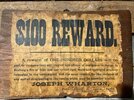
Read this forum last week and noticed this sign in Allens Clam Bar near the bathroom yesterday. I guess this was to stop or curtail people burning his lands from illegal activities?
 

Attachments

  • JWSIMG_2536.jpg
    JWSIMG_2536.jpg
    59.4 KB · Views: 60
D

Deleted member 7363

Guest
Read this forum last week and noticed this sign in Allens Clam Bar near the bathroom yesterday. I guess this was to stop or curtail people burning his lands from illegal activities?
Too small to read, but back in the 19th century or early 20th century when he owned the lands, wildfire was a really big problem to regeneration of the forest. Wharton may have wanted trees for charcoal production, too, but maybe not as fossil coal likely replaced wood charcoal by 1873.

Wharton SF had huge areas cleared of tree. You can see the open areas in this site's old 1930s aerial photos. Unlike longleaf, both pitch and shortleaf require a few fire free years to grow above the level where fire will kill them. Both pitch and shortleaf will sprout from their base post fire, at least.

I don't know enough about the forestry history of the pinelands to know why loblolly pine never really got planted here. We have areas with soils that can support it. You can see pretty large loblolly pines around the Lebanon SF fire tower, and the state planted some seedlings there in the late 1990s, or they seeded in naturally at a very high stocking level.

I'm not confused as to why longleaf never got planted in NJ, though. Foresters considered it too hard to plant widely back then, and that is one reason why loblolly and slash got planted so widely. Longleaf might have been a viable southern pine to plant in NJ back then, as it can take fire pretty well when young. If the site was managed, we might have acres and acres of longleaf in NJ. I never got out onto the ranges at Ft Dix when I worked there in 2006, but I was told the area still burns similar to how it was pre-1930 in NJ. It would be pretty neat to start planting NC and VA sourced longleaf out on the ranges to see what happens.

This of course, has nothing to do with your photo.
 
Last edited by a moderator:
Top