Red Flag Warning

Boyd

Administrator
Staff member
Site Administrator
Jul 31, 2004
9,547
2,806
Ben's Branch, Stephen Creek
Red Flag Warning
URGENT - FIRE WEATHER MESSAGE
National Weather Service Mount Holly NJ
345 AM EDT Sun Mar 19 2023

...Gusty Winds and Low Humidity For Today Combining with Dry Fine
Fuels...

.In the wake of a dry cold front, low humidity and gusty west-
northwest winds will combine with dry fuels, resulting in critical
fire weather conditions, especially this afternoon. Winds will
relax tonight into Monday, but humidity will remain low.

NJZ001-007>010-012>027-192000-
/O.CON.KPHI.FW.W.0001.230319T1400Z-230320T0000Z/
Sussex-Warren-Morris-Hunterdon-Somerset-Middlesex-
Western Monmouth-Eastern Monmouth-Mercer-Salem-Gloucester-Camden-
Northwestern Burlington-Ocean-Cumberland-Atlantic-Cape May-
Atlantic Coastal Cape May-Coastal Atlantic-Coastal Ocean-
Southeastern Burlington-
345 AM EDT Sun Mar 19 2023

...RED FLAG WARNING REMAINS IN EFFECT FROM 10 AM THIS MORNING TO
8 PM EDT THIS EVENING FOR GUSTY WINDS AND LOW RELATIVE HUMIDITY
FOR MUCH OF NORTHWEST, CENTRAL AND SOUTHERN NEW JERSEY...

* AFFECTED AREA...Sussex, Warren, Morris, Hunterdon, Somerset,
Middlesex, Western Monmouth, Eastern Monmouth, Mercer, Salem,
Gloucester, Camden, Northwestern Burlington, Ocean,
Cumberland, Atlantic, Cape May, Atlantic Coastal Cape May,
Coastal Atlantic, Coastal Ocean and Southeastern Burlington.

* TIMING...10 AM to 8 PM Today.

* WINDS...West-northwest 12 to 20 mph with gusts up to 30 mph.

* RELATIVE HUMIDITY...Recoveries only 40 to 50 percent early this
morning, with minimum humidity 20 to 25 percent this afternoon.

* TEMPERATURES...Mid 30s to mid 40s.

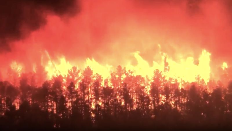
* IMPACTS...Critical fire weather conditions could cause rapid
wildfire growth and spread if ignition occurs.

PRECAUTIONARY/PREPAREDNESS ACTIONS...

A Red Flag Warning means that critical fire weather conditions
are either occurring now, or will shortly due to a combination of
strong winds, low relative humidity, and dry fuels. Any fires
that develop may quickly get out of control and become difficult
to contain.

For more information about wildfire danger, burn restrictions,
and wildfire prevention and education, please visit your state
forestry or environmental protection website.
 

Teegate

Administrator
Site Administrator
Sep 17, 2002
25,642
8,250
There is a fire in Whiting and 539 is closed near Route 70. That is not a good area to have a fire.
 
  • Wow
Reactions: Boyd

Boyd

Administrator
Staff member
Site Administrator
Jul 31, 2004
9,547
2,806
Ben's Branch, Stephen Creek
Special Weather Statement
National Weather Service Mount Holly NJ
324 AM EDT Wed Apr 12 2023

DEZ001>004-NJZ001-007>010-012>027-130000-
New Castle-Kent-Inland Sussex-Delaware Beaches-Sussex-Warren-
Morris-Hunterdon-Somerset-Middlesex-Western Monmouth-
Eastern Monmouth-Mercer-Salem-Gloucester-Camden-
Northwestern Burlington-Ocean-Cumberland-Atlantic-Cape May-
Atlantic Coastal Cape May-Coastal Atlantic-Coastal Ocean-
Southeastern Burlington-
Including the cities of Wilmington, Dover, Georgetown,
Rehoboth Beach, Newton, Washington, Morristown, Flemington,
Somerville, New Brunswick, Freehold, Sandy Hook, Trenton,
Pennsville, Glassboro, Camden, Cherry Hill, Moorestown,
Mount Holly, Jackson, Millville, Hammonton, Cape May Court House,
Ocean City, Atlantic City, Long Beach Island,
and Wharton State Forest
324 AM EDT Wed Apr 12 2023

...ELEVATED RISK OF WILDFIRE SPREAD THIS AFTERNOON AND EARLY THIS
EVENING...

A combination of low relative humidity, gusty westerly winds, and
dry fine fuels will lead to an elevated risk for fire spread with
any potential fire starts this afternoon across both New Jersey
and Delaware. Minimum relative humidity values this afternoon will
range from 25 to 30 percent across the region. Winds will be
sustained from 10 to 15 mph with gusts around 20 to 25 mph,
highest around mid to late afternoon. Fine fuel moisture may be
somewhat of a limiting factor from reaching true Red Flag Warning
conditions, mainly across southern New Jersey, due to rainfall
last Friday and perhaps some degree of greenup beginning. However,
with a few wildfires started across the region on Tuesday, dry and
dead vegetation is clearly receptive to fire starts and fire
spread.

Residents are urged to exercise caution if handling any potential
ignition source, including machinery, cigarettes, and matches. Be
sure to properly discard all smoking materials. Any dry grasses,
dead leaves, and other tree litter that ignite will have the
potential to spread fire quickly.

For more information about wildfire danger, burn restrictions,
and wildfire prevention and eduction, please visit your state`s
forestry or environmental protection website.
 

Boyd

Administrator
Staff member
Site Administrator
Jul 31, 2004
9,547
2,806
Ben's Branch, Stephen Creek
Special Weather Statement
National Weather Service Mount Holly NJ
238 AM EDT Thu Apr 13 2023

DEZ001>004-MDZ012-015-019-020-NJZ001-007>010-012>027-PAZ054-055-
060>062-070-071-101>106-140000-
New Castle-Kent-Inland Sussex-Delaware Beaches-Kent MD-
Queen Annes-Talbot-Caroline-Sussex-Warren-Morris-Hunterdon-
Somerset-Middlesex-Western Monmouth-Eastern Monmouth-Mercer-Salem-
Gloucester-Camden-Northwestern Burlington-Ocean-Cumberland-
Atlantic-Cape May-Atlantic Coastal Cape May-Coastal Atlantic-
Coastal Ocean-Southeastern Burlington-Carbon-Monroe-Berks-Lehigh-
Northampton-Delaware-Philadelphia-Western Chester-Eastern Chester-
Western Montgomery-Eastern Montgomery-Upper Bucks-Lower Bucks-
Including the cities of Wilmington, Dover, Georgetown,
Rehoboth Beach, Chestertown, Centreville, Easton, Denton, Newton,
Washington, Morristown, Flemington, Somerville, New Brunswick,
Freehold, Sandy Hook, Trenton, Pennsville, Glassboro, Camden,
Cherry Hill, Moorestown, Mount Holly, Jackson, Millville,
Hammonton, Cape May Court House, Ocean City, Atlantic City,
Long Beach Island, Wharton State Forest, Jim Thorpe, Stroudsburg,
Reading, Allentown, Bethlehem, Media, Philadelphia, Honey Brook,
Oxford, West Chester, Kennett Square, Collegeville, Pottstown,
Norristown, Lansdale, Chalfont, Perkasie, Morrisville,
and Doylestown
238 AM EDT Thu Apr 13 2023

...ELEVATED RISK OF WILDFIRE SPREAD THIS AFTERNOON INTO THIS
EVENING...

A combination of low relative humidity, westerly breezes, and dry
fine fuels will lead to an elevated risk for fire spread with any
potential fire starts Thursday afternoon and evening across
eastern Pennsylvania, New Jersey, Delaware, and the eastern shores
of Maryland.

Minimum relative humidity values this afternoon will range from
22 to 26 percent across the region. Winds will be somewhat lighter
and not as gusty as the past couple of days. However, this
afternoon into early evening west winds will still be sustained 8
to 12 mph, and a brief gust to 20 mph cannot be ruled out. Fine
fuels in the form of dry or dead vegetation will be quite dry as
well, and conducive to fire starts and fairly quick fire spread.
This is particularly true in areas that have not received hardly
any rainfall in the last 10 days, across much of Pennsylvania to
northern and central New Jersey.

Residents are urged to exercise caution if handling any potential
ignition source, including machinery, cigarettes, and matches. Be
sure to properly discard all smoking materials. Any dry grasses,
dead leaves, and other tree litter that ignite will have the
potential to spread fire quickly.

For more information about wildfire danger, burn restrictions,
and wildfire prevention and eduction, please visit your state`s
forestry or environmental protection website.
 

Boyd

Administrator
Staff member
Site Administrator
Jul 31, 2004
9,547
2,806
Ben's Branch, Stephen Creek
URGENT - FIRE WEATHER MESSAGE
National Weather Service Mount Holly NJ
324 AM EDT Wed May 17 2023

NJZ017>020-022-027-180000-
/O.CON.KPHI.FW.W.0005.230517T1300Z-230518T0000Z/
Gloucester-Camden-Northwestern Burlington-Ocean-Atlantic-
Southeastern Burlington-
324 AM EDT Wed May 17 2023

...RED FLAG WARNING REMAINS IN EFFECT FROM 9 AM THIS MORNING TO 8
PM EDT THIS EVENING FOR GUSTY WINDS AND LOW RELATIVE HUMIDITY FOR
PARTS OF SOUTHERN NEW JERSEY..

* AFFECTED AREA...The New Jersey counties of Gloucester, Camden,
Burlington, Ocean and Atlantic.

* TIMING...This morning through early this evening.

* WINDS...North 10 to 15 mph gusting to 20 to 25 mph.

* RELATIVE HUMIDITY...As low as 20 percent.

* TEMPERATURES...Reaching 65 to 70 degrees.

* IMPACTS...The combination of dry conditions, low relative
humidity and gusty winds will result in favorable conditions for
the rapid spread of wildfires today.
 

Boyd

Administrator
Staff member
Site Administrator
Jul 31, 2004
9,547
2,806
Ben's Branch, Stephen Creek
URGENT - FIRE WEATHER MESSAGE
National Weather Service Mount Holly NJ
323 PM EDT Mon Jun 5 2023

Sussex-Warren-Morris-Hunterdon-Somerset-Middlesex-
Western Monmouth-Eastern Monmouth-Mercer-Salem-Gloucester-Camden-
Northwestern Burlington-Ocean-Cumberland-Atlantic-Cape May-
Atlantic Coastal Cape May-Coastal Atlantic-Coastal Ocean-
Southeastern Burlington-Carbon-Monroe-Berks-Lehigh-Northampton-
Delaware-Philadelphia-Western Chester-Eastern Chester-
Western Montgomery-Eastern Montgomery-Upper Bucks-Lower Bucks-
323 PM EDT Mon Jun 5 2023

...FIRE WEATHER WATCH IN EFFECT FROM TUESDAY MORNING THROUGH
TUESDAY EVENING FOR GUSTY WINDS AND LOW RELATIVE HUMIDITY FOR
SOUTHEASTERN PENNSYLVANIA, INCLUDING THE LEHIGH VALLEY AND POCONO
PLATEAU, SOUTHERN AND CENTRAL NEW JERSEY, AND PORTIONS OF
NORTHERN NEW JERSEY...

The National Weather Service in Mount Holly has issued a Fire
Weather Watch for gusty winds and low relative humidity, which is
in effect from Tuesday morning through Tuesday evening.

* AFFECTED AREA...Sussex, Warren, Morris, Hunterdon, Somerset,
Middlesex, Western Monmouth, Eastern Monmouth, Mercer, Salem,
Gloucester, Camden, Northwestern Burlington, Ocean,
Cumberland, Atlantic, Cape May, Atlantic Coastal Cape May,
Coastal Atlantic, Coastal Ocean, Southeastern Burlington,
Carbon, Monroe, Berks, Lehigh, Northampton, Delaware,
Philadelphia, Western Chester, Eastern Chester, Western
Montgomery, Eastern Montgomery, Upper Bucks and Lower Bucks.

* TIMING...

* WINDS...Northwest 10 to 15 mph with gusts up to 25 mph.

* RELATIVE HUMIDITY...As low as 26 percent.

* TEMPERATURES...In the mid 70s to low 80s.

* IMPACTS...

PRECAUTIONARY/PREPAREDNESS ACTIONS...

A Fire Weather Watch means that critical fire weather conditions
are forecast to occur due to a combination of strong winds, low
relative humidities, and dry fuels. Listen for later forecasts
and possible Red Flag Warnings.
 

dragoncjo

Piney
Aug 12, 2005
1,530
242
42
camden county
We got about 1 inch of rain in May and typically get 5-6. It’s once again drying up ponds, canals, etc. Woods is quite quiet, grey tree frogs barely calling because it’s so cool at night.
 

Boyd

Administrator
Staff member
Site Administrator
Jul 31, 2004
9,547
2,806
Ben's Branch, Stephen Creek
URGENT - FIRE WEATHER MESSAGE
National Weather Service Mount Holly NJ
349 AM EDT Tue Jun 6 2023

...CRITICAL FIRE WEATHER CONDITIONS EXPECTED TODAY...

.Low fuel moistures, low daytime relative humidity values, and
breezy conditions will result in critical fire weather conditions
into this afternoon and evening. Any fires that develop may
quickly get out of control and become difficult to contain. There
is also a chance of isolated dry thunderstorms, which could serve
as an ignition source for fires today.

Sussex-Warren-Morris-Hunterdon-Somerset-Middlesex-
Western Monmouth-Eastern Monmouth-Mercer-Salem-Gloucester-Camden-
Northwestern Burlington-Ocean-Cumberland-Atlantic-Cape May-
Atlantic Coastal Cape May-Coastal Atlantic-Coastal Ocean-
Southeastern Burlington-Carbon-Monroe-Berks-Lehigh-Northampton-
Delaware-Philadelphia-Western Chester-Eastern Chester-
Western Montgomery-Eastern Montgomery-Upper Bucks-Lower Bucks-
349 AM EDT Tue Jun 6 2023

...RED FLAG WARNING IN EFFECT FROM 11 AM THIS MORNING TO 8 PM EDT

THIS EVENING FOR GUSTY WINDS AND LOW RELATIVE HUMIDITY FOR SOUTHEASTERN
PENNSYLVANIA, INCLUDING THE LEHIGH VALLEY AND POCONO PLATEAU,
SOUTHERN AND CENTRAL NEW JERSEY, AND PORTIONS OF NORTHERN NEW

JERSEY...

The National Weather Service in Mount Holly has issued a Red Flag
Warning for gusty winds and low relative humidity, which is in
effect from 11 AM this morning to 8 PM EDT this evening. The Fire
Weather Watch is no longer in effect.

* AFFECTED AREA...Sussex, Warren, Morris, Hunterdon, Somerset,
Middlesex, Western Monmouth, Eastern Monmouth, Mercer, Salem,
Gloucester, Camden, Northwestern Burlington, Ocean,
Cumberland, Atlantic, Cape May, Atlantic Coastal Cape May,
Coastal Atlantic, Coastal Ocean, Southeastern Burlington,
Carbon, Monroe, Berks, Lehigh, Northampton, Delaware,
Philadelphia, Western Chester, Eastern Chester, Western
Montgomery, Eastern Montgomery, Upper Bucks and Lower Bucks.

* TIMING...Tuesday morning through Tuesday evening.

* WINDS...Northwest 10 to 15 mph with gusts up to 25 mph.

* RELATIVE HUMIDITY...As low as 25 percent.

* TEMPERATURES...In the mid 70s to low 80s.

* IMPACTS...The combination of very dry conditions, low
humidity, and gusty winds will result in favorable conditions
for the rapid spread of fires on Tuesday.

PRECAUTIONARY/PREPAREDNESS ACTIONS...

A Red Flag Warning means that critical fire weather conditions
are either occurring now, or will shortly due to a combination of
strong winds, low relative humidity, and dry fuels. Any fires
that develop may quickly get out of control and become difficult
to contain.
 
  • Like
Reactions: BeachandBarrens

Boyd

Administrator
Staff member
Site Administrator
Jul 31, 2004
9,547
2,806
Ben's Branch, Stephen Creek
URGENT - FIRE WEATHER MESSAGE
National Weather Service Mount Holly NJ
858 AM EDT Thu Mar 21 2024

...CRITICAL FIRE WEATHER CONDITIONS EXPECTED TODAY...


.Low fuel moistures, low daytime relative humidity values, and
breezy conditions will result in critical fire weather conditions
through the early evening hours. Any fires that develop may

become difficult to contain.

NJZ012>027-212300-
/O.NEW.KPHI.FW.W.0001.240321T1258Z-240321T2300Z/
Middlesex-Western Monmouth-Eastern Monmouth-Mercer-Salem-
Gloucester-Camden-Northwestern Burlington-Ocean-Cumberland-
Atlantic-Cape May-Atlantic Coastal Cape May-Coastal Atlantic-
Coastal Ocean-Southeastern Burlington-
858 AM EDT Thu Mar 21 2024

...RED FLAG WARNING IN EFFECT UNTIL 7 PM EDT THIS EVENING FOR
GUSTY WINDS AND LOW RELATIVE HUMIDITY FOR CENTRAL AND SOUTHERN NEW
JERSEY...

The National Weather Service in Mount Holly has issued a Red Flag
Warning for gusty winds and low relative humidity, which is in
effect until 7 PM EDT this evening.

* AFFECTED AREA...Middlesex, Western Monmouth, Eastern Monmouth,
Mercer, Salem, Gloucester, Camden, Northwestern Burlington,
Ocean, Cumberland, Atlantic, Cape May, Atlantic Coastal Cape
May, Coastal Atlantic, Coastal Ocean and Southeastern
Burlington.

* TIMING...Through early this evening.

* WINDS...Northwest 10 to 20 mph with gusts up to 30 mph.

* RELATIVE HUMIDITY...As low as 21 percent.

* TEMPERATURES...Up to 45.

* IMPACTS...The combination of dry conditions, low relative
humidity, and gusty winds will result in favorable conditions
for the rapid spread of fires. Any fires that develop may become
difficult to contain.

PRECAUTIONARY/PREPAREDNESS ACTIONS...

A Red Flag Warning means that critical fire weather conditions
are either occurring now, or will shortly due to a combination of
strong winds, low relative humidity, and dry fuels. Any fires
that develop may quickly get out of control and become difficult
to contain.


For more information about wildfire danger, burn restrictions,
and wildfire prevention and education, please visit your state
forestry or environmental protection website.
 

GermanG

Piney
Apr 2, 2005
1,113
436
Little Egg Harbor
Is there currently a fire? It smells awfully Smokey in Shamong. Seems late for control burn unless they are trying to kill emerging wildlife like dopes!
How exactly would this be a problem in a naturally fire dependent habitat? And since the prescribed burn season leads right into the highest risk part of the wildfire season, with associated hotter and faster moving fires, if fire was a problem at this time of the year for these species they wouldn't be here in the first place.

Individuals are always harmed in these either natural or human-induced events, but in nature, habitat and populations matter more than individuals.
 
Top